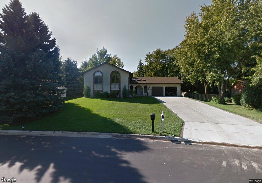
1863 Duck Pond Dr Saint Paul, MN 55118
Estimated Value: $465,000 - $496,756
5
Beds
3
Baths
2,443
Sq Ft
$199/Sq Ft
Est. Value
About This Home
This home is located at 1863 Duck Pond Dr, Saint Paul, MN 55118 and is currently estimated at $487,189, approximately $199 per square foot. 1863 Duck Pond Dr is a home located in Dakota County with nearby schools including Garlough Environmental Magnet, Friendly Hills Middle School, and Two Rivers High School.
Ownership History
Date
Name
Owned For
Owner Type
Purchase Details
Closed on
Jan 8, 2015
Sold by
Sullivan James F and Sullivan Jacquelyn D
Bought by
Hogendorf Dustin and Dunpy Natalie
Current Estimated Value
Home Financials for this Owner
Home Financials are based on the most recent Mortgage that was taken out on this home.
Original Mortgage
$261,250
Interest Rate
3.95%
Mortgage Type
New Conventional
Create a Home Valuation Report for This Property
The Home Valuation Report is an in-depth analysis detailing your home's value as well as a comparison with similar homes in the area
Home Values in the Area
Average Home Value in this Area
Purchase History
| Date | Buyer | Sale Price | Title Company |
|---|---|---|---|
| Hogendorf Dustin | $275,000 | Cornerstone Title Inc |
Source: Public Records
Mortgage History
| Date | Status | Borrower | Loan Amount |
|---|---|---|---|
| Previous Owner | Hogendorf Dustin | $261,250 |
Source: Public Records
Tax History Compared to Growth
Tax History
| Year | Tax Paid | Tax Assessment Tax Assessment Total Assessment is a certain percentage of the fair market value that is determined by local assessors to be the total taxable value of land and additions on the property. | Land | Improvement |
|---|---|---|---|---|
| 2024 | $5,762 | $448,700 | $145,800 | $302,900 |
| 2023 | $5,762 | $464,900 | $154,400 | $310,500 |
| 2022 | $5,300 | $457,100 | $153,800 | $303,300 |
| 2021 | $5,096 | $402,500 | $133,800 | $268,700 |
| 2020 | $4,854 | $385,300 | $127,400 | $257,900 |
| 2019 | $4,567 | $358,500 | $121,300 | $237,200 |
| 2018 | $4,272 | $323,700 | $113,400 | $210,300 |
| 2017 | $3,985 | $316,500 | $108,100 | $208,400 |
| 2016 | $3,789 | $285,600 | $98,300 | $187,300 |
| 2015 | $3,809 | $260,548 | $91,840 | $168,708 |
| 2014 | -- | $253,790 | $84,977 | $168,813 |
| 2013 | -- | $233,080 | $77,537 | $155,543 |
Source: Public Records
Map
Nearby Homes
- 2012 Pine Ridge Dr
- 25 W Kraft Rd
- 8XX Humboldt Ave
- 180 Wentworth Ave W Unit E
- 170 Wentworth Ave W Unit F
- 1620 Charlton St Unit 109
- 485 Preserve Path
- 1810 Delaware Ave
- 492 Deer Run Trail
- 255 Westview Dr Unit 305
- 1450 Bidwell St Unit 110
- 1513 Smith Ave S
- 280 Edith Dr
- 2122 Delaware Ave
- 69 Langer Cir
- 100 Imperial Dr W Unit 204
- 2148 Delaware Ave
- 614 Hidden Creek Trail
- 111 Imperial Dr W Unit 102
- 63 Langer Cir
- 1871 Duck Pond Dr
- 1855 Duck Pond Dr
- 1864 Bidwell St
- 1879 Duck Pond Dr
- 1879 1879 Duck Pond Dr
- 130 Marie Ave W
- 1845 1845 Duck Pond Dr
- 1845 Duck Pond Dr
- 1862 Duck Pond Dr
- 1874 Bidwell St
- 1870 Duck Pond Dr
- 1889 Duck Pond Dr
- 1889 1889 Duck Pond-Drive-
- 1878 Duck Pond Dr
- 1854 Duck Pond Dr
- 1878 1878 Duck Pond Dr
- 1886 Duck Pond Dr
- 1844 Duck Pond Dr
- 1895 Duck Pond Dr
- 165 Oakview Rd