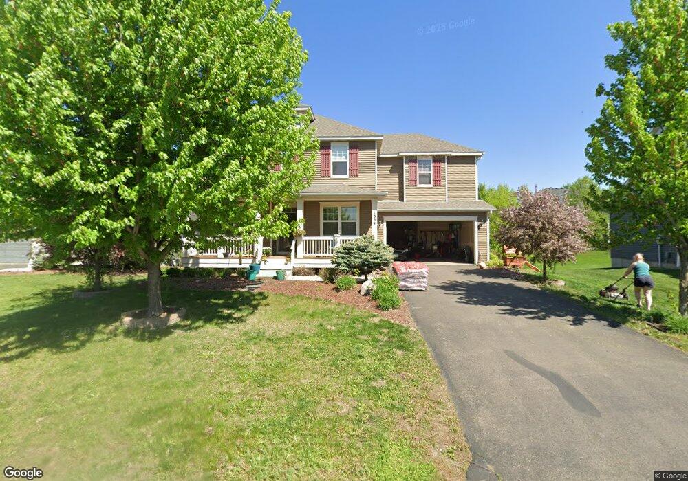
1864 Cedar Ct Carver, MN 55315
Estimated Value: $547,526 - $695,000
5
Beds
4
Baths
3,026
Sq Ft
$202/Sq Ft
Est. Value
About This Home
This home is located at 1864 Cedar Ct, Carver, MN 55315 and is currently estimated at $611,382, approximately $202 per square foot. 1864 Cedar Ct is a home located in Carver County with nearby schools including Carver Elementary School, Pioneer Ridge Middle School, and Chaska High School.
Ownership History
Date
Name
Owned For
Owner Type
Purchase Details
Closed on
Nov 26, 2019
Sold by
Ogle Jason T and Robetson Lindsay S
Bought by
Peterson Dawn M
Current Estimated Value
Home Financials for this Owner
Home Financials are based on the most recent Mortgage that was taken out on this home.
Original Mortgage
$338,400
Outstanding Balance
$298,348
Interest Rate
3.6%
Mortgage Type
New Conventional
Estimated Equity
$313,034
Purchase Details
Closed on
Oct 21, 2011
Sold by
Centex Homes
Bought by
Ogle Jason T and Robertson Lindsay S
Home Financials for this Owner
Home Financials are based on the most recent Mortgage that was taken out on this home.
Original Mortgage
$342,520
Interest Rate
3.87%
Mortgage Type
FHA
Create a Home Valuation Report for This Property
The Home Valuation Report is an in-depth analysis detailing your home's value as well as a comparison with similar homes in the area
Home Values in the Area
Average Home Value in this Area
Purchase History
| Date | Buyer | Sale Price | Title Company |
|---|---|---|---|
| Peterson Dawn M | $423,000 | Titlesmart Inc | |
| Ogle Jason T | $351,430 | -- |
Source: Public Records
Mortgage History
| Date | Status | Borrower | Loan Amount |
|---|---|---|---|
| Open | Peterson Dawn M | $338,400 | |
| Previous Owner | Ogle Jason T | $342,520 |
Source: Public Records
Tax History
| Year | Tax Paid | Tax Assessment Tax Assessment Total Assessment is a certain percentage of the fair market value that is determined by local assessors to be the total taxable value of land and additions on the property. | Land | Improvement |
|---|---|---|---|---|
| 2025 | $6,234 | $524,600 | $125,000 | $399,600 |
| 2024 | $6,122 | $509,600 | $110,000 | $399,600 |
| 2023 | $6,044 | $509,600 | $110,000 | $399,600 |
| 2022 | $6,090 | $514,400 | $102,000 | $412,400 |
| 2021 | $5,922 | $441,500 | $76,000 | $365,500 |
| 2020 | $6,276 | $445,300 | $76,000 | $369,300 |
| 2019 | $6,192 | $419,900 | $72,400 | $347,500 |
| 2018 | $5,938 | $419,900 | $72,400 | $347,500 |
| 2017 | $5,866 | $405,600 | $65,800 | $339,800 |
| 2016 | $6,162 | $391,900 | $0 | $0 |
| 2015 | $5,704 | $381,000 | $0 | $0 |
| 2014 | $5,704 | $336,300 | $0 | $0 |
Source: Public Records
Map
Nearby Homes
- 1976 Mulberry Ln
- 1832 Spring Creek Dr
- 2002 Mulberry Ln
- 2010 Mulberry Ln
- 2013 Mulberry Ln
- 2015 Mulberry Ln
- 1760 Mount Hope Rd
- 1935 Prospect Ln
- 1599 Sumac Cir Unit A
- 1927 Prospect Ln
- 1409 Copper Hills Dr
- 1353 Chestnut Cir
- 1336 Chestnut Cir
- 1460 Nutmeg Cir
- 1315 Lylewood Pkwy
- 4250 Chaska Blvd
- 1900 Ravine Rd
- 1444 Nutmeg Cir
- 12120 Jonathan Carver Pkwy
- 2018 Tamarack Rd
- 1866 Cedar Ct
- 1862 Cedar Ct
- 1859 Spring Creek Dr
- 1857 Spring Creek Dr
- 1877 Green Ash Dr
- 1868 Cedar Ct
- 1855 Spring Creek Dr
- 1861 Spring Creek Dr
- 1875 Cedar Ct
- 1853 Spring Creek Dr
- 1869 Cedar Ct
- 1872 Green Ash Dr
- 1879 Green Ash Dr
- 1874 Green Ash Dr
- 1870 Green Ash Dr
- 1873 Cedar Ct
- 1871 Cedar Ct
- 1851 Spring Creek Dr
- 1876 Green Ash Dr
- 1868 Green Ash Dr
Your Personal Tour Guide
Ask me questions while you tour the home.