1868 Kolb Farm Cir SW Unit 1868 Marietta, GA 30008
Estimated Value: $334,000 - $383,000
3
Beds
3
Baths
1,712
Sq Ft
$209/Sq Ft
Est. Value
About This Home
This home is located at 1868 Kolb Farm Cir SW Unit 1868, Marietta, GA 30008 and is currently estimated at $357,898, approximately $209 per square foot. 1868 Kolb Farm Cir SW Unit 1868 is a home located in Cobb County with nearby schools including Dowell Elementary School, Smitha Middle School, and Osborne High School.
Ownership History
Date
Name
Owned For
Owner Type
Purchase Details
Closed on
May 12, 2020
Sold by
Bianchi Barbara Anne
Bought by
Johnson Jerry S
Current Estimated Value
Purchase Details
Closed on
Sep 24, 2015
Sold by
Casey Betty Jane
Bought by
Bianchi Barbara Anne
Purchase Details
Closed on
Mar 29, 2005
Sold by
Stucet Lori Sa
Bought by
Casey Betty J
Create a Home Valuation Report for This Property
The Home Valuation Report is an in-depth analysis detailing your home's value as well as a comparison with similar homes in the area
Home Values in the Area
Average Home Value in this Area
Purchase History
| Date | Buyer | Sale Price | Title Company |
|---|---|---|---|
| Johnson Jerry S | $204,900 | None Available | |
| Bianchi Barbara Anne | $128,000 | -- | |
| Casey Rodney Neal | -- | -- | |
| Casey Betty J | $157,900 | -- |
Source: Public Records
Mortgage History
| Date | Status | Borrower | Loan Amount |
|---|---|---|---|
| Open | Johnson Jerry S | $143,000 | |
| Previous Owner | Bianchi Barbara Anne | $122,800 | |
| Previous Owner | Casey Lori S | $50,000 |
Source: Public Records
Tax History Compared to Growth
Tax History
| Year | Tax Paid | Tax Assessment Tax Assessment Total Assessment is a certain percentage of the fair market value that is determined by local assessors to be the total taxable value of land and additions on the property. | Land | Improvement |
|---|---|---|---|---|
| 2024 | $946 | $135,104 | $28,000 | $107,104 |
| 2023 | $740 | $135,104 | $28,000 | $107,104 |
| 2022 | $833 | $97,192 | $12,600 | $84,592 |
| 2021 | $764 | $74,124 | $12,600 | $61,524 |
| 2020 | $570 | $74,124 | $12,600 | $61,524 |
| 2019 | $547 | $66,372 | $12,600 | $53,772 |
| 2018 | $547 | $66,372 | $12,600 | $53,772 |
| 2017 | $451 | $55,760 | $12,600 | $43,160 |
| 2016 | $1,472 | $51,184 | $12,064 | $39,120 |
| 2015 | $491 | $53,472 | $12,600 | $40,872 |
| 2014 | $499 | $53,472 | $0 | $0 |
Source: Public Records
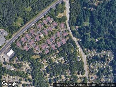
Map
Nearby Homes
- 1489 Kolb Ridge Dr SW
- 1491 Kolb Ridge Dr SW
- 1951 Bergerac Ct SW
- 2093 Kolb Ridge Ct SW
- 1785 Hammond Woods Cir SW
- 2097 Kolb Ridge Ct SW
- 1703 Rifle Ridge SW
- 1681 Hammond Woods Cir SW
- 1237 Samuel St SW
- 1773 Kimberly Dr SW
- 2001 MacLand Square Dr Unit 11
- 1772 Benningfield Dr SW
- 1622 Bunting Forest Ct
- 2157 Brandon Lee Dr SW
- 1706 Brandon Lee Way SW Unit 1
- 2035 MacLand Square Dr Unit 7
- 1710 Brandon Lee Way SW
- 1868 Kolb Farm Cir SW
- 1868 Kolb Farm Cir SW Unit 1868
- 1870 Kolb Farm Cir SW
- 1866 Kolb Farm Cir SW Unit 11
- 1872 Kolb Farm Cir SW
- 1872 Kolb Farm Cir SW Unit 1872
- 1862 Kolb Farm Cir SW Unit 13
- 1869 Kolb Farm Cir SW
- 1876 Kolb Farm Cir SW Unit 8
- 1876 Kolb Farm Cir SW Unit 1876
- 1864 Kolb Farm Cir SW Unit 14
- 1867 Kolb Farm Cir SW Unit 67
- 1860 Kolb Farm Cir SW Unit 16
- 0 Kolb Farm Cir SW Unit 7054881
- 0 Kolb Farm Cir SW Unit 7088885
- 0 Kolb Farm Cir SW Unit 7088258
- 0 Kolb Farm Cir SW Unit 7034172
- 0 Kolb Farm Cir SW Unit 3252001
- 0 Kolb Farm Cir SW Unit 3053270
- 0 Kolb Farm Cir SW Unit 37 3133240