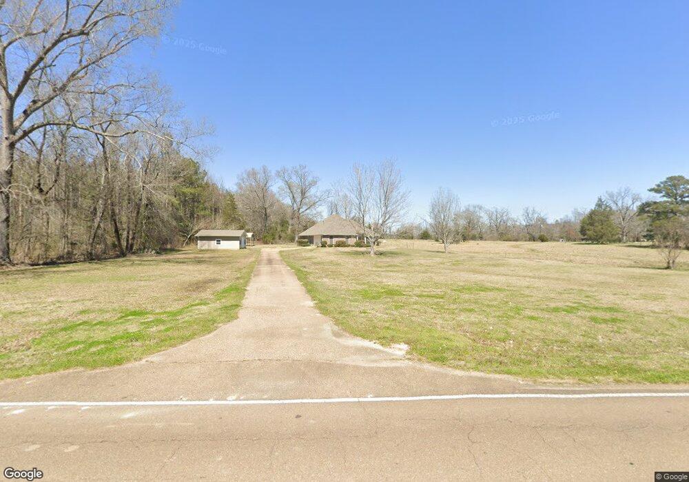
187 Baker Ln Brandon, MS 39047
Estimated Value: $300,714 - $368,000
3
Beds
3
Baths
2,095
Sq Ft
$162/Sq Ft
Est. Value
About This Home
This home is located at 187 Baker Ln, Brandon, MS 39047 and is currently estimated at $340,429, approximately $162 per square foot. 187 Baker Ln is a home located in Rankin County with nearby schools including Oakdale Elementary School, Northwest Rankin Middle School, and Northwest Rankin High School.
Ownership History
Date
Name
Owned For
Owner Type
Purchase Details
Closed on
Jul 15, 2022
Sold by
Griffith Sherren Oneil
Bought by
Griffith Sherren Oneil
Current Estimated Value
Home Financials for this Owner
Home Financials are based on the most recent Mortgage that was taken out on this home.
Original Mortgage
$203,800
Outstanding Balance
$193,770
Interest Rate
5.81%
Mortgage Type
New Conventional
Estimated Equity
$146,659
Purchase Details
Closed on
Mar 8, 2019
Sold by
Griffith Oneil
Bought by
Tucker Sherren
Create a Home Valuation Report for This Property
The Home Valuation Report is an in-depth analysis detailing your home's value as well as a comparison with similar homes in the area
Purchase History
| Date | Buyer | Sale Price | Title Company |
|---|---|---|---|
| Griffith Sherren Oneil | -- | None Listed On Document | |
| Griffith Sherren Oneil | -- | None Listed On Document | |
| Tucker Sherren | -- | -- |
Source: Public Records
Mortgage History
| Date | Status | Borrower | Loan Amount |
|---|---|---|---|
| Open | Griffith Sherren Oneil | $203,800 | |
| Closed | Griffith Sherren Oneil | $203,800 |
Source: Public Records
Tax History
| Year | Tax Paid | Tax Assessment Tax Assessment Total Assessment is a certain percentage of the fair market value that is determined by local assessors to be the total taxable value of land and additions on the property. | Land | Improvement |
|---|---|---|---|---|
| 2024 | $2,665 | $26,460 | $0 | $0 |
| 2023 | $2,597 | $26,308 | $0 | $0 |
| 2022 | $2,557 | $26,308 | $0 | $0 |
| 2021 | $2,438 | $25,082 | $0 | $0 |
| 2020 | $2,438 | $25,087 | $0 | $0 |
| 2019 | $2,224 | $22,249 | $0 | $0 |
| 2018 | $2,180 | $22,249 | $0 | $0 |
| 2017 | $2,179 | $22,244 | $0 | $0 |
| 2016 | $653 | $14,524 | $0 | $0 |
| 2015 | $649 | $14,482 | $0 | $0 |
| 2014 | $634 | $14,476 | $0 | $0 |
| 2013 | -- | $14,470 | $0 | $0 |
Source: Public Records
Map
Nearby Homes
- 562 Stump Ridge Rd
- 475 Stump Ridge Rd
- 538 Stump Ridge Rd
- 1203 Old Court Crossing
- 1212 Old Court Crossing
- 917 Brunswick Ct
- 1106 Old Court Crossing
- 913 Brunswick Ct
- 1110 Old Court Crossing
- 116 Shenandoah Estates Cir
- 1114 Old Court Crossing
- 1117 Old Court Crossing
- 1125 Old Court Crossing
- 705 Queens Ct
- 342 Royal Pond Cir
- 309 Royal Pond Cir
- 23 Le Bourgeois Dr
- 312 Royal Pond Cir
- 0 Marshall Rd Unit 4122368
- 346 Oakville Cir
- 201 Baker Ln
- 211 Baker Ln
- 100 Virginia Valley Dr
- 104 Virginia Valley Dr
- 186 Baker Ln
- 118 Virginia Hollow Rd
- 108 Virginia Valley Dr
- 148 Baker Ln
- 112 Virginia Valley Dr
- 237 Baker Ln
- 230 Baker Ln
- 184 Baker Ln
- 130 Baker Ln
- 116 Virginia Valley Dr
- 206 Langford Farms Cove
- 100 Beatrice Ln
- 117 Virginia Valley Dr
- 124 Baker Ln
- 120 Virginia Valley Dr
- 108 Beatrice Ln
Your Personal Tour Guide
Ask me questions while you tour the home.