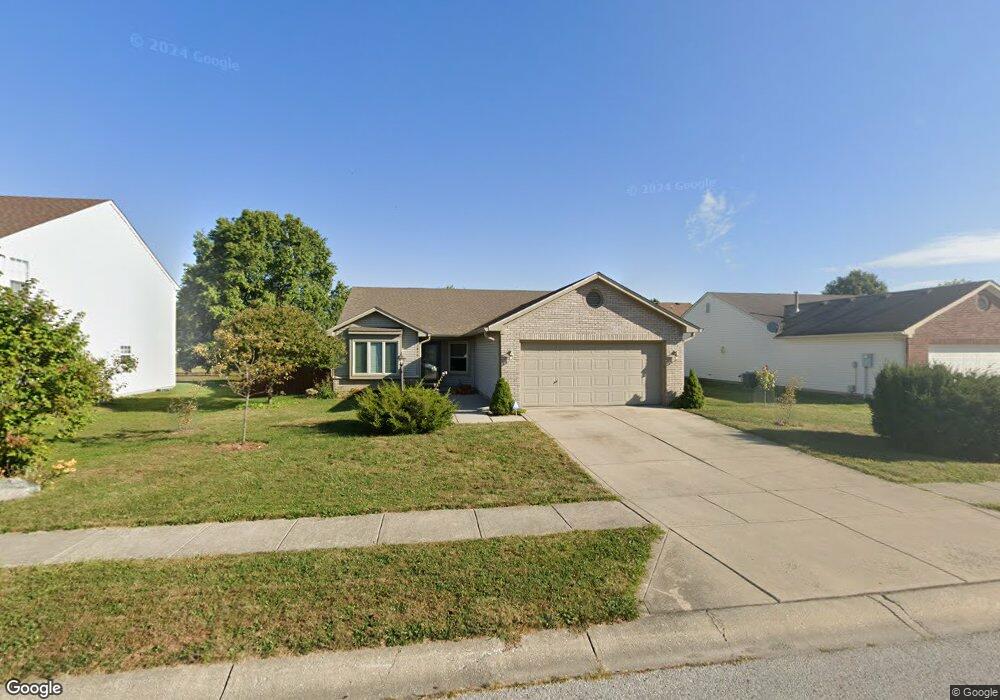
1870 E Fork Dr Brownsburg, IN 46112
Estimated Value: $302,000 - $326,000
3
Beds
2
Baths
1,650
Sq Ft
$190/Sq Ft
Est. Value
About This Home
This home is located at 1870 E Fork Dr, Brownsburg, IN 46112 and is currently estimated at $313,267, approximately $189 per square foot. 1870 E Fork Dr is a home located in Hendricks County with nearby schools including Brownsburg East Middle School and Brownsburg High School.
Ownership History
Date
Name
Owned For
Owner Type
Purchase Details
Closed on
Sep 28, 2018
Sold by
Mackey Derek and Mackey Dykhouse Ursula
Bought by
Fetters Joseph G and Amarante Gilda M
Current Estimated Value
Home Financials for this Owner
Home Financials are based on the most recent Mortgage that was taken out on this home.
Original Mortgage
$133,600
Outstanding Balance
$115,542
Interest Rate
4.5%
Mortgage Type
New Conventional
Estimated Equity
$197,725
Purchase Details
Closed on
Sep 24, 2009
Sold by
Mackey Derek
Bought by
Mackey Derek and Mackey Dykhouse Ursula
Home Financials for this Owner
Home Financials are based on the most recent Mortgage that was taken out on this home.
Original Mortgage
$118,030
Interest Rate
5.19%
Mortgage Type
FHA
Purchase Details
Closed on
Sep 28, 2006
Sold by
Nichols Martin T and Nichols Geraldine A
Bought by
Mackey Derek
Home Financials for this Owner
Home Financials are based on the most recent Mortgage that was taken out on this home.
Original Mortgage
$117,000
Interest Rate
6.49%
Mortgage Type
New Conventional
Create a Home Valuation Report for This Property
The Home Valuation Report is an in-depth analysis detailing your home's value as well as a comparison with similar homes in the area
Home Values in the Area
Average Home Value in this Area
Purchase History
| Date | Buyer | Sale Price | Title Company |
|---|---|---|---|
| Fetters Joseph G | -- | Fidelity National Title | |
| Mackey Derek | -- | Nations Title Agency | |
| Mackey Derek | -- | None Available |
Source: Public Records
Mortgage History
| Date | Status | Borrower | Loan Amount |
|---|---|---|---|
| Open | Fetters Joseph G | $133,600 | |
| Previous Owner | Mackey Derek | $118,030 | |
| Previous Owner | Mackey Derek | $117,000 |
Source: Public Records
Tax History
| Year | Tax Paid | Tax Assessment Tax Assessment Total Assessment is a certain percentage of the fair market value that is determined by local assessors to be the total taxable value of land and additions on the property. | Land | Improvement |
|---|---|---|---|---|
| 2025 | $2,563 | $260,800 | $44,100 | $216,700 |
| 2024 | $2,563 | $256,300 | $44,100 | $212,200 |
| 2023 | $2,199 | $217,400 | $37,400 | $180,000 |
| 2022 | $2,011 | $198,700 | $34,600 | $164,100 |
| 2021 | $1,735 | $171,400 | $31,500 | $139,900 |
| 2020 | $1,560 | $153,500 | $31,500 | $122,000 |
| 2019 | $1,528 | $150,300 | $31,500 | $118,800 |
| 2018 | $1,302 | $145,200 | $31,500 | $113,700 |
| 2017 | $1,205 | $138,900 | $31,500 | $107,400 |
| 2016 | $1,154 | $135,800 | $31,500 | $104,300 |
| 2014 | $1,016 | $126,000 | $30,600 | $95,400 |
Source: Public Records
Map
Nearby Homes
- 1844 Creekside Dr
- 1560 Cold Spring Dr
- 216 Rapid Rill Ln
- 168 Rapid Rill Ln
- 8903 Motorsports Way
- 3924 Castle Hill Dr
- 1635 Beacon Pointe Blvd
- 8562 Goldfinch Rd
- 8558 Goldfinch Rd
- 8538 Goldfinch Rd
- 8524 Goldfinch Rd
- 8516 Goldfinch Rd
- 3819 Castle Hill Dr
- 3780 Concord Point Way
- 3883 Wren Dr
- 1045 Lakewood South Dr
- 17 Roselawn Ave
- 1617 Cottongrass Dr
- 867 Ironwood West Dr
- 1804 Pine Cone Dr
- 1870 Eastfork Dr
- 1850 Eastfork Dr
- 1890 E Fork Dr
- 1850 E Fork Dr
- 1890 Eastfork Dr
- 260 Watercress Way
- 1830 E Fork Dr
- 1830 Eastfork Dr
- 1851 Eastfork Dr
- 1810 E Fork Dr
- 1871 E Fork Dr
- 1810 Eastfork Dr
- 1810 Eastfork Dr
- 1831 Eastfork Dr
- 1831 E Fork Dr
- 230 Watercress Way
- 1871 Eastfork Dr
- 1811 Eastfork Dr
- 281 Watercress Way
- 299 Watercress Way
Your Personal Tour Guide
Ask me questions while you tour the home.