1875 Litchfield Turnpike New Haven, CT 06525
Estimated payment $2,650/month
About This Lot
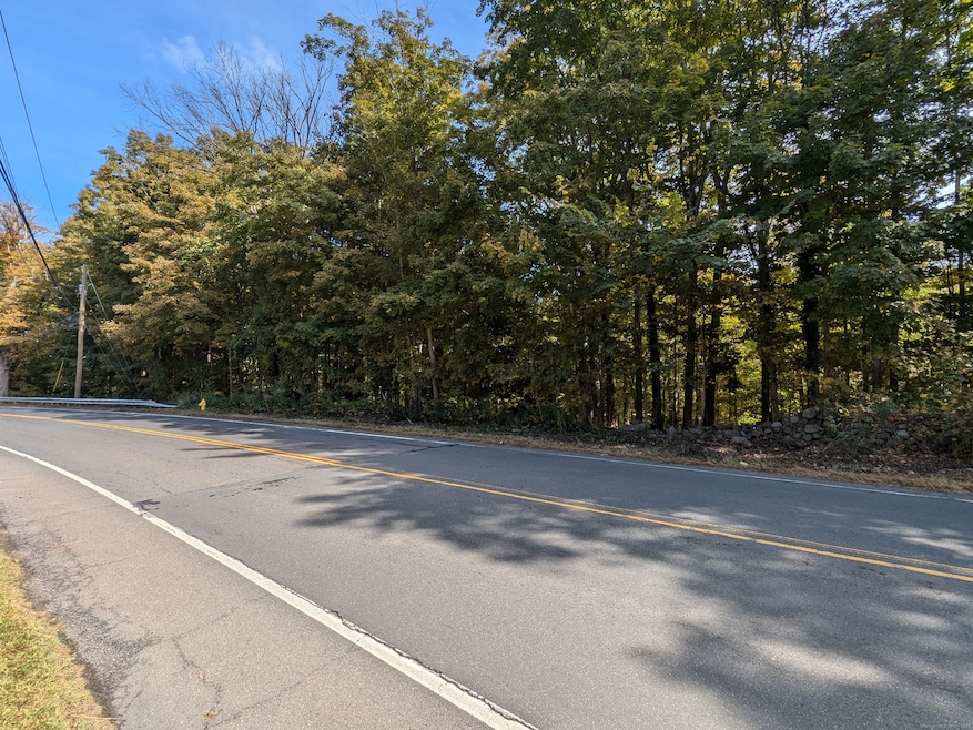
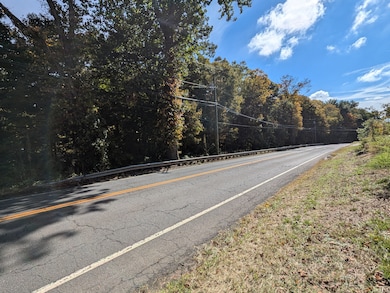
Hike to the top of west rock ridge from your own back yard and enjoy views for miles. Believe city water is present, some of the property is located in an AE flood zone. Buyer to do own due diligence.
Listing Agent
Houlihan Lawrence WD Brokerage Phone: (203) 676-1825 License #RES.0829017 Listed on: 10/02/2024

Co-Listing Agent
Houlihan Lawrence WD Brokerage Phone: (203) 676-1825 License #REB.0789479
Property Details
Property Type
- Land
Est. Annual Taxes
- $8,090
Lot Details
- 28.2 Acre Lot
- Property fronts a state road
Location
- Flood Zone Lot
Listing and Financial Details
- Assessor Parcel Number 1451166
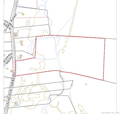
Map
Home Values in the Area
Average Home Value in this Area
Property History
| Date | Event | Price | List to Sale | Price per Sq Ft |
|---|---|---|---|---|
| 10/02/2024 10/02/24 | For Sale | $375,000 | -- | -- |
Source: SmartMLS
MLS Number: 24050432
Disclaimer: Certain information contained herein is derived from information provided by parties other than Homes.com. All information provided is deemed reliable, but is not guaranteed to be accurate and should be independently verified.
![]() IDX information is provided exclusively for personal, non-commercial use, and may not be used for any purpose other than to identify prospective properties consumers may be interested in purchasing. Information is deemed reliable but not guaranteed.
IDX information is provided exclusively for personal, non-commercial use, and may not be used for any purpose other than to identify prospective properties consumers may be interested in purchasing. Information is deemed reliable but not guaranteed.
- 204 Amity Rd
- 950 Benham St
- 11 Ariel Rd
- 701 Main St
- 17 Dunbar Ln
- 1020 Wintergreen Ave
- 28 Seymour Rd
- 284 Wintergreen Ave
- 71 Dunbar Hill Rd
- 23 Heritage Ln Unit 59
- 21 Heritage Ln Unit 60
- 762 Woodin St
- 13 Heritage Ln Unit 64
- 144 Mueller Dr
- 11 Heritage Ln Unit 65
- 4 Whisper Ridge Way Unit 41
- 6 Whisper Ridge Way Unit 42
- 8 Whisper Ridge Way
- 14 Whisper Ridge Way Unit 46
- 12 Whisper Ridge Way Unit 45
- 473 Amity Rd
- 40 Mettler St Unit 2
- 134 W
- 121 Pond Lily Ave
- 23 Pond Lily Ave
- 958 Dunbar Hill Rd
- 127 Ursini Dr
- 119 Frederick St Unit 2R
- 203 Gorham Ave
- 2 Valley Place N Unit 2
- 26 Albertson Rd
- 89 Beacon St Unit 1
- 108 Concord St Unit 2
- 190 Pine Rock Ave
- 223 Fairfield St Unit L1
- 46 Millis St Unit 2
- 46 Millis St
- 195 Valley St
- 283 Cooper Place
- 1458 Dixwell Ave