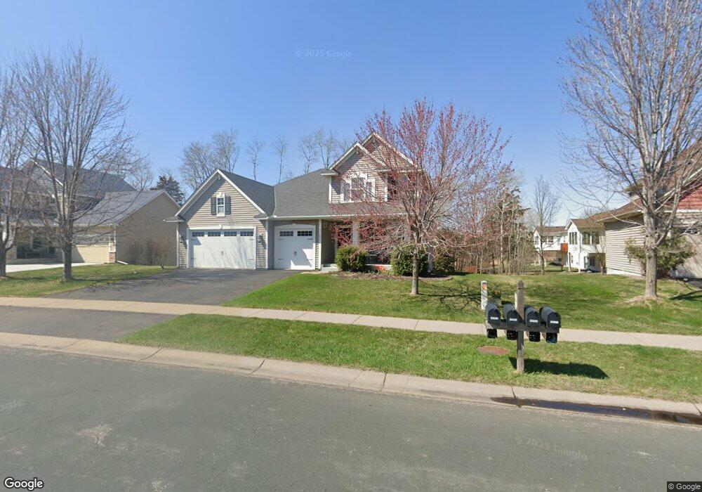
18752 64th Ave N Maple Grove, MN 55311
Estimated Value: $693,120 - $746,000
4
Beds
3
Baths
2,707
Sq Ft
$266/Sq Ft
Est. Value
About This Home
This home is located at 18752 64th Ave N, Maple Grove, MN 55311 and is currently estimated at $721,280, approximately $266 per square foot. 18752 64th Ave N is a home located in Hennepin County with nearby schools including Wayzata Central Middle School, Wayzata High School, and Ave Maria Academy.
Ownership History
Date
Name
Owned For
Owner Type
Purchase Details
Closed on
Apr 6, 2016
Sold by
Mathews William A and Mathews Shawn M
Bought by
Nienstedt Christopher N and Nienstedt Laura M
Current Estimated Value
Home Financials for this Owner
Home Financials are based on the most recent Mortgage that was taken out on this home.
Original Mortgage
$417,000
Outstanding Balance
$330,627
Interest Rate
3.62%
Mortgage Type
New Conventional
Estimated Equity
$390,653
Purchase Details
Closed on
Oct 15, 2009
Sold by
U S Home Corporation
Bought by
Mathews William A and Mathews Shawn M
Create a Home Valuation Report for This Property
The Home Valuation Report is an in-depth analysis detailing your home's value as well as a comparison with similar homes in the area
Home Values in the Area
Average Home Value in this Area
Purchase History
| Date | Buyer | Sale Price | Title Company |
|---|---|---|---|
| Nienstedt Christopher N | $439,000 | Burnet Title | |
| Mathews William A | $415,000 | -- |
Source: Public Records
Mortgage History
| Date | Status | Borrower | Loan Amount |
|---|---|---|---|
| Open | Nienstedt Christopher N | $417,000 |
Source: Public Records
Tax History Compared to Growth
Tax History
| Year | Tax Paid | Tax Assessment Tax Assessment Total Assessment is a certain percentage of the fair market value that is determined by local assessors to be the total taxable value of land and additions on the property. | Land | Improvement |
|---|---|---|---|---|
| 2024 | $7,787 | $647,700 | $185,400 | $462,300 |
| 2023 | $7,135 | $626,400 | $183,800 | $442,600 |
| 2022 | $5,982 | $595,800 | $140,800 | $455,000 |
| 2021 | $6,002 | $474,400 | $100,600 | $373,800 |
| 2020 | $6,146 | $471,700 | $113,100 | $358,600 |
| 2019 | $6,224 | $465,200 | $113,600 | $351,600 |
| 2018 | $6,265 | $464,400 | $127,600 | $336,800 |
| 2017 | $5,821 | $421,700 | $116,000 | $305,700 |
| 2016 | $5,926 | $418,100 | $116,000 | $302,100 |
| 2015 | $6,058 | $418,600 | $125,000 | $293,600 |
| 2014 | -- | $376,400 | $115,000 | $261,400 |
Source: Public Records
Map
Nearby Homes
- 6540 Yellowstone Ln N
- 1988 Leaping Deer Cir
- 6298 Larkspur Ln
- 6290 Larkspur Ln
- 6288 Larkspur Ln
- 6300 Ranier Ln N
- 6205 Ranier Ln N
- 6757 Urbandale Ln N
- 6430 Bluestem Cir
- 6750 Troy Ln N
- 5989 Xanthus Ln N
- 19422 Lupine Ln
- 20144 68th Ave N
- 6647 Peony Ln N
- 6848 Troy Ln N
- 20045 67th Ave
- 17716 Elm Rd N
- 17812 66th Ave N
- 17749 62nd Ave N
- 6566 Merrimac Ln N
- 18752 64th Ave N
- 18784 64th Ave N
- 18720 64th Ave N
- 18720 64th Ave N
- 6407 Vagabond Ln N
- 18816 64th Ave N
- 6419 Vagabond Ln N
- 18721 64th Ave N
- 18721 64th Ave N
- 18763 64th Ave N
- 18763 64th Ave N
- 18848 64th Ave N
- 6424 Zircon Ln N
- 6431 Vagabond Ln N
- 6412 Zircon Ln N
- 6378 Vagabond Ln N
- 6443 Vagabond Ln N
- 6387 Vagabond Ln N
- 6374 Vagabond Ln N
- 6374 Vagabond Ln N