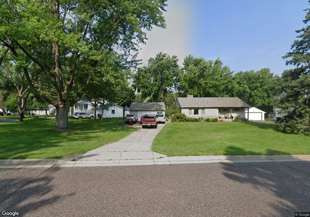
1879 Kennard St Saint Paul, MN 55109
Gladstone NeighborhoodEstimated Value: $317,000 - $333,213
3
Beds
2
Baths
731
Sq Ft
$444/Sq Ft
Est. Value
About This Home
This home is located at 1879 Kennard St, Saint Paul, MN 55109 and is currently estimated at $324,303, approximately $443 per square foot. 1879 Kennard St is a home located in Ramsey County with nearby schools including Weaver Elementary School, John Glenn Middle School, and Mounds Park Academy.
Ownership History
Date
Name
Owned For
Owner Type
Purchase Details
Closed on
Aug 20, 1998
Sold by
Ewald Joseph E
Bought by
Knapp Charles R and Knapp Julianne
Current Estimated Value
Purchase Details
Closed on
Sep 23, 1995
Sold by
Ewald John A and Ewald G
Bought by
Ewald Joseph E
Create a Home Valuation Report for This Property
The Home Valuation Report is an in-depth analysis detailing your home's value as well as a comparison with similar homes in the area
Home Values in the Area
Average Home Value in this Area
Purchase History
| Date | Buyer | Sale Price | Title Company |
|---|---|---|---|
| Knapp Charles R | $85,000 | -- | |
| Ewald Joseph E | $86,000 | -- |
Source: Public Records
Mortgage History
| Date | Status | Borrower | Loan Amount |
|---|---|---|---|
| Closed | Ewald Joseph E | -- |
Source: Public Records
Tax History Compared to Growth
Tax History
| Year | Tax Paid | Tax Assessment Tax Assessment Total Assessment is a certain percentage of the fair market value that is determined by local assessors to be the total taxable value of land and additions on the property. | Land | Improvement |
|---|---|---|---|---|
| 2025 | $4,248 | $327,700 | $72,200 | $255,500 |
| 2023 | $4,248 | $306,200 | $72,200 | $234,000 |
| 2022 | $3,882 | $297,900 | $72,200 | $225,700 |
| 2021 | $3,182 | $269,600 | $72,200 | $197,400 |
| 2020 | $3,088 | $230,800 | $72,200 | $158,600 |
| 2019 | $2,676 | $211,200 | $72,200 | $139,000 |
| 2018 | $2,898 | $189,500 | $72,200 | $117,300 |
| 2017 | $3,254 | $180,600 | $72,200 | $108,400 |
| 2016 | $3,212 | $0 | $0 | $0 |
| 2015 | $3,168 | $189,300 | $66,200 | $123,100 |
| 2014 | $2,780 | $0 | $0 | $0 |
Source: Public Records
Map
Nearby Homes
- 1849 Kennard St
- 1856 Flandrau St
- 1937 Flandrau St
- 1984 Prosperity Rd
- 1854 Barclay St
- 1940 Barclay St
- 1743 White Bear Ave N
- 1627 Christie Place
- 1869 Birmingham St
- 1740 California Ave E
- 1435 Price Ave
- 1672 Manton St
- 1637 Iowa Ave E
- 1666 Laurie Rd E
- 1694 Laurie Rd E
- 1467 County Road B E
- 1509 Sandhurst Ave E
- 1840 Iowa Ave E
- 1676 Montana Ave E
- 1740 English St
- 1861 Summer Ave
- 1885 Kennard St
- 1893 Kennard St
- 1855 Summer Ave
- 1870 Maryknoll Ave
- 1870 Maryknoll Ave N
- 1884 Kennard St
- 1888 Kennard St
- 1880 Maryknoll Ave
- 1892 Kennard St
- 1866 Maryknoll Ave
- 1878 Kennard St
- 1894 Maryknoll Ave
- 1896 Kennard St
- 1638 Frost Ave
- 1868 Kennard St
- 1904 Maryknoll Ave
- 1904 Maryknoll Ave N
- 1844 Summer Ave
- 1850 Maryknoll Ave