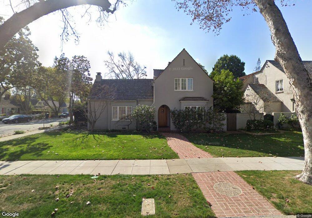
1880 Fulton St Palo Alto, CA 94303
Old Palo Alto NeighborhoodEstimated Value: $4,238,712 - $5,357,000
3
Beds
3
Baths
2,300
Sq Ft
$2,064/Sq Ft
Est. Value
About This Home
This home is located at 1880 Fulton St, Palo Alto, CA 94303 and is currently estimated at $4,746,928, approximately $2,063 per square foot. 1880 Fulton St is a home located in Santa Clara County with nearby schools including Walter Hays Elementary, Frank S. Greene Jr. Middle, and Palo Alto High School.
Ownership History
Date
Name
Owned For
Owner Type
Purchase Details
Closed on
Sep 17, 2008
Sold by
Vuksinick Louis M and Vuksinick Janet S Robinson
Bought by
Vuksinick Louis M and Vuksinick Janet Robinson
Current Estimated Value
Create a Home Valuation Report for This Property
The Home Valuation Report is an in-depth analysis detailing your home's value as well as a comparison with similar homes in the area
Home Values in the Area
Average Home Value in this Area
Purchase History
| Date | Buyer | Sale Price | Title Company |
|---|---|---|---|
| Vuksinick Louis M | -- | None Available |
Source: Public Records
Tax History Compared to Growth
Tax History
| Year | Tax Paid | Tax Assessment Tax Assessment Total Assessment is a certain percentage of the fair market value that is determined by local assessors to be the total taxable value of land and additions on the property. | Land | Improvement |
|---|---|---|---|---|
| 2025 | $10,279 | $811,485 | $338,113 | $473,372 |
| 2024 | $10,279 | $795,575 | $331,484 | $464,091 |
| 2023 | $10,123 | $779,977 | $324,985 | $454,992 |
| 2022 | $9,998 | $764,684 | $318,613 | $446,071 |
| 2021 | $9,799 | $749,691 | $312,366 | $437,325 |
| 2020 | $9,608 | $742,005 | $309,164 | $432,841 |
| 2019 | $9,497 | $727,456 | $303,102 | $424,354 |
| 2018 | $9,250 | $713,193 | $297,159 | $416,034 |
| 2017 | $9,085 | $699,210 | $291,333 | $407,877 |
| 2016 | $8,841 | $685,501 | $285,621 | $399,880 |
| 2015 | $8,749 | $675,205 | $281,331 | $393,874 |
| 2014 | $8,501 | $661,980 | $275,821 | $386,159 |
Source: Public Records
Map
Nearby Homes
- 627 Tennyson Ave
- 1711 Guinda St
- 1730 Webster St
- 1827 Cowper St
- 444 Tennyson Ave
- 1119 Hopkins Ave
- 61 Primrose Way
- 1218 Middlefield Rd
- 836 Warren Way
- 184 Tennyson Ave
- 2399 South Ct
- 1932 Emerson St
- 671 Kingsley Ave
- 535 Kingsley Ave
- 161 Primrose Way
- 2590 Webster St
- 125 Lowell Ave
- 20 Kent Place
- 1555 Alma St
- 1033 Guinda St
- 1850 Fulton St
- 1830 Fulton St
- 710 Seale Ave
- 720 Seale Ave
- 1849 Middlefield Rd
- 700 Seale Ave
- 1881 Fulton St
- 1861 Fulton St
- 730 Seale Ave
- 1835 Middlefield Rd
- 1845 Fulton St
- 1820 Fulton St
- 1921 Middlefield Rd
- 1833 Fulton St
- 740 Seale Ave
- 1823 Middlefield Rd
- 1810 Fulton St
- 1941 Middlefield Rd
- 1821 Fulton St
- 737 Northampton Dr