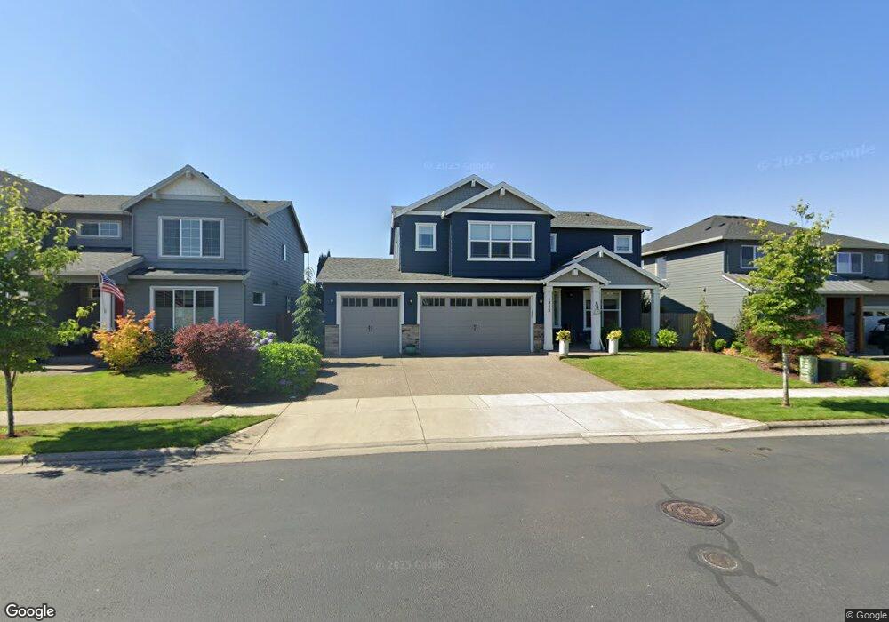
1880 Silverstone Dr Forest Grove, OR 97116
Estimated Value: $695,284 - $761,000
5
Beds
3
Baths
2,765
Sq Ft
$260/Sq Ft
Est. Value
About This Home
This home is located at 1880 Silverstone Dr, Forest Grove, OR 97116 and is currently estimated at $720,071, approximately $260 per square foot. 1880 Silverstone Dr is a home with nearby schools including Harvey Clarke Elementary School, Tom McCall Upper Elementary School, and Neil Armstrong Middle School.
Ownership History
Date
Name
Owned For
Owner Type
Purchase Details
Closed on
Feb 7, 2018
Sold by
Stone Bridge Homes Nw Llc
Bought by
Arrigotti Greg Steven and Arrigotti Christina Marie
Current Estimated Value
Home Financials for this Owner
Home Financials are based on the most recent Mortgage that was taken out on this home.
Original Mortgage
$420,160
Outstanding Balance
$354,194
Interest Rate
3.99%
Mortgage Type
New Conventional
Estimated Equity
$365,877
Purchase Details
Closed on
Jan 29, 2018
Sold by
Stone Bridge Homes Nw Llc
Bought by
Arrigotti Greg Steven and Arrigotti Christina Marie
Home Financials for this Owner
Home Financials are based on the most recent Mortgage that was taken out on this home.
Original Mortgage
$420,160
Outstanding Balance
$354,194
Interest Rate
3.99%
Mortgage Type
New Conventional
Estimated Equity
$365,877
Create a Home Valuation Report for This Property
The Home Valuation Report is an in-depth analysis detailing your home's value as well as a comparison with similar homes in the area
Home Values in the Area
Average Home Value in this Area
Purchase History
| Date | Buyer | Sale Price | Title Company |
|---|---|---|---|
| Arrigotti Greg Steven | $525,200 | First American Title | |
| Arrigotti Greg Steven | $525,200 | First American Title |
Source: Public Records
Mortgage History
| Date | Status | Borrower | Loan Amount |
|---|---|---|---|
| Open | Arrigotti Greg Steven | $420,160 | |
| Closed | Arrigotti Greg Steven | $420,160 |
Source: Public Records
Tax History Compared to Growth
Tax History
| Year | Tax Paid | Tax Assessment Tax Assessment Total Assessment is a certain percentage of the fair market value that is determined by local assessors to be the total taxable value of land and additions on the property. | Land | Improvement |
|---|---|---|---|---|
| 2026 | $7,145 | $401,210 | -- | -- |
| 2025 | $7,145 | $389,530 | -- | -- |
| 2024 | $6,893 | $378,190 | -- | -- |
| 2023 | $6,893 | $367,180 | $0 | $0 |
| 2022 | $6,027 | $367,180 | $0 | $0 |
| 2021 | $5,949 | $346,110 | $0 | $0 |
| 2020 | $5,917 | $336,030 | $0 | $0 |
| 2019 | $5,785 | $326,250 | $0 | $0 |
| 2018 | $4,189 | $236,640 | $0 | $0 |
| 2017 | $704 | $39,860 | $0 | $0 |
Source: Public Records
Map
Nearby Homes
- 3522 Arleen Ct
- 1815 35th Ave
- 3605 Main St
- 2035 35th Ave
- 3594 Ash St Unit Lot 25
- Pacific Plan at Davis Estates
- Newport Plan at Davis Estates
- Dahlia Plan at Davis Estates
- Azalea Plan at Davis Estates
- 3609 Main St
- 2043 35th Ave
- 2002 Aspen Ln
- 3610 Ash St Unit Lot 17
- 2081 Silverstone Dr
- 3300 N Main St Unit 110
- 2091 35th Ave
- 2123 Colby Ln Unit Lot 74
- 2149 36th Unit Lot 59
- 2180 36th Ave
- 2150 36th Ave
- 1872 Silverstone Dr
- 1888 Silverstone Dr
- 2465 NW Highway 47
- 1904 Silverstone Dr
- 1883 Silverstone Dr
- 1875 Silverstone Dr
- 1912 Silverstone Dr
- 1901 Silverstone Dr
- 1869 Silverstone Dr
- 1905 Silverstone Dr
- 1917 Silverstone Dr
- 3505 Arleen Ct
- 3514 Arleen Ct
- 3525 Arleen Ct
- 1921 Silverstone Dr
- 1857 Silverstone Dr
- 3521 Arleen Ct
- 1845 Silverstone Dr
- 3432 Hank Ct