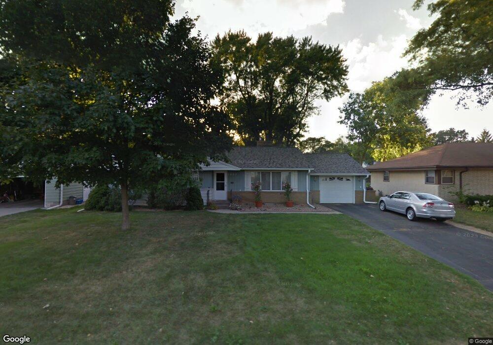
1883 Albert St N Saint Paul, MN 55113
Estimated Value: $358,000 - $406,000
3
Beds
2
Baths
1,296
Sq Ft
$301/Sq Ft
Est. Value
About This Home
This home is located at 1883 Albert St N, Saint Paul, MN 55113 and is currently estimated at $390,008, approximately $300 per square foot. 1883 Albert St N is a home located in Ramsey County with nearby schools including Falcon Heights Elementary, Roseville Area Middle School, and Roseville Area Senior High School.
Ownership History
Date
Name
Owned For
Owner Type
Purchase Details
Closed on
Apr 19, 2018
Sold by
Hagen Thomas M and Hagen Cara D
Bought by
Hagen Thomas M and Hagen Cara D
Current Estimated Value
Purchase Details
Closed on
Aug 3, 1998
Sold by
Legare David and Legare Susan
Bought by
Hagen Thomas and Hagen Cara
Create a Home Valuation Report for This Property
The Home Valuation Report is an in-depth analysis detailing your home's value as well as a comparison with similar homes in the area
Home Values in the Area
Average Home Value in this Area
Purchase History
| Date | Buyer | Sale Price | Title Company |
|---|---|---|---|
| Hagen Thomas M | -- | None Available | |
| Hagen Thomas | $144,700 | -- |
Source: Public Records
Tax History Compared to Growth
Tax History
| Year | Tax Paid | Tax Assessment Tax Assessment Total Assessment is a certain percentage of the fair market value that is determined by local assessors to be the total taxable value of land and additions on the property. | Land | Improvement |
|---|---|---|---|---|
| 2025 | $5,262 | $389,000 | $105,700 | $283,300 |
| 2023 | $5,262 | $376,500 | $105,700 | $270,800 |
| 2022 | $4,320 | $319,200 | $105,700 | $213,500 |
| 2021 | $3,872 | $293,800 | $105,700 | $188,100 |
| 2020 | $4,240 | $285,100 | $105,700 | $179,400 |
| 2019 | $4,208 | $296,300 | $105,700 | $190,600 |
| 2018 | $3,994 | $284,200 | $105,700 | $178,500 |
| 2017 | $3,192 | $274,900 | $105,700 | $169,200 |
| 2016 | $3,492 | $0 | $0 | $0 |
| 2015 | $3,504 | $268,300 | $105,700 | $162,600 |
| 2014 | $3,188 | $0 | $0 | $0 |
Source: Public Records
Map
Nearby Homes
- 57X Roselawn Ave W
- 1446 Shryer Ave W
- 1455 Shryer Ave W
- 1265 Shryer Ave W
- 1150 Summer St
- 1776 Saint Marys St
- 692 Skillman Ave W
- 1116 Roselawn Ave W
- 1609 Huron St
- 1615 Chelsea St
- 1541 Hamline Ave N
- 1620 County Road B W
- 1529 Hamline Ave N
- 1624 County Road B W
- 1544 Asbury St
- 1507 Holton St
- 1031 Ryan Ave W
- 1836 Hamline Ave N
- 1464 Sheldon St
- 204X Eldridge Ave W
- 1877 Albert St N
- 1891 Albert St N
- 1886 Holton St
- 1886 1886 Holton St
- 1880 Holton St
- 1869 Albert St N
- 1897 Albert St N
- 1892 Holton St
- 1897 1897 Albert-Street-n
- 1897 1897 Albert St N
- 1892 1892 Holton St
- 1874 Holton St
- 1884 Albert St N
- 1896 Holton St
- 1878 Albert St N
- 1892 Albert St N
- 1868 Holton St
- 1905 Albert St N
- 1870 Albert St N
- 1906 Holton St