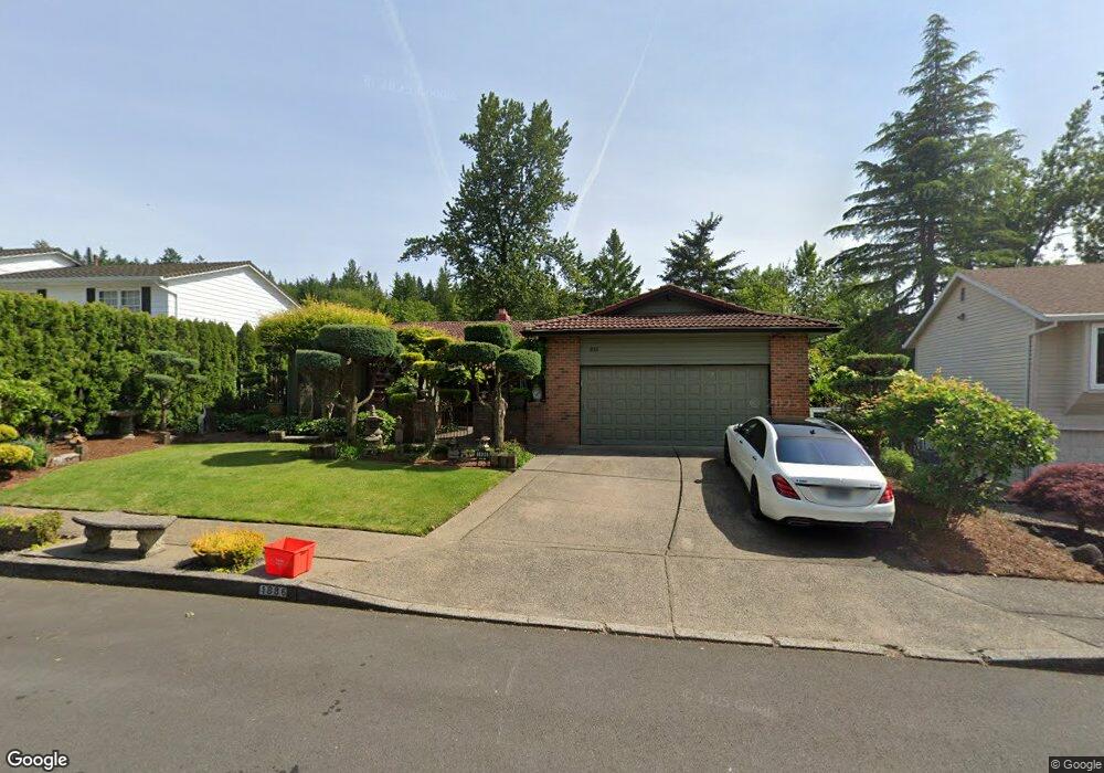
1886 SW 29th Dr Gresham, OR 97080
Southwest Gresham NeighborhoodEstimated Value: $604,000 - $711,000
5
Beds
3
Baths
1,951
Sq Ft
$332/Sq Ft
Est. Value
About This Home
This home is located at 1886 SW 29th Dr, Gresham, OR 97080 and is currently estimated at $647,054, approximately $331 per square foot. 1886 SW 29th Dr is a home located in Multnomah County with nearby schools including Dexter McCarty Middle School, Gresham High School, and Portland Adventist Elementary School.
Ownership History
Date
Name
Owned For
Owner Type
Purchase Details
Closed on
Apr 22, 2025
Sold by
Hadeed Harvey Z and Hadeed Hiam F
Bought by
Hadeed Harvey Z and Hadeed Hiam F
Current Estimated Value
Home Financials for this Owner
Home Financials are based on the most recent Mortgage that was taken out on this home.
Original Mortgage
$451,500
Outstanding Balance
$447,852
Interest Rate
6.65%
Mortgage Type
New Conventional
Estimated Equity
$199,202
Create a Home Valuation Report for This Property
The Home Valuation Report is an in-depth analysis detailing your home's value as well as a comparison with similar homes in the area
Home Values in the Area
Average Home Value in this Area
Purchase History
| Date | Buyer | Sale Price | Title Company |
|---|---|---|---|
| Hadeed Harvey Z | -- | First American Title |
Source: Public Records
Mortgage History
| Date | Status | Borrower | Loan Amount |
|---|---|---|---|
| Open | Hadeed Harvey Z | $451,500 |
Source: Public Records
Tax History
| Year | Tax Paid | Tax Assessment Tax Assessment Total Assessment is a certain percentage of the fair market value that is determined by local assessors to be the total taxable value of land and additions on the property. | Land | Improvement |
|---|---|---|---|---|
| 2025 | $8,298 | $407,770 | -- | -- |
| 2024 | $7,943 | $395,900 | -- | -- |
| 2023 | $7,943 | $384,370 | -- | -- |
| 2022 | $7,034 | $373,180 | $0 | $0 |
| 2021 | $6,857 | $362,320 | $0 | $0 |
| 2020 | $6,452 | $351,770 | $0 | $0 |
| 2019 | $6,283 | $341,530 | $0 | $0 |
| 2018 | $5,991 | $331,590 | $0 | $0 |
| 2017 | $5,748 | $321,940 | $0 | $0 |
| 2016 | $5,068 | $312,570 | $0 | $0 |
| 2015 | $4,959 | $303,470 | $0 | $0 |
| 2014 | $4,838 | $294,640 | $0 | $0 |
Source: Public Records
Map
Nearby Homes
- 3120 SW Orchard Place
- 1645 SW 27th St
- 2160 SW 26th St
- 1320 SW 31st St
- 2520 SW Towle Ave
- 1278 SW 27th Ct
- 0 SW Battaglia Ave
- 1441 SW 23rd Ct
- 3506 SW Battaglia Ave
- 3512 SW Battaglia Ave
- 3536 SW Battaglia Ave
- 2715 SW 31st St
- 1421 SW Binford Lake Pkwy
- 3510 SW Binford Ave
- 3542 SW Binford Ave
- 3626 SW Binford Ave
- 3674 SW Binford Ave
- 3650 SW Binford Ave
- 3588 SW Binford Ave
- 2294 SW Wallula Ln
- 1860 SW 29th Dr
- 1900 SW 29th Dr
- 1906 SW 29th Dr
- 2985 SW Angeline Ave
- 3015 SW Angeline Ave
- 2882 SW Willowbrook Ct
- 1855 SW 29th Dr
- 1797 SW Willow Pw
- 1797 SW Willow Pkwy
- 2925 SW Angeline Ave
- 1920 SW 29th Dr
- 1933 SW Willow Pkwy
- 2881 SW Willowbrook Ct
- 2862 SW Willowbrook Ct
- 2895 SW Angeline Ave
- 2990 SW Angeline Ave
- 1936 SW 29th Dr
- 1860 SW Willow Pkwy
- 1820 SW Willow Pkwy
- 1910 SW Willow Pw
Your Personal Tour Guide
Ask me questions while you tour the home.