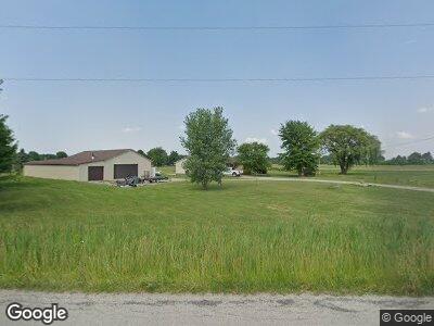
18899 Erhart Rd Grafton, OH 44044
Estimated Value: $405,453 - $468,000
3
Beds
2
Baths
1,928
Sq Ft
$225/Sq Ft
Est. Value
About This Home
This home is located at 18899 Erhart Rd, Grafton, OH 44044 and is currently estimated at $433,363, approximately $224 per square foot. 18899 Erhart Rd is a home with nearby schools including Midview West Elementary School, Midview North Elementary School, and Midview East Intermediate School.
Ownership History
Date
Name
Owned For
Owner Type
Purchase Details
Closed on
Mar 12, 2015
Sold by
Mcwilliams Michael A and Groesser Heather D
Bought by
Mcwilliams Michael A and Mcwilliams Heather D
Current Estimated Value
Home Financials for this Owner
Home Financials are based on the most recent Mortgage that was taken out on this home.
Original Mortgage
$50,000
Interest Rate
3.68%
Mortgage Type
Credit Line Revolving
Purchase Details
Closed on
Jan 18, 1999
Sold by
Raymond Neal and Raymond Pauline
Bought by
Mcwilliams Michael A and Groesser Heather D
Home Financials for this Owner
Home Financials are based on the most recent Mortgage that was taken out on this home.
Original Mortgage
$28,900
Interest Rate
6.76%
Create a Home Valuation Report for This Property
The Home Valuation Report is an in-depth analysis detailing your home's value as well as a comparison with similar homes in the area
Home Values in the Area
Average Home Value in this Area
Purchase History
| Date | Buyer | Sale Price | Title Company |
|---|---|---|---|
| Mcwilliams Michael A | -- | Liberty Title & Escrow Co | |
| Mcwilliams Michael A | $34,000 | Midland Title |
Source: Public Records
Mortgage History
| Date | Status | Borrower | Loan Amount |
|---|---|---|---|
| Closed | Mcwilliams Michael A | $50,000 | |
| Closed | Mcwilliams Michael A | $102,500 | |
| Closed | Mcwilliams Michael A | $5,000 | |
| Closed | Mcwilliams Michael A | $130,000 | |
| Closed | Mcwilliams Michael A | $129,600 | |
| Closed | Mcwilliams Michael A | $28,900 |
Source: Public Records
Tax History Compared to Growth
Tax History
| Year | Tax Paid | Tax Assessment Tax Assessment Total Assessment is a certain percentage of the fair market value that is determined by local assessors to be the total taxable value of land and additions on the property. | Land | Improvement |
|---|---|---|---|---|
| 2024 | $5,897 | $129,388 | $37,429 | $91,959 |
| 2023 | $4,664 | $93,156 | $22,334 | $70,823 |
| 2022 | $4,571 | $93,156 | $22,334 | $70,823 |
| 2021 | $4,584 | $93,156 | $22,334 | $70,823 |
| 2020 | $4,353 | $82,220 | $19,710 | $62,510 |
| 2019 | $4,337 | $82,220 | $19,710 | $62,510 |
| 2018 | $4,242 | $79,570 | $19,710 | $59,860 |
| 2017 | $3,589 | $62,100 | $19,740 | $42,360 |
| 2016 | $3,638 | $62,100 | $19,740 | $42,360 |
| 2015 | $3,657 | $62,100 | $19,740 | $42,360 |
| 2014 | -- | $59,710 | $18,980 | $40,730 |
| 2013 | $3,615 | $59,070 | $18,980 | $40,090 |
Source: Public Records
Map
Nearby Homes
- 18710 State Route 57
- 34433 Law Rd
- 2490 Station Rd
- 0 Dunham Rd
- 6972 Stagecoach Trail
- 3770 Station Rd
- 1416 Deer Crossing
- 6721 River Walk Dr
- 2815 Columbia Rd
- 15774 Cowley Rd
- 6566 Wolff Rd
- 3215 Columbia Rd
- 0 Norwalk Rd
- 16200 Ohio 83
- 8266 Stone Rd
- 1140 W River Rd Unit ED
- 0 Spieth Rd
- 7116 Norwalk Rd
- 15864 Avon Belden Rd
- 4152 Avon Lake Rd
- 18899 Erhart Rd
- 18889 Erhart Rd
- 18818 State Route 57
- 34110 Neff Rd
- 18879 Erhart Rd
- 34102 Neff Rd
- 34081 Neff Rd
- 18780 State Route 57
- 34165 Neff Rd
- 33933 Neff Rd
- 18730 State Route 57
- 34250 Neff Rd
- 34253 Neff Rd
- 33843 Neff Rd
- 18710 Ohio 57
- 33823 Neff Rd
- 19159 State Route 57
- 34184 Neff Rd
- 18648 State Route 57
- 19160 State Route 57
