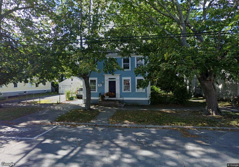
189 High St Bristol, RI 02809
Downtown Bristol NeighborhoodEstimated Value: $710,000 - $947,000
3
Beds
3
Baths
2,016
Sq Ft
$416/Sq Ft
Est. Value
About This Home
This home is located at 189 High St, Bristol, RI 02809 and is currently estimated at $838,951, approximately $416 per square foot. 189 High St is a home located in Bristol County with nearby schools including Mt. Hope High School and Our Lady of Mt. Carmel School.
Ownership History
Date
Name
Owned For
Owner Type
Purchase Details
Closed on
Apr 15, 2015
Sold by
Damaskos James C
Bought by
Damaskos James C and Patterson Susan P
Current Estimated Value
Purchase Details
Closed on
Aug 29, 1989
Sold by
Prindville Paul
Bought by
Damaskos James
Home Financials for this Owner
Home Financials are based on the most recent Mortgage that was taken out on this home.
Original Mortgage
$187,600
Interest Rate
9.67%
Create a Home Valuation Report for This Property
The Home Valuation Report is an in-depth analysis detailing your home's value as well as a comparison with similar homes in the area
Home Values in the Area
Average Home Value in this Area
Purchase History
| Date | Buyer | Sale Price | Title Company |
|---|---|---|---|
| Damaskos James C | -- | -- | |
| Damaskos James | $235,000 | -- |
Source: Public Records
Mortgage History
| Date | Status | Borrower | Loan Amount |
|---|---|---|---|
| Previous Owner | Damaskos James | $187,600 |
Source: Public Records
Tax History
| Year | Tax Paid | Tax Assessment Tax Assessment Total Assessment is a certain percentage of the fair market value that is determined by local assessors to be the total taxable value of land and additions on the property. | Land | Improvement |
|---|---|---|---|---|
| 2025 | $7,735 | $559,700 | $216,000 | $343,700 |
| 2024 | $7,735 | $559,700 | $216,000 | $343,700 |
| 2023 | $7,478 | $559,700 | $216,000 | $343,700 |
| 2022 | $7,276 | $559,700 | $216,000 | $343,700 |
| 2021 | $6,887 | $478,900 | $207,600 | $271,300 |
| 2020 | $6,738 | $478,900 | $207,600 | $271,300 |
| 2019 | $6,571 | $478,900 | $207,600 | $271,300 |
| 2018 | $7,890 | $513,000 | $180,900 | $332,100 |
| 2017 | $6,226 | $417,300 | $166,400 | $250,900 |
| 2016 | $6,164 | $417,300 | $166,400 | $250,900 |
| 2015 | $5,855 | $417,300 | $166,400 | $250,900 |
| 2014 | -- | $419,160 | $225,500 | $193,660 |
Source: Public Records
Map
Nearby Homes
- 423 Hope St Unit 1A
- 78 State St
- 18 State St Unit 5 (3rd Floor East)
- 88 Burton St
- 53 Catherine St
- 44 Bradford St Unit 49
- 236 State St
- 2 Wilson St
- 2 Chilton St
- 9 Hope St
- 413 High St
- 293 State St
- 85 Bay View Ave Unit 2
- 32 Massasoit Ave
- 30 Massasoit Ave
- 11 Gladding St
- 25 Massasoit Ave
- 27 Massasoit Ave
- 26 Roosevelt Dr
- 79 Hopeworth Ave
- 195 High St
- 183 High St
- 188 High St
- 201 High St
- 201 High St Unit 2R
- 201 High St Unit 2F
- 201 High St Unit 1
- 184 High St
- 46 Byfield St
- 42 Byfield St
- 73 Constitution St
- 79 Constitution St
- 75 Constitution St
- 180 High St
- 180 High St Unit 2
- 203 High St
- 67 Constitution St
- 38 Byfield St
- 178 High St
- 178 High St Unit 2
Your Personal Tour Guide
Ask me questions while you tour the home.