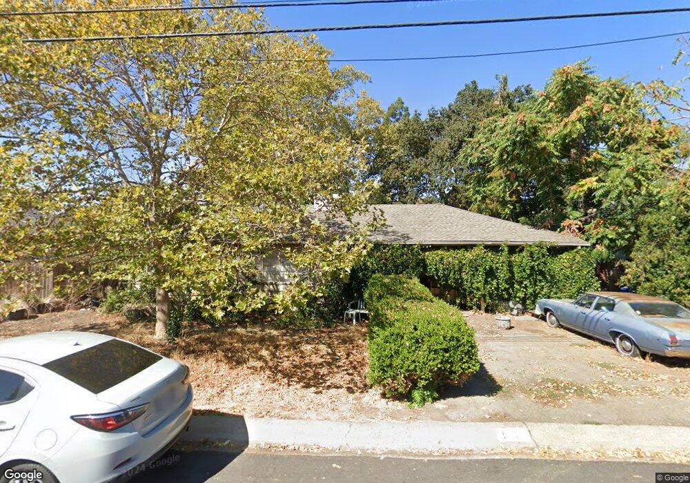
1891 Pear Dr Concord, CA 94518
Tree Haven NeighborhoodEstimated Value: $565,933 - $685,000
3
Beds
1
Bath
956
Sq Ft
$681/Sq Ft
Est. Value
About This Home
This home is located at 1891 Pear Dr, Concord, CA 94518 and is currently estimated at $651,233, approximately $681 per square foot. 1891 Pear Dr is a home located in Contra Costa County with nearby schools including Ygnacio Valley Elementary School, Oak Grove Middle School, and Ygnacio Valley High School.
Ownership History
Date
Name
Owned For
Owner Type
Purchase Details
Closed on
Jun 2, 2025
Sold by
Mcdavid Joan E
Bought by
Joan E Mcdavid 2025 Living Trust and Mcdavid
Current Estimated Value
Purchase Details
Closed on
Sep 3, 2003
Sold by
Mcdavid Joan E
Bought by
Mcdavid Joan E
Home Financials for this Owner
Home Financials are based on the most recent Mortgage that was taken out on this home.
Original Mortgage
$160,000
Interest Rate
5.87%
Mortgage Type
Purchase Money Mortgage
Purchase Details
Closed on
Jul 7, 2003
Sold by
Mcdavid Joan E
Bought by
Mcdavid Joan E
Home Financials for this Owner
Home Financials are based on the most recent Mortgage that was taken out on this home.
Original Mortgage
$160,000
Interest Rate
5.87%
Mortgage Type
Purchase Money Mortgage
Purchase Details
Closed on
Aug 6, 1998
Sold by
Mcdavid Robert G and Mcdavid Carol S
Bought by
Mcdavid Joan E
Home Financials for this Owner
Home Financials are based on the most recent Mortgage that was taken out on this home.
Original Mortgage
$109,500
Interest Rate
6.88%
Mortgage Type
Purchase Money Mortgage
Purchase Details
Closed on
Jul 17, 1998
Sold by
Mcdavid Joan E and Mcdavid Robert C
Bought by
Mcdavid Joan E
Home Financials for this Owner
Home Financials are based on the most recent Mortgage that was taken out on this home.
Original Mortgage
$109,500
Interest Rate
6.88%
Mortgage Type
Purchase Money Mortgage
Purchase Details
Closed on
May 29, 1996
Sold by
Millard Michael E and Millard Janet R
Bought by
Mcdavid Joan E and Mcdavid Robert G
Home Financials for this Owner
Home Financials are based on the most recent Mortgage that was taken out on this home.
Original Mortgage
$95,200
Interest Rate
7.97%
Mortgage Type
Purchase Money Mortgage
Purchase Details
Closed on
May 3, 1996
Sold by
Millard Michael E and Millard Janet R
Bought by
Millard Michael E and Millard Janet R
Home Financials for this Owner
Home Financials are based on the most recent Mortgage that was taken out on this home.
Original Mortgage
$95,200
Interest Rate
7.97%
Mortgage Type
Purchase Money Mortgage
Create a Home Valuation Report for This Property
The Home Valuation Report is an in-depth analysis detailing your home's value as well as a comparison with similar homes in the area
Home Values in the Area
Average Home Value in this Area
Purchase History
| Date | Buyer | Sale Price | Title Company |
|---|---|---|---|
| Joan E Mcdavid 2025 Living Trust | -- | None Listed On Document | |
| Mcdavid Joan E | -- | None Listed On Document | |
| Mcdavid Joan E | -- | Old Republic Title Company | |
| Mcdavid Joan E | -- | Old Republic Title | |
| Mcdavid Joan E | -- | -- | |
| Mcdavid Joan E | -- | Old Republic Title | |
| Mcdavid Joan E | -- | -- | |
| Mcdavid Joan E | $119,000 | Old Republic Title Company | |
| Millard Michael E | -- | -- |
Source: Public Records
Mortgage History
| Date | Status | Borrower | Loan Amount |
|---|---|---|---|
| Previous Owner | Mcdavid Joan E | $160,000 | |
| Previous Owner | Mcdavid Joan E | $109,500 | |
| Previous Owner | Mcdavid Joan E | $95,200 | |
| Closed | Mcdavid Joan E | $25,000 |
Source: Public Records
Tax History
| Year | Tax Paid | Tax Assessment Tax Assessment Total Assessment is a certain percentage of the fair market value that is determined by local assessors to be the total taxable value of land and additions on the property. | Land | Improvement |
|---|---|---|---|---|
| 2025 | $3,117 | $197,660 | $145,430 | $52,230 |
| 2024 | $3,021 | $193,785 | $142,579 | $51,206 |
| 2023 | $2,943 | $189,986 | $139,784 | $50,202 |
| 2022 | $2,881 | $186,262 | $137,044 | $49,218 |
| 2021 | $2,793 | $182,610 | $134,357 | $48,253 |
| 2019 | $2,724 | $177,196 | $130,373 | $46,823 |
| 2018 | $2,610 | $173,722 | $127,817 | $45,905 |
| 2017 | $2,508 | $170,316 | $125,311 | $45,005 |
| 2016 | $2,412 | $166,977 | $122,854 | $44,123 |
| 2015 | $2,355 | $164,470 | $121,009 | $43,461 |
| 2014 | $2,287 | $161,249 | $118,639 | $42,610 |
Source: Public Records
Map
Nearby Homes
- 2005 Sierra Rd
- 1036 Oak Grove Rd Unit 23
- 1036 Oak Grove Rd Unit 86
- 1036 Oak Grove Rd Unit 21
- 1060 Oak Grove Rd Unit 37
- 2045 Sierra Rd Unit 2
- 2055 Sierra Rd Unit 53
- 1035 Heckmann Ln
- 1110 Eureka Ln
- 1133 Meadow Ln Unit 106
- 1133 Meadow Ln Unit 53
- 1630 Nicholas Dr
- 1459 Del Rio Cir Unit C
- 954 Alla Ave
- 1237 Pine Creek Way Unit A
- 1181 Aspen Dr
- 1134 Lovell Ct
- 1040 Mohr Ln Unit A
- 1040 Mohr Ln Unit C
- 1044 Mohr Ln Unit D
Your Personal Tour Guide
Ask me questions while you tour the home.