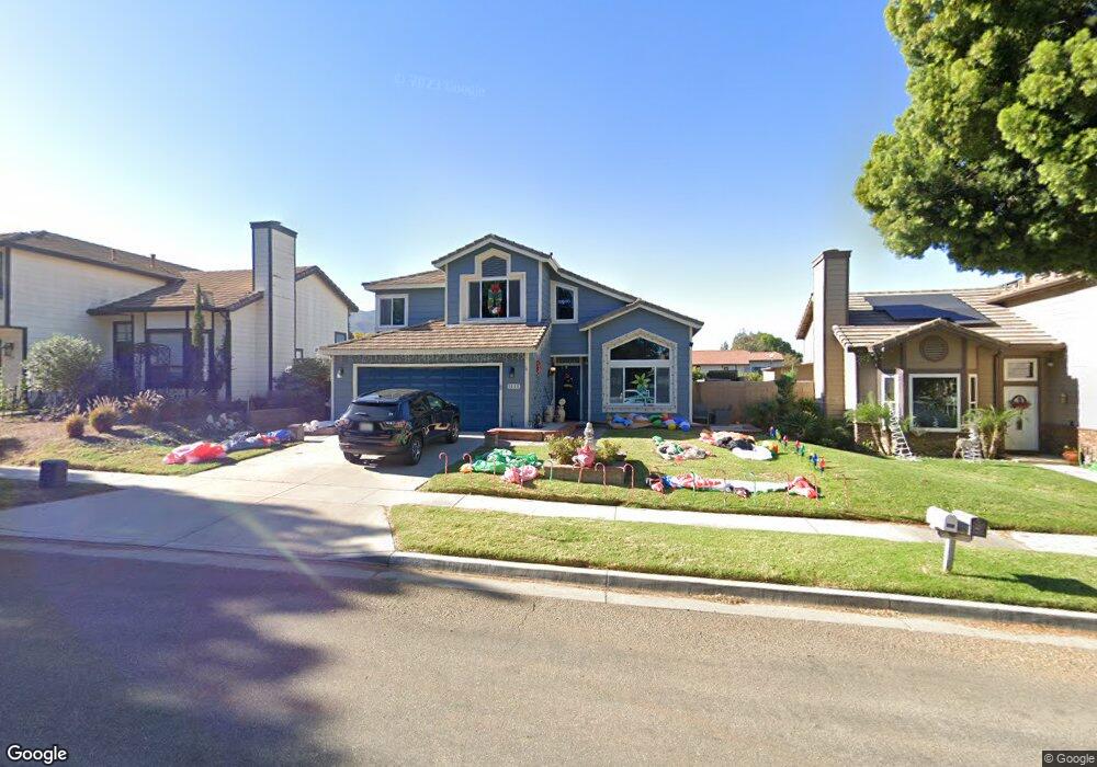
1892 Fir St Corona, CA 92882
Central Corona NeighborhoodEstimated Value: $758,921 - $824,000
4
Beds
3
Baths
1,885
Sq Ft
$422/Sq Ft
Est. Value
About This Home
This home is located at 1892 Fir St, Corona, CA 92882 and is currently estimated at $795,980, approximately $422 per square foot. 1892 Fir St is a home located in Riverside County with nearby schools including Benjamin Franklin Elementary School, Letha Raney Intermediate School, and Corona High School.
Ownership History
Date
Name
Owned For
Owner Type
Purchase Details
Closed on
Dec 29, 2021
Sold by
Adan Family Trust
Bought by
Adan Andrew and Adan Elizabeth H
Current Estimated Value
Home Financials for this Owner
Home Financials are based on the most recent Mortgage that was taken out on this home.
Original Mortgage
$500,000
Interest Rate
3.11%
Mortgage Type
New Conventional
Purchase Details
Closed on
Sep 1, 2016
Sold by
Adan Regulo P and Adan Marilou A
Bought by
Adan Regulo P and Adan Marilou A
Create a Home Valuation Report for This Property
The Home Valuation Report is an in-depth analysis detailing your home's value as well as a comparison with similar homes in the area
Home Values in the Area
Average Home Value in this Area
Purchase History
| Date | Buyer | Sale Price | Title Company |
|---|---|---|---|
| Adan Andrew | -- | Lawyers Title | |
| Adan Regulo P | -- | None Available |
Source: Public Records
Mortgage History
| Date | Status | Borrower | Loan Amount |
|---|---|---|---|
| Closed | Adan Andrew | $500,000 |
Source: Public Records
Tax History Compared to Growth
Tax History
| Year | Tax Paid | Tax Assessment Tax Assessment Total Assessment is a certain percentage of the fair market value that is determined by local assessors to be the total taxable value of land and additions on the property. | Land | Improvement |
|---|---|---|---|---|
| 2025 | $3,489 | $317,045 | $93,805 | $223,240 |
| 2023 | $3,489 | $683,400 | $170,340 | $513,060 |
| 2022 | $3,378 | $298,764 | $88,398 | $210,366 |
| 2021 | $3,311 | $292,907 | $86,665 | $206,242 |
| 2020 | $3,274 | $289,905 | $85,777 | $204,128 |
| 2019 | $3,199 | $284,222 | $84,096 | $200,126 |
| 2018 | $3,128 | $278,650 | $82,448 | $196,202 |
| 2017 | $3,052 | $273,187 | $80,832 | $192,355 |
| 2016 | $3,021 | $267,832 | $79,248 | $188,584 |
| 2015 | $2,956 | $263,810 | $78,058 | $185,752 |
| 2014 | $2,850 | $258,644 | $76,530 | $182,114 |
Source: Public Records
Map
Nearby Homes
- 1310 Brentwood Cir Unit B
- 1365 Kroonen Dr
- 1344 Brentwood Cir Unit C
- 1317 Sonora Dr
- 1535 Border Ave Unit C
- 1598 Border Ave Unit H
- 1427 Baird St
- 1486 Baird St
- 1386 Fairmont Dr
- 1284 Mayfair Dr
- 1361 Camelot Dr
- 1558 Camelot Dr
- 1505 Camelot Dr
- 1533 Camelot Dr
- 1514 Via Del Rio
- 2350 Centennial Way
- 2393 Mesquite Ln
- 1764 Coplen Cir
- 1194 Border Ave Unit A
- 1757 Fraser Cir
- 1896 Fir St
- 1884 Fir St
- 1898 Fir St
- 1876 Fir St
- 1382 Bottlebrush St
- 1868 Fir St
- 1310 Brentwood Cir Unit D
- 1310 Brentwood Cir
- 1310 Brentwood Cir Unit A
- 1310 Brentwood Cir Unit C
- 1304 Brentwood Cir Unit C
- 1304 Brentwood Cir Unit D
- 1304 Brentwood Cir Unit B
- 1304 Brentwood Cir Unit A
- 1374 Bottlebrush St
- 1860 Fir St
- 1359 Kroonen Dr
- 1300 Brentwood Cir Unit C
- 1300 Brentwood Cir Unit D
- 1300 Brentwood Cir Unit B