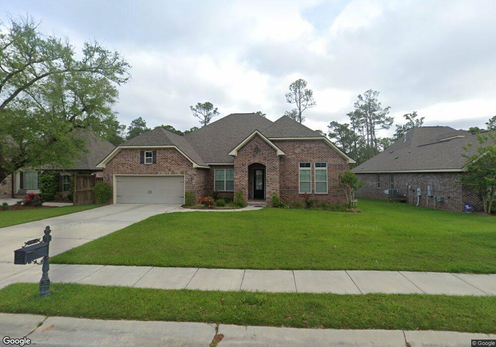
1896 Paul David Dr Biloxi, MS 39532
Estimated Value: $484,666 - $750,000
--
Bed
--
Bath
3,323
Sq Ft
$169/Sq Ft
Est. Value
About This Home
This home is located at 1896 Paul David Dr, Biloxi, MS 39532 and is currently estimated at $560,417, approximately $168 per square foot. 1896 Paul David Dr is a home with nearby schools including North Bay Elementary School, Biloxi Junior High School, and Biloxi High School.
Ownership History
Date
Name
Owned For
Owner Type
Purchase Details
Closed on
Nov 11, 2022
Sold by
Sawant Ulhas Sitaram
Bought by
Sawant Ulhas Sitaram and Sawant Chandramaniben Ulhas
Current Estimated Value
Purchase Details
Closed on
Nov 14, 2019
Sold by
Kher Rasing R
Bought by
Sawant Ulhas Sitaram
Home Financials for this Owner
Home Financials are based on the most recent Mortgage that was taken out on this home.
Original Mortgage
$204,800
Interest Rate
3.6%
Mortgage Type
New Conventional
Create a Home Valuation Report for This Property
The Home Valuation Report is an in-depth analysis detailing your home's value as well as a comparison with similar homes in the area
Home Values in the Area
Average Home Value in this Area
Purchase History
| Date | Buyer | Sale Price | Title Company |
|---|---|---|---|
| Sawant Ulhas Sitaram | -- | Pilger Title | |
| Sawant Ulhas Sitaram | -- | None Available |
Source: Public Records
Mortgage History
| Date | Status | Borrower | Loan Amount |
|---|---|---|---|
| Previous Owner | Sawant Ulhas Sitaram | $204,800 |
Source: Public Records
Tax History Compared to Growth
Tax History
| Year | Tax Paid | Tax Assessment Tax Assessment Total Assessment is a certain percentage of the fair market value that is determined by local assessors to be the total taxable value of land and additions on the property. | Land | Improvement |
|---|---|---|---|---|
| 2024 | $5,879 | $53,071 | $0 | $0 |
| 2023 | $5,771 | $52,577 | $0 | $0 |
| 2022 | $5,771 | $52,577 | $0 | $0 |
| 2021 | $5,771 | $52,577 | $0 | $0 |
| 2020 | $5,343 | $48,620 | $0 | $0 |
| 2019 | $5,343 | $48,620 | $0 | $0 |
| 2018 | $5,343 | $48,620 | $0 | $0 |
| 2017 | $5,334 | $48,538 | $0 | $0 |
| 2015 | $659 | $6,000 | $0 | $0 |
| 2014 | -- | $10,000 | $0 | $0 |
| 2013 | -- | $6,000 | $6,000 | $0 |
Source: Public Records
Map
Nearby Homes
- 0 Caroline Dr Unit 4117846
- 1853 Popps Ferry Rd
- 0 Campbell Road Dr Unit 4027188
- 939 Tommy Munro Dr
- 0 Jam Ln
- 1099 Campbell Dr
- 0 Popps Ferry Rd Unit 4108141
- 0 Popps Ferry Rd Unit 4108136
- 2077 Crane Ridge
- 2090 Woodfield Ln
- 944 Cedar Lake Rd
- 748 Malpass Landing Dr
- 957 Rustwood Dr
- 11532 Cedar Lake Rd
- 739 Malpass Landing Dr
- 2053 Carolwood Dr
- 820 Leeward Dr
- 0 Silkwood Ln
- 694 Water's View Dr
- 0 Masterson Ave Unit 4116225
- 1898 Paul David Dr
- 1894 Paul David Dr
- 1892 Paul David Dr
- 1900 Paul David Dr
- 918 Caroline Dr
- 1902 Paul David Dr
- 1890 Paul David Dr
- 917 Burdonne Dr
- LOT 6 Lot 6 Paul David Dr
- LOT 5 Lot 5 Paul David Dr
- LOT 7 Lot 7 Paul David Dr
- LOT 3 Lot 3 Paul David Dr
- 919 Caroline Dr
- LOT 16 Lot 16 Paul David Dr
- LOT 9 Lot 9 Paul David Dr
- LOT 8 Lot 8 Paul David Dr
- LOT 4 Lot 4 Paul David Dr
- 970 Emily Dr
- 920 Caroline Dr
- 1904 Paul David Dr