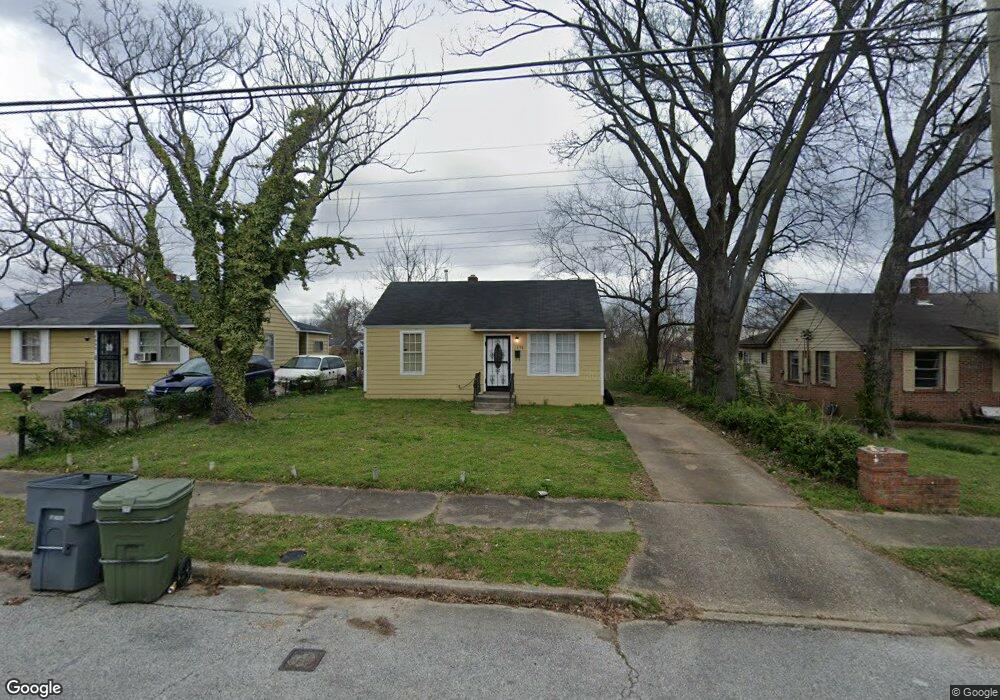
1898 Freemont Rd Memphis, TN 38114
Southeast Memphis NeighborhoodEstimated Value: $54,000 - $90,000
2
Beds
1
Bath
720
Sq Ft
$100/Sq Ft
Est. Value
About This Home
This home is located at 1898 Freemont Rd, Memphis, TN 38114 and is currently estimated at $72,292, approximately $100 per square foot. 1898 Freemont Rd is a home located in Shelby County with nearby schools including Hamilton High School, Memphis College Preparatory, and Veritas College Preparatory.
Ownership History
Date
Name
Owned For
Owner Type
Purchase Details
Closed on
Jul 20, 2021
Sold by
Stewart Donald
Bought by
D Stewarts Empire Llc
Current Estimated Value
Purchase Details
Closed on
Jul 14, 2016
Sold by
Johnson Joseph and Stewart Susie A
Bought by
Stewart Donald
Purchase Details
Closed on
May 31, 1996
Sold by
Baruti Omar M
Bought by
Johnson Joseph and Stewart Susie A
Home Financials for this Owner
Home Financials are based on the most recent Mortgage that was taken out on this home.
Original Mortgage
$35,339
Interest Rate
7.88%
Mortgage Type
FHA
Create a Home Valuation Report for This Property
The Home Valuation Report is an in-depth analysis detailing your home's value as well as a comparison with similar homes in the area
Home Values in the Area
Average Home Value in this Area
Purchase History
| Date | Buyer | Sale Price | Title Company |
|---|---|---|---|
| D Stewarts Empire Llc | -- | None Available | |
| Stewart Donald | $1,900 | None Available | |
| Johnson Joseph | $35,000 | Security Title Company Inc |
Source: Public Records
Mortgage History
| Date | Status | Borrower | Loan Amount |
|---|---|---|---|
| Previous Owner | Johnson Joseph | $35,339 | |
| Closed | Johnson Joseph | $1,913 |
Source: Public Records
Tax History Compared to Growth
Tax History
| Year | Tax Paid | Tax Assessment Tax Assessment Total Assessment is a certain percentage of the fair market value that is determined by local assessors to be the total taxable value of land and additions on the property. | Land | Improvement |
|---|---|---|---|---|
| 2025 | $122 | $6,500 | $1,500 | $5,000 |
| 2024 | $122 | $3,600 | $1,000 | $2,600 |
| 2023 | $219 | $3,600 | $1,000 | $2,600 |
| 2022 | $219 | $3,600 | $1,000 | $2,600 |
| 2021 | $261 | $3,600 | $1,000 | $2,600 |
| 2020 | $241 | $3,325 | $1,000 | $2,325 |
| 2019 | $106 | $3,325 | $1,000 | $2,325 |
| 2018 | $106 | $3,325 | $1,000 | $2,325 |
| 2017 | $109 | $3,325 | $1,000 | $2,325 |
| 2016 | $170 | $3,900 | $0 | $0 |
| 2014 | $170 | $3,900 | $0 | $0 |
Source: Public Records
Map
Nearby Homes
- 1817 S Barksdale St
- 1949 Lapaloma St
- 1936 Frisco Ave
- 1971 Boyle Ave
- 1832 Rozelle St
- 1824 Rozelle St
- 996 Rozelle St
- 2151 Goff Ave
- 1560 Cane Rd
- 1698 Rayner St
- 2149 Wabash Ave
- 1790 Westmore St
- 0 Airways Blvd Unit 10199303
- 1721 W Silver St
- 1720 Airways Blvd
- 1493 Oaklawn St
- 0 Dublin Ave Unit LOTS 20 & 21 LAST TW
- 1998 Cloverdale Dr
- 1911 Quinn Ave
- 1481 Oaklawn St
- 1892 Freemont Rd
- 1902 Freemont Rd
- 1888 Freemont Rd
- 1906 Freemont Rd
- 1884 Freemont Rd
- 1903 Freemont Rd
- 1910 Freemont Rd
- 1878 Freemont Rd
- 1887 Freemont Rd
- 1915 Ferber Ave
- 1879 Freemont Rd
- 1916 Freemont Rd
- 1909 Ferber Ave
- 1874 Freemont Rd
- 1902 S Barksdale St
- 1903 Ferber Ave
- 1907 Freemont Rd
- 1895 Ferber Ave
- 1901 S Barksdale St
- 1920 Freemont Rd