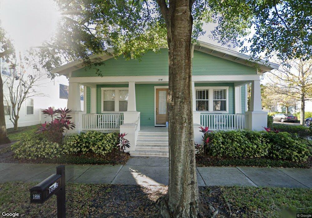
1898 Robin Rd Orlando, FL 32814
Baldwin Park NeighborhoodEstimated Value: $784,000 - $1,293,000
3
Beds
2
Baths
2,929
Sq Ft
$378/Sq Ft
Est. Value
About This Home
This home is located at 1898 Robin Rd, Orlando, FL 32814 and is currently estimated at $1,106,532, approximately $377 per square foot. 1898 Robin Rd is a home located in Orange County with nearby schools including Baldwin Park Elementary, Glenridge Middle, and Winter Park High.
Ownership History
Date
Name
Owned For
Owner Type
Purchase Details
Closed on
Dec 18, 2013
Sold by
Farrell Ann Marie and Farrell Ann Marie
Bought by
Farrell Ann M
Current Estimated Value
Purchase Details
Closed on
Feb 1, 2013
Sold by
Farrell Ann Marie
Bought by
Farrell Ann Marie
Purchase Details
Closed on
Dec 10, 2012
Sold by
Farrell Ann Marie and Estate Of Joseph T Farrell
Bought by
Farrell Ann Marie and Family Trust Uw Joseph T Farre
Purchase Details
Closed on
Jul 8, 2004
Sold by
Cambridge Homes Ltd
Bought by
Farrell Joseph T and Farrell Ann Marie
Home Financials for this Owner
Home Financials are based on the most recent Mortgage that was taken out on this home.
Original Mortgage
$333,700
Interest Rate
5.97%
Mortgage Type
Purchase Money Mortgage
Create a Home Valuation Report for This Property
The Home Valuation Report is an in-depth analysis detailing your home's value as well as a comparison with similar homes in the area
Home Values in the Area
Average Home Value in this Area
Purchase History
| Date | Buyer | Sale Price | Title Company |
|---|---|---|---|
| Farrell Ann M | -- | Attorney | |
| Farrell Ann Marie | -- | Attorney | |
| Farrell Ann Marie | -- | Attorney | |
| Farrell Ann Marie | -- | Attorney | |
| Farrell Joseph T | $461,200 | Fidelity National Title Ins |
Source: Public Records
Mortgage History
| Date | Status | Borrower | Loan Amount |
|---|---|---|---|
| Previous Owner | Farrell Joseph T | $333,700 | |
| Closed | Farrell Joseph T | $35,245 |
Source: Public Records
Tax History
| Year | Tax Paid | Tax Assessment Tax Assessment Total Assessment is a certain percentage of the fair market value that is determined by local assessors to be the total taxable value of land and additions on the property. | Land | Improvement |
|---|---|---|---|---|
| 2025 | $19,693 | $1,031,450 | $155,000 | $876,450 |
| 2024 | $16,650 | $959,327 | -- | -- |
| 2023 | $16,650 | $909,182 | $137,000 | $772,182 |
| 2022 | $14,691 | $728,089 | $137,000 | $591,089 |
| 2021 | $13,607 | $655,233 | $137,000 | $518,233 |
| 2020 | $12,394 | $613,099 | $137,000 | $476,099 |
| 2019 | $13,143 | $616,823 | $137,000 | $479,823 |
| 2018 | $12,253 | $563,373 | $137,000 | $426,373 |
| 2017 | $12,204 | $552,111 | $137,000 | $415,111 |
| 2016 | $12,156 | $539,544 | $137,000 | $402,544 |
| 2015 | $12,043 | $522,532 | $137,000 | $385,532 |
| 2014 | $11,670 | $497,161 | $137,000 | $360,161 |
Source: Public Records
Map
Nearby Homes
- 3838 Haws Ln
- 2002 Shaw Ln
- 4264 Haws Ct
- 4250 Corrine Dr Unit 203
- 3018 Northwood Blvd
- 1819 Common Way Rd Unit 203
- 2066 Brink Aly
- 3504 Finch St
- 2058 Prospect Ave
- 1725 Firehouse Ln Unit 207
- 1865 Britlyn Aly
- 1674 Lakemont Ave Unit 201
- 1631 Lakemont Ave
- 4571 Virginia Dr
- 4500 Virginia Dr
- 1563 Common Way Rd
- 4510 Lower Park Rd
- 4575 New Broad St
- 2812 Mulford Ave
- 1616 Oriole Ave
- 1854 Robin Rd Unit 4
- 3964 Haws Ln
- 1910 Robin Rd
- 3946 Haws Ln Unit 4
- 3977 Corrine Dr
- 1899 Robin Rd
- 3993 Corrine Dr
- 1853 Robin Rd
- 3971 Haws Ln
- 3961 Corrine Dr Unit 4
- 1954 Robin Rd
- 3928 Haws Ln
- 3945 Corrine Dr
- 1911 Robin Rd
- 3947 Haws Ln Unit 4
- 4009 Corrine Dr Unit 4
- 3910 Haws Ln Unit 4
- 3923 Haws Ln Unit 4
- 3923 Haws Ln
- 1955 Robin Rd
Your Personal Tour Guide
Ask me questions while you tour the home.