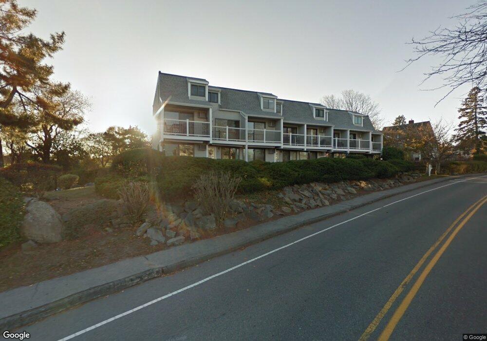
19 Atlantic Rd Unit 15 Gloucester, MA 01930
East Gloucester NeighborhoodEstimated Value: $522,447 - $681,000
2
Beds
1
Bath
1,050
Sq Ft
$556/Sq Ft
Est. Value
About This Home
This home is located at 19 Atlantic Rd Unit 15, Gloucester, MA 01930 and is currently estimated at $583,862, approximately $556 per square foot. 19 Atlantic Rd Unit 15 is a home located in Essex County with nearby schools including East Gloucester Elementary School, Ralph B O'maley Middle School, and Gloucester High School.
Ownership History
Date
Name
Owned For
Owner Type
Purchase Details
Closed on
Mar 13, 2025
Sold by
Bell Rt and Bell
Bought by
Bell Ft and Bell
Current Estimated Value
Purchase Details
Closed on
Apr 20, 2001
Sold by
Est Bailey Mildred H and Bailey Cynthia
Bought by
Bell Rt and Bell Selma R
Home Financials for this Owner
Home Financials are based on the most recent Mortgage that was taken out on this home.
Original Mortgage
$164,000
Interest Rate
6.9%
Mortgage Type
Purchase Money Mortgage
Create a Home Valuation Report for This Property
The Home Valuation Report is an in-depth analysis detailing your home's value as well as a comparison with similar homes in the area
Home Values in the Area
Average Home Value in this Area
Purchase History
| Date | Buyer | Sale Price | Title Company |
|---|---|---|---|
| Bell Ft | -- | None Available | |
| Bell Ft | -- | None Available | |
| Bell Ft | -- | None Available | |
| Bell Rt | $205,000 | -- | |
| Bell Rt | $205,000 | -- |
Source: Public Records
Mortgage History
| Date | Status | Borrower | Loan Amount |
|---|---|---|---|
| Previous Owner | Bell Rt | $164,000 |
Source: Public Records
Tax History Compared to Growth
Tax History
| Year | Tax Paid | Tax Assessment Tax Assessment Total Assessment is a certain percentage of the fair market value that is determined by local assessors to be the total taxable value of land and additions on the property. | Land | Improvement |
|---|---|---|---|---|
| 2025 | $4,835 | $497,400 | $0 | $497,400 |
| 2024 | $4,533 | $465,900 | $0 | $465,900 |
| 2023 | $4,673 | $441,300 | $0 | $441,300 |
| 2022 | $4,469 | $381,000 | $0 | $381,000 |
| 2021 | $4,508 | $362,400 | $0 | $362,400 |
| 2020 | $4,468 | $362,400 | $0 | $362,400 |
| 2019 | $4,051 | $319,200 | $0 | $319,200 |
| 2018 | $4,116 | $318,300 | $0 | $318,300 |
| 2017 | $3,887 | $294,700 | $0 | $294,700 |
| 2016 | $3,690 | $271,100 | $0 | $271,100 |
| 2015 | $3,620 | $265,200 | $0 | $265,200 |
Source: Public Records
Map
Nearby Homes
- 20 Haskell St
- 9 Rocky Pasture Rd
- 10 Amero Ct
- 26 Marina Dr
- 20 Calder St
- 86 E Main St
- 100 E Main St
- 97 E Main St
- 30 Chapel St Unit B
- 29 Harrison Ave
- 36 Links Rd
- 197 E Main St
- 197 E Main St Unit 1
- 197 E Main St Unit 2
- 197 E Main St Unit 1 & 2
- 22 Taylor St Unit 1
- 160 Prospect St Unit 3
- 10 Seaview Rd
- 4 Mount Vernon St
- 60 Rocky Neck Ave Unit 202
- 19 Atlantic Rd Unit 19
- 19 Atlantic Rd Unit 33
- 19 Atlantic Rd Unit 32
- 19 Atlantic Rd Unit 31
- 19 Atlantic Rd Unit 30
- 19 Atlantic Rd Unit 29
- 19 Atlantic Rd Unit 28
- 19 Atlantic Rd Unit 27
- 19 Atlantic Rd Unit 26
- 19 Atlantic Rd Unit 25
- 19 Atlantic Rd Unit 24
- 19 Atlantic Rd Unit 23
- 19 Atlantic Rd Unit 22G
- 19 Atlantic Rd Unit 21
- 19 Atlantic Rd Unit 20
- 19 Atlantic Rd
- 19 Atlantic Rd Unit 18
- 19 Atlantic Rd Unit 17
- 19 Atlantic Rd Unit 16
- 19 Atlantic Rd Unit 14