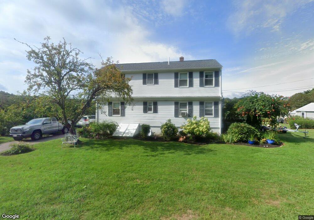
19 Beverly Rd Pocasset, MA 02559
Pocasset NeighborhoodEstimated Value: $1,039,509 - $1,827,000
4
Beds
3
Baths
2,201
Sq Ft
$582/Sq Ft
Est. Value
About This Home
This home is located at 19 Beverly Rd, Pocasset, MA 02559 and is currently estimated at $1,280,127, approximately $581 per square foot. 19 Beverly Rd is a home located in Barnstable County with nearby schools including Bourne High School and Cadence Academy Preschool - Bourne.
Ownership History
Date
Name
Owned For
Owner Type
Purchase Details
Closed on
Sep 23, 2021
Sold by
19 Beverly Rd Rt
Bought by
Robert H Corliss Irt
Current Estimated Value
Purchase Details
Closed on
Oct 2, 2015
Sold by
Corliss Robert H and Corliss Mary E
Bought by
19 Beverly Road Rt and Corliss Ally M
Purchase Details
Closed on
Apr 28, 1994
Sold by
Mcintosh James F and Mcintosh Helen C
Bought by
Corliss Robert H and Corliss Mary E
Home Financials for this Owner
Home Financials are based on the most recent Mortgage that was taken out on this home.
Original Mortgage
$155,000
Interest Rate
7.7%
Mortgage Type
Purchase Money Mortgage
Create a Home Valuation Report for This Property
The Home Valuation Report is an in-depth analysis detailing your home's value as well as a comparison with similar homes in the area
Home Values in the Area
Average Home Value in this Area
Purchase History
| Date | Buyer | Sale Price | Title Company |
|---|---|---|---|
| Robert H Corliss Irt | -- | None Available | |
| 19 Beverly Road Rt | -- | -- | |
| Corliss Robert H | $255,000 | -- |
Source: Public Records
Mortgage History
| Date | Status | Borrower | Loan Amount |
|---|---|---|---|
| Previous Owner | Corliss Robert H | $129,000 | |
| Previous Owner | Corliss Robert H | $147,000 | |
| Previous Owner | Corliss Robert H | $155,000 |
Source: Public Records
Tax History
| Year | Tax Paid | Tax Assessment Tax Assessment Total Assessment is a certain percentage of the fair market value that is determined by local assessors to be the total taxable value of land and additions on the property. | Land | Improvement |
|---|---|---|---|---|
| 2025 | $7,794 | $997,900 | $610,100 | $387,800 |
| 2024 | $7,621 | $950,300 | $581,000 | $369,300 |
| 2023 | $6,851 | $777,600 | $452,400 | $325,200 |
| 2022 | $6,184 | $612,900 | $354,800 | $258,100 |
| 2021 | $6,008 | $557,800 | $322,800 | $235,000 |
| 2020 | $5,860 | $545,600 | $319,700 | $225,900 |
| 2019 | $5,601 | $532,900 | $319,700 | $213,200 |
| 2018 | $5,432 | $515,400 | $312,400 | $203,000 |
| 2017 | $5,495 | $533,500 | $340,400 | $193,100 |
| 2016 | $5,065 | $498,500 | $309,500 | $189,000 |
| 2015 | $5,020 | $498,500 | $309,500 | $189,000 |
Source: Public Records
Map
Nearby Homes
- 4 Barlow Rd Unit 11
- 23 Beverly Rd
- 22 Beverly Rd
- 15 Beverly Rd
- 17 Pier View Rd
- 19 Spurr Rd
- 21 Pier View Rd
- 26 Beverly Rd
- 15 Pier View Rd
- 10 Beverly Rd
- 25 Pier View Rd
- 180 Wings Neck Rd
- 27 Beverly Rd
- 11 Pier View Rd
- 20 Pier View Rd
- 26 Pier View Rd
- 34 Beverly Rd
- 176 Wings Neck Rd
- 33 Pier View Rd
- 33 Pier View Rd Unit Guest House
Your Personal Tour Guide
Ask me questions while you tour the home.