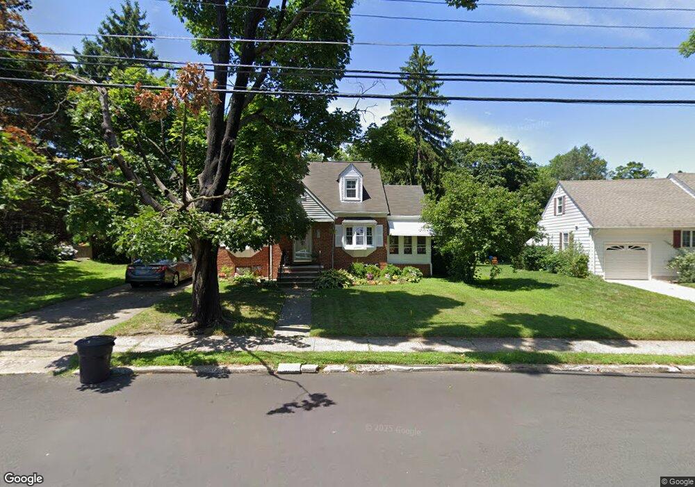
19 Bradway Ave Ewing, NJ 08618
Glendale NeighborhoodEstimated Value: $356,000 - $482,000
Studio
--
Bath
1,515
Sq Ft
$274/Sq Ft
Est. Value
About This Home
This home is located at 19 Bradway Ave, Ewing, NJ 08618 and is currently estimated at $414,745, approximately $273 per square foot. 19 Bradway Ave is a home located in Mercer County with nearby schools including Ewing High School and Trenton Stem-To-Civics Charter School.
Ownership History
Date
Name
Owned For
Owner Type
Purchase Details
Closed on
Jul 7, 2000
Sold by
Maguire Joseph
Bought by
Royster Ronald and Royster Francine
Current Estimated Value
Home Financials for this Owner
Home Financials are based on the most recent Mortgage that was taken out on this home.
Original Mortgage
$143,927
Outstanding Balance
$52,668
Interest Rate
8.55%
Mortgage Type
FHA
Estimated Equity
$362,077
Purchase Details
Closed on
Jul 31, 1996
Sold by
Seeland Jennifer
Bought by
Maguire Joseph and Kirner Kimberly
Home Financials for this Owner
Home Financials are based on the most recent Mortgage that was taken out on this home.
Original Mortgage
$125,000
Interest Rate
8.27%
Purchase Details
Closed on
Aug 14, 1991
Sold by
Martin Robert C and Martin Patricia P
Bought by
Cooney Sandy A and Cooney Seeland J
Create a Home Valuation Report for This Property
The Home Valuation Report is an in-depth analysis detailing your home's value as well as a comparison with similar homes in the area
Home Values in the Area
Average Home Value in this Area
Purchase History
We collect this data history from publicly available records. To have your information removed, we recommend requesting removal directly through your county’s website.
| Date | Buyer | Sale Price | Title Company |
|---|---|---|---|
| Royster Ronald | $144,000 | -- | |
| Maguire Joseph | $131,500 | -- | |
| Cooney Sandy A | $132,000 | -- |
Source: Public Records
Mortgage History
We collect this data history from publicly available records. To have your information removed, we recommend requesting removal directly through your county’s website.
| Date | Status | Borrower | Loan Amount |
|---|---|---|---|
| Open | Royster Ronald | $143,927 | |
| Previous Owner | Maguire Joseph | $125,000 |
Source: Public Records
Tax History
| Year | Tax Paid | Tax Assessment Tax Assessment Total Assessment is a certain percentage of the fair market value that is determined by local assessors to be the total taxable value of land and additions on the property. | Land | Improvement |
|---|---|---|---|---|
| 2025 | $8,657 | $220,100 | $66,600 | $153,500 |
| 2024 | $8,137 | $220,100 | $66,600 | $153,500 |
| 2023 | $8,137 | $220,100 | $66,600 | $153,500 |
| 2022 | $7,917 | $220,100 | $66,600 | $153,500 |
| 2021 | $7,723 | $220,100 | $66,600 | $153,500 |
| 2020 | $7,613 | $220,100 | $66,600 | $153,500 |
| 2019 | $7,415 | $220,100 | $66,600 | $153,500 |
| 2018 | $6,729 | $127,400 | $48,700 | $78,700 |
| 2017 | $6,886 | $127,400 | $48,700 | $78,700 |
| 2016 | $6,793 | $127,400 | $48,700 | $78,700 |
| 2015 | $6,703 | $127,400 | $48,700 | $78,700 |
| 2014 | $6,685 | $127,400 | $48,700 | $78,700 |
Source: Public Records
Map
Nearby Homes
- 5 Pershing Ave
- 530 Greenway Ave
- 1410 Pennington Rd
- 584 Parkway Ave
- 644 Parkway Ave
- 423 Sutherland Rd
- 365 Concord Ave
- 363 Concord Ave
- 268 Weber Ave
- 87 Pennwood Dr
- 344 Gardner Ave
- 2 Mccarthy Dr
- 318 Gardner Ave
- 16 Ranchwood Dr
- 306 Berwyn Ave
- 239 Huff Ave
- 10 Stacey Ave
- 50 Groveland Ave
- 278 Hillcrest Ave
- 222 Oliver Ave
Your Personal Tour Guide
Ask me questions while you tour the home.