Estimated Value: $381,094 - $425,000
3
Beds
2
Baths
1,267
Sq Ft
$319/Sq Ft
Est. Value
About This Home
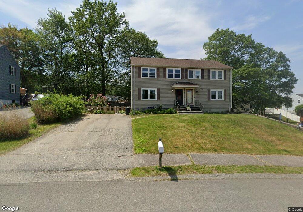
This home is located at 19 Brian Ave Unit L, Derry, NH 03038 and is currently estimated at $404,024, approximately $318 per square foot. 19 Brian Ave Unit L is a home located in Rockingham County with nearby schools including South Range Elementary School, West Running Brook Middle School, and Pinkerton Academy.
Ownership History
Date
Name
Owned For
Owner Type
Purchase Details
Closed on
Oct 5, 2006
Sold by
Claire A Mulcahy T
Bought by
Rand Christopher S
Current Estimated Value
Home Financials for this Owner
Home Financials are based on the most recent Mortgage that was taken out on this home.
Original Mortgage
$140,000
Outstanding Balance
$81,730
Interest Rate
6.54%
Mortgage Type
Purchase Money Mortgage
Estimated Equity
$322,294
Create a Home Valuation Report for This Property
The Home Valuation Report is an in-depth analysis detailing your home's value as well as a comparison with similar homes in the area
Home Values in the Area
Average Home Value in this Area
Purchase History
| Date | Buyer | Sale Price | Title Company |
|---|---|---|---|
| Rand Christopher S | $175,000 | -- |
Source: Public Records
Mortgage History
| Date | Status | Borrower | Loan Amount |
|---|---|---|---|
| Open | Rand Christopher S | $140,000 |
Source: Public Records
Tax History
| Year | Tax Paid | Tax Assessment Tax Assessment Total Assessment is a certain percentage of the fair market value that is determined by local assessors to be the total taxable value of land and additions on the property. | Land | Improvement |
|---|---|---|---|---|
| 2025 | $6,552 | $345,000 | $0 | $345,000 |
| 2024 | $6,448 | $345,000 | $0 | $345,000 |
| 2023 | $6,057 | $292,900 | $0 | $292,900 |
| 2022 | $5,577 | $292,900 | $0 | $292,900 |
| 2021 | $5,474 | $221,100 | $0 | $221,100 |
| 2020 | $5,382 | $221,100 | $0 | $221,100 |
| 2019 | $5,015 | $192,000 | $89,000 | $103,000 |
| 2018 | $5,000 | $192,100 | $89,000 | $103,100 |
| 2017 | $4,872 | $168,800 | $84,600 | $84,200 |
| 2016 | $4,568 | $168,800 | $84,600 | $84,200 |
| 2015 | $2,999 | $102,600 | $42,300 | $60,300 |
| 2014 | $3,018 | $102,600 | $42,300 | $60,300 |
| 2013 | $3,225 | $102,400 | $41,400 | $61,000 |
Source: Public Records
Map
Nearby Homes
- 12R Brian Ave Unit R
- 8 Blueberry Rd Unit U: R
- 4 Norman Dr Unit L
- 17 Tyler Rd
- 6 Mills Farm Cir Unit R
- 13 Sunnyside Ln Unit L
- 65 Fordway Extension
- 36 Highland Ave
- 51 Bedard Ave
- 56 Bedard Ave
- 41 Derryfield Rd
- 29 Central St
- 21 Berry Rd
- 144 Rockingham Rd
- 139 Rockingham Rd Unit 21
- 4 Stonegate Ln
- 6 Stonegate Ln
- 84 E Broadway
- 25 Wyman St
- 5 Gamache Rd
- 19 Brian Ave Unit R
- 19 Brian Ave
- 17 Brian Ave Unit R
- 17 Brian Ave Unit L
- 17 Brian Ave
- 24 Phillip Rd Unit R
- 24 Phillip Rd Unit L
- 24 Phillip Rd Unit 2
- 24 Phillip Rd Unit 24R
- 21 Brian Ave Unit R
- 21 Brian Ave Unit L
- 26 Phillip Rd Unit R
- 26 Phillip Rd Unit L
- 26 Phillip Rd Unit 26R
- 26 Phillip Rd
- 22 Phillip Rd Unit R
- 22 Phillip Rd Unit L
- 22 Phillip Rd
- 22 Phillip Rd Unit 22R
- 24 Brian Ave Unit R
Your Personal Tour Guide
Ask me questions while you tour the home.