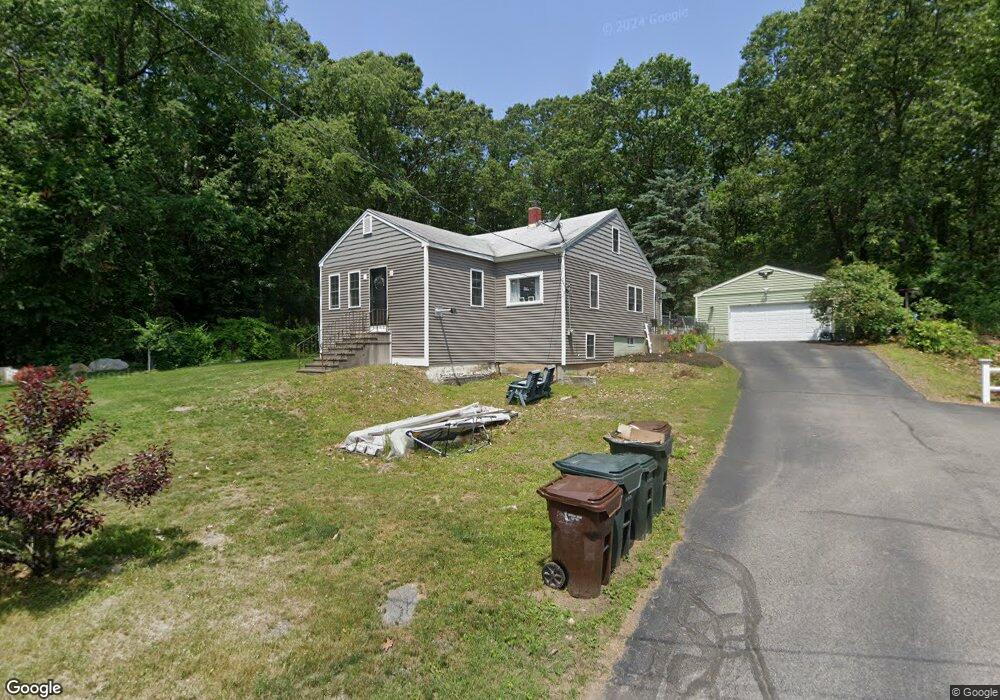
19 Drake Ct Auburn, MA 01501
West Auburn NeighborhoodEstimated Value: $361,000 - $428,000
2
Beds
1
Bath
1,681
Sq Ft
$237/Sq Ft
Est. Value
About This Home
This home is located at 19 Drake Ct, Auburn, MA 01501 and is currently estimated at $398,515, approximately $237 per square foot. 19 Drake Ct is a home located in Worcester County with nearby schools including Auburn Senior High School and Shrewsbury Montessori School - Auburn Campus.
Ownership History
Date
Name
Owned For
Owner Type
Purchase Details
Closed on
Dec 16, 2005
Sold by
Angenette I Stewart T and Bostic Anthony E
Bought by
Buckly Allison and Dasilva Gilsomar
Current Estimated Value
Home Financials for this Owner
Home Financials are based on the most recent Mortgage that was taken out on this home.
Original Mortgage
$200,000
Outstanding Balance
$112,234
Interest Rate
6.34%
Mortgage Type
Purchase Money Mortgage
Estimated Equity
$286,281
Purchase Details
Closed on
Jul 15, 2004
Sold by
Bostic Walter A
Bought by
Bostic Anthony E and Pendarvis Maureen
Create a Home Valuation Report for This Property
The Home Valuation Report is an in-depth analysis detailing your home's value as well as a comparison with similar homes in the area
Home Values in the Area
Average Home Value in this Area
Purchase History
| Date | Buyer | Sale Price | Title Company |
|---|---|---|---|
| Buckly Allison | $250,000 | -- | |
| Bostic Anthony E | -- | -- |
Source: Public Records
Mortgage History
| Date | Status | Borrower | Loan Amount |
|---|---|---|---|
| Open | Buckly Allison | $200,000 |
Source: Public Records
Tax History Compared to Growth
Tax History
| Year | Tax Paid | Tax Assessment Tax Assessment Total Assessment is a certain percentage of the fair market value that is determined by local assessors to be the total taxable value of land and additions on the property. | Land | Improvement |
|---|---|---|---|---|
| 2025 | $37 | $257,700 | $114,300 | $143,400 |
| 2024 | $3,495 | $234,100 | $110,000 | $124,100 |
| 2023 | $3,459 | $217,800 | $100,000 | $117,800 |
| 2022 | $3,367 | $200,200 | $100,000 | $100,200 |
| 2021 | $4,618 | $171,300 | $88,400 | $82,900 |
| 2020 | $16,793 | $167,000 | $88,400 | $78,600 |
| 2019 | $3,220 | $174,800 | $82,900 | $91,900 |
| 2018 | $3,046 | $165,200 | $77,500 | $87,700 |
| 2017 | $2,870 | $156,500 | $70,200 | $86,300 |
| 2016 | $2,875 | $158,900 | $72,400 | $86,500 |
| 2015 | $2,732 | $158,300 | $72,400 | $85,900 |
| 2014 | $2,656 | $153,600 | $69,000 | $84,600 |
Source: Public Records
Map
Nearby Homes
- Lot 2 Leicester St
- 37 Inwood Rd
- 88 Wallace Ave
- 30 Briarcliff Dr
- 3 Old Cart Rd
- 7 Sara Dr
- 707 Stafford St
- 28 Lorna Dr
- 19-20 Williams St
- 381 Oxford St N
- 16 Homestead Ave
- 177 Oxford St N
- 88 Vine St
- 5 Main St
- 19 Virginia Dr Unit 19
- 6 Ryans Way Unit 6
- 34 Rockland Rd
- 35 Pinehurst Ave
- 177 Boyce St
- 25 Vinal St Unit 30
- 21 Drake Ct
- 13 Drake Ct
- 204 Rochdale St
- 206 Rochdale St
- 200 Rochdale St
- 208 Rochdale St
- 210 Rochdale St
- 404 Leicester St
- 408 Leicester St
- 187 Rochdale St
- 189 Rochdale St
- 185 Rochdale St
- 198 Rochdale St
- 191 Rochdale St
- 403 Leicester St
- 411 Leicester St
- 401 Leicester St
- 4 Rotary Rd
- 195 Rochdale St
- 2 Rotary Rd