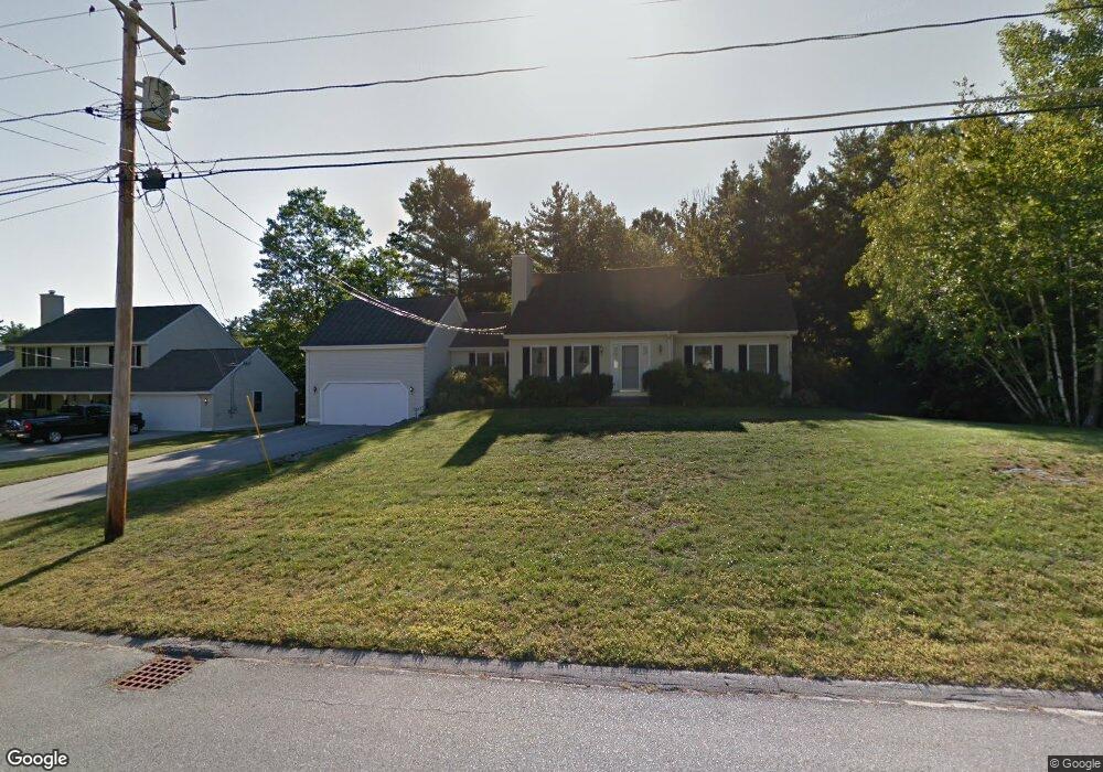
19 Glencliff Way Unit U477 Nashua, NH 03063
Northwest Nashua NeighborhoodEstimated Value: $512,000 - $655,000
3
Beds
2
Baths
2,004
Sq Ft
$296/Sq Ft
Est. Value
About This Home
This home is located at 19 Glencliff Way Unit U477, Nashua, NH 03063 and is currently estimated at $592,652, approximately $295 per square foot. 19 Glencliff Way Unit U477 is a home located in Hillsborough County with nearby schools including Broad Street Elementary School, Pennichuck Middle School, and Nashua High School North.
Ownership History
Date
Name
Owned For
Owner Type
Purchase Details
Closed on
Aug 18, 2014
Sold by
Livsey Susan L
Bought by
Susan L Livsey Ft
Current Estimated Value
Purchase Details
Closed on
Jul 30, 1996
Sold by
Brookfield Acres
Bought by
Livsey Susan L
Home Financials for this Owner
Home Financials are based on the most recent Mortgage that was taken out on this home.
Original Mortgage
$144,400
Interest Rate
8.37%
Create a Home Valuation Report for This Property
The Home Valuation Report is an in-depth analysis detailing your home's value as well as a comparison with similar homes in the area
Home Values in the Area
Average Home Value in this Area
Purchase History
| Date | Buyer | Sale Price | Title Company |
|---|---|---|---|
| Susan L Livsey Ft | -- | -- | |
| Livsey Susan L | $180,600 | -- |
Source: Public Records
Mortgage History
| Date | Status | Borrower | Loan Amount |
|---|---|---|---|
| Previous Owner | Livsey Susan L | $144,400 |
Source: Public Records
Tax History Compared to Growth
Tax History
| Year | Tax Paid | Tax Assessment Tax Assessment Total Assessment is a certain percentage of the fair market value that is determined by local assessors to be the total taxable value of land and additions on the property. | Land | Improvement |
|---|---|---|---|---|
| 2024 | $9,165 | $576,400 | $0 | $576,400 |
| 2023 | $8,665 | $475,300 | $0 | $475,300 |
| 2022 | $8,589 | $475,300 | $0 | $475,300 |
| 2021 | $8,624 | $371,400 | $0 | $371,400 |
| 2020 | $8,397 | $371,400 | $0 | $371,400 |
| 2019 | $8,082 | $371,400 | $0 | $371,400 |
| 2018 | $7,877 | $371,400 | $0 | $371,400 |
| 2017 | $7,234 | $280,500 | $0 | $280,500 |
| 2016 | $7,032 | $280,500 | $0 | $280,500 |
| 2015 | $6,881 | $280,500 | $0 | $280,500 |
| 2014 | $6,746 | $280,500 | $0 | $280,500 |
Source: Public Records
Map
Nearby Homes
- 38 Highbridge Hill Rd Unit 186
- 26 Andover Down Unit 276
- 66 Tinker Rd
- 5 Dumaine Ave Unit B
- 5 Dumaine Ave Unit N
- 75 Deerwood Dr Unit B
- 77 Deerwood Dr Unit E
- 218 Millwright Dr Unit 218
- 201 Millwright Dr
- 2 New Haven Dr Unit E303
- 3 Roedean Dr Unit C-207
- 123 Cannongate III
- 47 Hanna Cir Unit 47
- 47 Hanna Cir
- 58 Profile Cir
- 74 Profile Cir
- 18 Swift Ln
- 9 Cambridge Dr
- 40 Merrimack Dr
- 28 Merrimack Dr
- 21 Glencliff Way Unit U476
- 17 Glencliff Way Unit U478
- 20 Glencliff Way Unit U462
- 18 Glencliff Way Unit U461
- 23 Glencliff Way Unit U475
- 15 Glencliff Way Unit U479
- 16 Glencliff Way Unit U460
- 7 Bellingrath Place Unit U474
- 5 Bellingrath Place Unit U473
- 11 Glencliff Way Unit U480
- 3 Bellingrath Place Unit U472
- 8 Magnolia Way Unit U465
- 9 Glencliff Way Unit U481
- 6 Magnolia Way Unit U464
- 3 Castlegate Way Unit U459
- 4 Bellingrath Place Unit U469
- 5 Castlegate Way Unit U458
- 8 Bellingrath Place Unit U471
- 7 Glencliff Way Unit U482