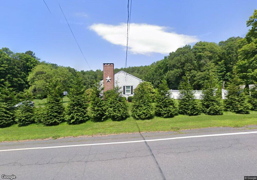
19 Main Rd Gill, MA 01354
Gill NeighborhoodEstimated Value: $388,207 - $477,000
3
Beds
3
Baths
2,665
Sq Ft
$164/Sq Ft
Est. Value
About This Home
This home is located at 19 Main Rd, Gill, MA 01354 and is currently estimated at $436,802, approximately $163 per square foot. 19 Main Rd is a home located in Franklin County with nearby schools including Turners Fall High School, Holy Trinity School, and Four Winds School.
Ownership History
Date
Name
Owned For
Owner Type
Purchase Details
Closed on
Jun 23, 2021
Sold by
Greene Ft
Bought by
Greene April C and Greene Corey M
Current Estimated Value
Home Financials for this Owner
Home Financials are based on the most recent Mortgage that was taken out on this home.
Original Mortgage
$210,000
Outstanding Balance
$190,129
Interest Rate
2.9%
Mortgage Type
Purchase Money Mortgage
Estimated Equity
$246,673
Purchase Details
Closed on
Jun 21, 2021
Sold by
Greene Ft
Bought by
Greene Corey M and Greene April C
Home Financials for this Owner
Home Financials are based on the most recent Mortgage that was taken out on this home.
Original Mortgage
$210,000
Outstanding Balance
$190,129
Interest Rate
2.9%
Mortgage Type
Purchase Money Mortgage
Estimated Equity
$246,673
Create a Home Valuation Report for This Property
The Home Valuation Report is an in-depth analysis detailing your home's value as well as a comparison with similar homes in the area
Home Values in the Area
Average Home Value in this Area
Purchase History
| Date | Buyer | Sale Price | Title Company |
|---|---|---|---|
| Greene April C | $300,000 | None Available | |
| Greene Corey M | -- | None Available |
Source: Public Records
Mortgage History
| Date | Status | Borrower | Loan Amount |
|---|---|---|---|
| Open | Greene April C | $210,000 |
Source: Public Records
Tax History
| Year | Tax Paid | Tax Assessment Tax Assessment Total Assessment is a certain percentage of the fair market value that is determined by local assessors to be the total taxable value of land and additions on the property. | Land | Improvement |
|---|---|---|---|---|
| 2025 | $4,803 | $327,600 | $60,000 | $267,600 |
| 2024 | $4,500 | $290,700 | $54,500 | $236,200 |
| 2023 | $3,832 | $230,000 | $49,500 | $180,500 |
| 2022 | $3,832 | $230,000 | $49,500 | $180,500 |
| 2021 | $3,920 | $226,700 | $49,500 | $177,200 |
| 2020 | $3,742 | $216,900 | $49,500 | $167,400 |
| 2019 | $5,457 | $203,000 | $47,200 | $155,800 |
| 2018 | $3,354 | $195,200 | $47,200 | $148,000 |
| 2017 | $3,236 | $195,200 | $47,200 | $148,000 |
| 2016 | $3,368 | $199,900 | $62,400 | $137,500 |
| 2015 | $3,303 | $196,000 | $62,400 | $133,600 |
Source: Public Records
Map
Nearby Homes
- 52 Canada Hill Rd
- 0 Millers Falls Rd Unit 73034825
- 001 Adams Rd
- 45 Millers Falls Rd
- 182 Main Rd
- 8 Country Club Ln
- 2 Alice St
- 696 Bernardston Rd
- 709 Fairway Ave
- 183 Millers Falls Rd
- 72 Meadowood Dr
- 372 Federal St
- 335 Federal St
- 61 Randall Wood Dr
- 37 Cleveland St
- 93 Maple St
- 34 Brookside Ave
- 47 Cross St
- 12 Leonard St
- 6 Pickett Ln
- 20 Main Rd
- 22 Main Rd
- 16 Main Rd
- 0 Mountain Rd Unit 70916615
- 0 Mountain Rd Unit 71468103
- 0 Mountain Rd Unit 71907633
- 0 Mountain Rd Unit 71938986
- 0 Mountain Rd Unit 72165297
- 0 Mountain Rd Unit 73088717
- 0 Mountain Rd Unit 30077704
- 0 Mountain Rd Unit 72964967
- 0 Mountain Rd Unit 72841320
- 0 Mountain Rd Unit 72691727
- 13 Main Rd
- 26 Main Rd
- 1 Mountain Rd Unit B
- 6 Mountain Rd
- 10 Main Rd
- 35 Main Rd
- 8 Main Rd
Your Personal Tour Guide
Ask me questions while you tour the home.