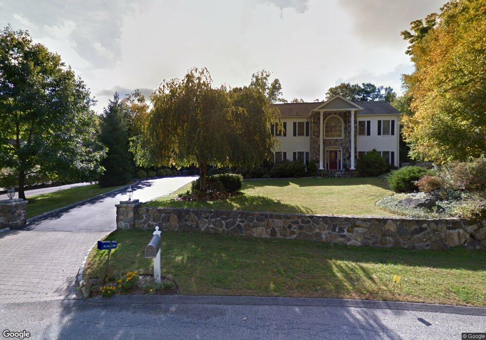
19 Robbie Rd Cortlandt Manor, NY 10567
Estimated Value: $1,295,211 - $1,520,000
4
Beds
4
Baths
5,400
Sq Ft
$261/Sq Ft
Est. Value
About This Home
This home is located at 19 Robbie Rd, Cortlandt Manor, NY 10567 and is currently estimated at $1,407,053, approximately $260 per square foot. 19 Robbie Rd is a home located in Westchester County with nearby schools including Furnace Woods Elementary School, Blue Mountain Middle School, and Hendrick Hudson High School.
Ownership History
Date
Name
Owned For
Owner Type
Purchase Details
Closed on
Apr 15, 2023
Sold by
Scott Phillip D and Scott Susan E
Bought by
Scott Philip D and Gardner Susan E
Current Estimated Value
Purchase Details
Closed on
Apr 28, 2016
Sold by
Hock Charles E and Hocky Yvonne E
Bought by
Scott Phillip D and Gardner Susan E
Purchase Details
Closed on
Apr 23, 2001
Sold by
Santucci Dominick and Santucci Debra
Bought by
Hock Charles E and Hock Yvonne E
Home Financials for this Owner
Home Financials are based on the most recent Mortgage that was taken out on this home.
Original Mortgage
$125,000
Interest Rate
6.59%
Mortgage Type
Purchase Money Mortgage
Create a Home Valuation Report for This Property
The Home Valuation Report is an in-depth analysis detailing your home's value as well as a comparison with similar homes in the area
Home Values in the Area
Average Home Value in this Area
Purchase History
| Date | Buyer | Sale Price | Title Company |
|---|---|---|---|
| Scott Philip D | -- | Benchmark Title | |
| Scott Phillip D | $822,500 | Freedom Land Title Agency | |
| Hock Charles E | $650,000 | -- |
Source: Public Records
Mortgage History
| Date | Status | Borrower | Loan Amount |
|---|---|---|---|
| Previous Owner | Hock Charles E | $125,000 |
Source: Public Records
Tax History Compared to Growth
Tax History
| Year | Tax Paid | Tax Assessment Tax Assessment Total Assessment is a certain percentage of the fair market value that is determined by local assessors to be the total taxable value of land and additions on the property. | Land | Improvement |
|---|---|---|---|---|
| 2024 | $26,938 | $14,350 | $2,050 | $12,300 |
| 2023 | $25,353 | $14,350 | $2,050 | $12,300 |
| 2022 | $8,320 | $14,350 | $2,050 | $12,300 |
| 2021 | $24,512 | $14,350 | $2,050 | $12,300 |
| 2020 | $23,909 | $14,350 | $2,050 | $12,300 |
| 2019 | $22,894 | $14,350 | $2,050 | $12,300 |
| 2018 | $22,558 | $14,350 | $2,050 | $12,300 |
| 2017 | $7,782 | $14,350 | $2,050 | $12,300 |
| 2016 | $22,334 | $14,350 | $2,050 | $12,300 |
| 2015 | -- | $14,350 | $2,050 | $12,300 |
| 2014 | -- | $14,350 | $2,050 | $12,300 |
| 2013 | -- | $14,350 | $2,050 | $12,300 |
Source: Public Records
Map
Nearby Homes
- 3 Benjamin Ln
- 267 Lafayette Ave
- 2091 Maple Ave
- 36 Hill And Dale Rd
- 2194 Maple Ave
- 2023 Old Maple Ave
- 5702 Manor Dr
- 204 Stoneway Ln Unit 21
- 97 Hillcrest Ln
- 0 Maple Unit KEY897284
- 126 Underhill Ln
- 62 Bayberry Dr
- 18 Bayberry Dr
- 41 Forest Ave
- 11 Arbor Way Unit 5
- 200 School House Rd Unit 2C
- 6 Elmwood Cir Unit 286
- 1879 Crompond Rd Unit F15
- 1879 Crompond Rd Unit F9
- 1879 Crompond Rd Unit E16