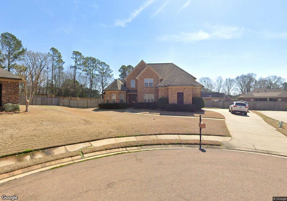
19 Sandstone Cir Clinton, MS 39056
Estimated Value: $386,000 - $429,000
4
Beds
3
Baths
2,728
Sq Ft
$149/Sq Ft
Est. Value
About This Home
This home is located at 19 Sandstone Cir, Clinton, MS 39056 and is currently estimated at $406,897, approximately $149 per square foot. 19 Sandstone Cir is a home located in Hinds County with nearby schools including Clinton Park Elementary School, Eastside Elementary School, and Northside Elementary School.
Ownership History
Date
Name
Owned For
Owner Type
Purchase Details
Closed on
Jun 30, 2009
Sold by
Vintage Home Builders Inc
Bought by
Thompson Brenda
Current Estimated Value
Home Financials for this Owner
Home Financials are based on the most recent Mortgage that was taken out on this home.
Original Mortgage
$275,793
Outstanding Balance
$175,184
Interest Rate
4.79%
Mortgage Type
FHA
Estimated Equity
$231,713
Create a Home Valuation Report for This Property
The Home Valuation Report is an in-depth analysis detailing your home's value as well as a comparison with similar homes in the area
Home Values in the Area
Average Home Value in this Area
Purchase History
| Date | Buyer | Sale Price | Title Company |
|---|---|---|---|
| Thompson Brenda | -- | -- |
Source: Public Records
Mortgage History
| Date | Status | Borrower | Loan Amount |
|---|---|---|---|
| Open | Thompson Brenda | $275,793 |
Source: Public Records
Tax History
| Year | Tax Paid | Tax Assessment Tax Assessment Total Assessment is a certain percentage of the fair market value that is determined by local assessors to be the total taxable value of land and additions on the property. | Land | Improvement |
|---|---|---|---|---|
| 2025 | $2,716 | $25,788 | $4,000 | $21,788 |
| 2024 | $2,716 | $25,189 | $4,000 | $21,189 |
| 2023 | $2,716 | $25,189 | $4,000 | $21,189 |
| 2022 | $3,829 | $25,189 | $4,000 | $21,189 |
| 2021 | $2,689 | $25,189 | $4,000 | $21,189 |
| 2020 | $2,610 | $24,793 | $4,000 | $20,793 |
| 2019 | $3,518 | $24,793 | $4,000 | $20,793 |
| 2018 | $3,518 | $24,793 | $4,000 | $20,793 |
| 2017 | $3,376 | $24,793 | $4,000 | $20,793 |
| 2016 | $3,376 | $24,793 | $4,000 | $20,793 |
| 2015 | $3,071 | $22,813 | $4,000 | $18,813 |
| 2014 | $3,071 | $22,813 | $4,000 | $18,813 |
Source: Public Records
Map
Nearby Homes
- 001 Pinehaven Dr
- 0 Copper Creek Dr Unit 4113527
- 0 Copper Creek Dr Unit 4113564
- 110 Horseshoe Blvd
- 112 Horseshoe Blvd
- 118 Bentwood Dr
- 100 Coldwater Cir
- 107 Saratoga Springs Ave
- 110 Saratoga Springs Ave
- 109 Saratoga Springs Ave
- 239 Copper Creek Dr
- 200 Saratoga Springs Ave
- 73 Canebrake Ct
- 101 Triple Crown Cove
- 102 Triple Crown Cove
- 123 Oakhurst Dr
- 180 Catherine Blvd
- 103 Catherine Blvd
- 111 Twain Trail
- 112 Pinehaven Place
- 15 Sandstone Cir
- 18 Sandstone Cir
- 14 Sandstone Cir
- 204 Stoney Ridge Rd
- 101 Copper Creek Dr
- 208 Stoney Ridge Rd
- 105 Copper Creek Dr
- 200 Stoney Ridge Rd
- 109 Copper Creek Dr
- 75 Copper Creek Dr Unit Lot 75
- 85 Copper Creek Dr Unit Lot 85
- 79 Copper Creek Dr Unit Lot 79
- 111 Stoney Ridge Rd Unit 111
- 101 Shadia Dr
- 59 River Rock Way
- 55 River Rock Way
- Lot 85 Copper Creek Dr
- Lot 86 Copper Creek Dr
- Lot 111 Copper Creek Dr
- Lot 59 Copper Creek Dr
Your Personal Tour Guide
Ask me questions while you tour the home.