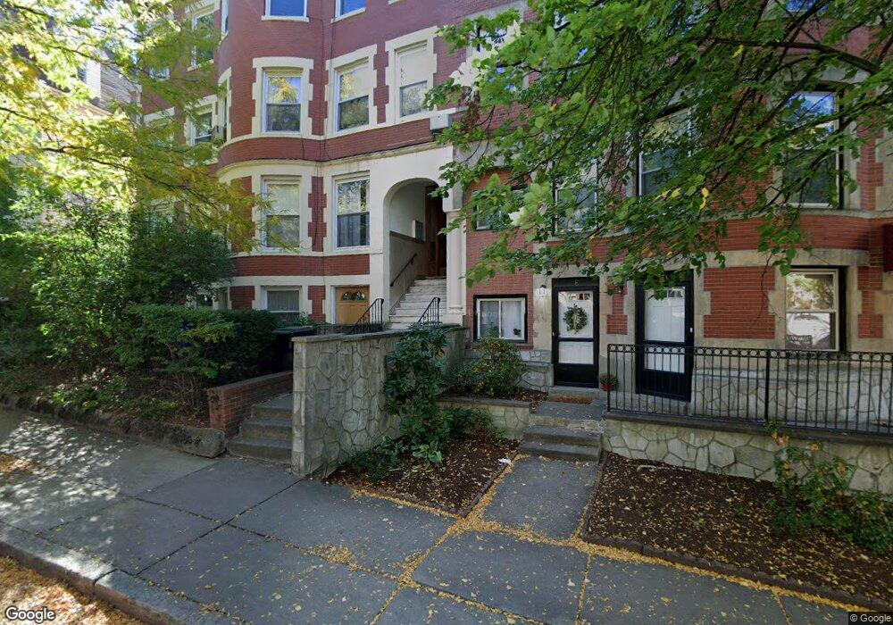
19 University Rd Brookline, MA 02445
Washington Square NeighborhoodEstimated Value: $2,610,000 - $3,315,000
8
Beds
3
Baths
5,496
Sq Ft
$524/Sq Ft
Est. Value
About This Home
This home is located at 19 University Rd, Brookline, MA 02445 and is currently estimated at $2,881,000, approximately $524 per square foot. 19 University Rd is a home located in Norfolk County with nearby schools including Torah Academy and St. Mary of the Assumption Elementary School.
Ownership History
Date
Name
Owned For
Owner Type
Purchase Details
Closed on
Nov 21, 2018
Sold by
Yee Fook J and Yee Wai J
Bought by
19 University Road Rt
Current Estimated Value
Purchase Details
Closed on
Mar 1, 2011
Sold by
Gee Richard
Bought by
Gee Fuller Ft
Purchase Details
Closed on
Aug 24, 2004
Sold by
Gee Doris M K and Gee Richard
Bought by
Gee Richard
Purchase Details
Closed on
Aug 3, 1976
Bought by
Gee Fuller Ft
Create a Home Valuation Report for This Property
The Home Valuation Report is an in-depth analysis detailing your home's value as well as a comparison with similar homes in the area
Home Values in the Area
Average Home Value in this Area
Purchase History
| Date | Buyer | Sale Price | Title Company |
|---|---|---|---|
| 19 University Road Rt | -- | -- | |
| Gee Fuller Ft | -- | -- | |
| Gee Richard | -- | -- | |
| Gee Fuller Ft | $68,000 | -- |
Source: Public Records
Tax History Compared to Growth
Tax History
| Year | Tax Paid | Tax Assessment Tax Assessment Total Assessment is a certain percentage of the fair market value that is determined by local assessors to be the total taxable value of land and additions on the property. | Land | Improvement |
|---|---|---|---|---|
| 2025 | $25,408 | $2,574,300 | $1,078,800 | $1,495,500 |
| 2024 | $25,454 | $2,605,300 | $1,034,400 | $1,570,900 |
| 2023 | $24,270 | $2,434,300 | $841,300 | $1,593,000 |
| 2022 | $23,623 | $2,318,300 | $801,200 | $1,517,100 |
| 2021 | $21,846 | $2,229,200 | $770,400 | $1,458,800 |
| 2020 | $20,595 | $2,179,400 | $690,300 | $1,489,100 |
| 2019 | $19,448 | $2,075,600 | $657,400 | $1,418,200 |
| 2018 | $17,755 | $1,876,800 | $506,900 | $1,369,900 |
| 2017 | $17,169 | $1,737,800 | $478,200 | $1,259,600 |
| 2016 | $16,462 | $1,579,800 | $446,900 | $1,132,900 |
| 2015 | $14,875 | $1,392,800 | $374,300 | $1,018,500 |
| 2014 | $15,250 | $1,338,900 | $346,300 | $992,600 |
Source: Public Records
Map
Nearby Homes
- 16 Garrison Rd Unit 7
- 57 University Rd Unit 3
- 90 Addington Rd Unit 1
- 648 Washington St Unit 7
- 15 Colbourne Crescent Unit 2
- 12 Colbourne Crescent Unit 1
- 184 Rawson Rd
- 19 Westbourne Terrace Unit 2
- 84 Winthrop Rd Unit 1
- 84 Winthrop Rd
- 4 Fairbanks St Unit 2
- 324 Tappan St Unit 1
- 324 Tappan St Unit 2
- 1572 Beacon St
- 255 Tappan St
- 757 Washington St Unit 2
- 1731 Beacon St Unit 717
- 1731 Beacon St Unit 1502
- 29 Mason Terrace
- 94 Beaconsfield Rd Unit 201
- 19 University Rd
- 19 University Rd Unit 3
- 19 University Rd Unit 1
- 25 University Rd
- 15 University Rd Unit 22
- 15 University Rd Unit 34
- 15 University Rd Unit 17
- 15 University Rd Unit 17
- 15 University Rd Unit 17
- 15 University Rd Unit 17
- 15 University Rd Unit 21
- 15 University Rd Unit C
- 15 University Rd Unit 45
- 15 University Rd Unit 36
- 15 University Rd Unit 23
- 15 University Rd Unit 1
- 15 University Rd
- 15 University Rd Unit D
- 15 University Rd Unit 41
- 15 University Rd Unit 44