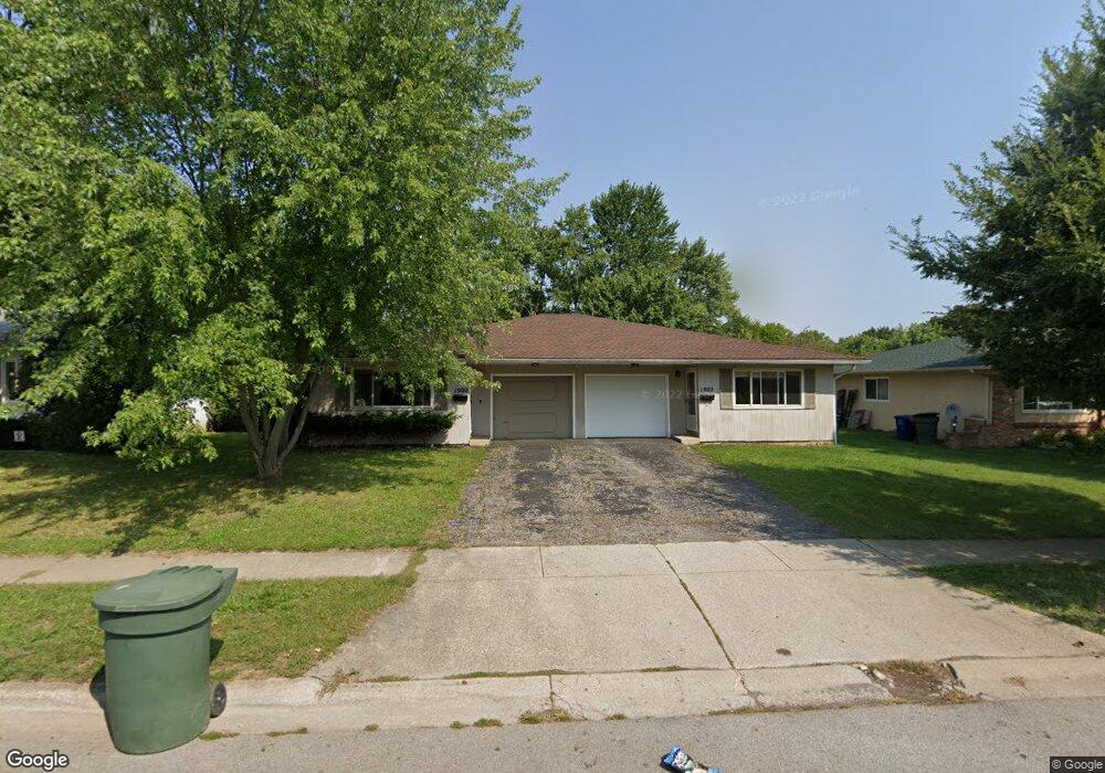
1900-1902 Hampstead Dr Columbus, OH 43229
Northgate NeighborhoodEstimated Value: $316,000 - $380,000
4
Beds
2
Baths
2,040
Sq Ft
$165/Sq Ft
Est. Value
About This Home
This home is located at 1900-1902 Hampstead Dr, Columbus, OH 43229 and is currently estimated at $336,905, approximately $165 per square foot. 1900-1902 Hampstead Dr is a home located in Franklin County with nearby schools including Alpine Elementary School, Northgate Intermediate, and Woodward Park Middle School.
Ownership History
Date
Name
Owned For
Owner Type
Purchase Details
Closed on
Mar 29, 2007
Sold by
Wells Fargo Bank Na
Bought by
Sherry Paul D
Current Estimated Value
Home Financials for this Owner
Home Financials are based on the most recent Mortgage that was taken out on this home.
Original Mortgage
$153,900
Outstanding Balance
$93,563
Interest Rate
6.25%
Mortgage Type
Purchase Money Mortgage
Estimated Equity
$243,342
Purchase Details
Closed on
Nov 6, 2006
Sold by
Tebay David T
Bought by
Wells Fargo Bank Na and Mlmi Trust Series 2004-Fm1
Purchase Details
Closed on
Dec 2, 1991
Purchase Details
Closed on
Nov 1, 1983
Create a Home Valuation Report for This Property
The Home Valuation Report is an in-depth analysis detailing your home's value as well as a comparison with similar homes in the area
Home Values in the Area
Average Home Value in this Area
Purchase History
| Date | Buyer | Sale Price | Title Company |
|---|---|---|---|
| Sherry Paul D | $162,000 | Title First | |
| Wells Fargo Bank Na | $130,000 | None Available | |
| -- | -- | -- | |
| -- | $85,900 | -- |
Source: Public Records
Mortgage History
| Date | Status | Borrower | Loan Amount |
|---|---|---|---|
| Open | Sherry Paul D | $153,900 |
Source: Public Records
Tax History Compared to Growth
Tax History
| Year | Tax Paid | Tax Assessment Tax Assessment Total Assessment is a certain percentage of the fair market value that is determined by local assessors to be the total taxable value of land and additions on the property. | Land | Improvement |
|---|---|---|---|---|
| 2024 | $4,361 | $95,170 | $24,220 | $70,950 |
| 2023 | $4,457 | $95,165 | $24,220 | $70,945 |
| 2022 | $3,007 | $53,770 | $13,130 | $40,640 |
| 2021 | $3,013 | $53,770 | $13,130 | $40,640 |
| 2020 | $3,017 | $53,770 | $13,130 | $40,640 |
| 2019 | $2,825 | $43,020 | $10,500 | $32,520 |
| 2018 | $2,806 | $43,020 | $10,500 | $32,520 |
| 2017 | $2,892 | $43,020 | $10,500 | $32,520 |
| 2016 | $3,060 | $44,310 | $10,500 | $33,810 |
| 2015 | $2,791 | $44,310 | $10,500 | $33,810 |
| 2014 | $2,747 | $44,310 | $10,500 | $33,810 |
| 2013 | $1,555 | $49,210 | $11,655 | $37,555 |
Source: Public Records
Map
Nearby Homes
- 6019 Beechcroft Rd
- 6245 Sharon Woods Blvd
- 5732 Beechcroft Rd Unit B
- 5726 Beechcroft Rd Unit J
- 2250 Webster Canyon Ct
- 1752 Pine Tree St S Unit H
- 1743 Pine Tree St N Unit A
- 6035 Karl Rd
- 1549 Alpine Dr
- 1881 Brimfield Rd
- 6342 Bellmeadow Dr
- 6355 Johnanne St
- 6407 Skywae Dr
- 2197 Bayfield Dr
- 1687 Brookfield Square S
- 2084 Brookfield Rd
- 6048 Pinemoor St
- 6407 Faircrest Rd
- 2292 Laurelwood Dr Unit 2292L
- 1914 Walden Dr
- 1900 Hampstead Dr Unit 902
- 1908 Hampstead Dr Unit 910
- 1892 Hampstead Dr Unit 894
- 1903 Fairhaven Rd
- 1891 Fairhaven Rd
- 1922 Hampstead Dr Unit 924
- 1915 Fairhaven Rd
- 1922-1924 Hampstead Dr
- 1882 Hampstead Dr Unit 884
- 1901 Hampstead Dr Unit 903
- 1901-1903 Hampstead Dr Unit 903
- 1893 Hampstead Dr Unit 895
- 1921 Fairhaven Rd
- 1913 Hampstead Dr Unit 915
- 1915 Hampstead Dr
- 1913 Hampstead Dr
- 1885 Hampstead Dr
- 1885 Hampstead Dr Unit 1885
- 1883 Hampstead Dr Unit 885
- 1883 Hampstead Dr Unit 1885