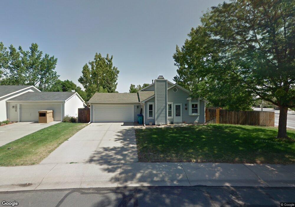
1900 Ames Ct Fort Collins, CO 80526
Estimated Value: $502,000 - $514,000
3
Beds
2
Baths
1,440
Sq Ft
$351/Sq Ft
Est. Value
About This Home
This home is located at 1900 Ames Ct, Fort Collins, CO 80526 and is currently estimated at $505,937, approximately $351 per square foot. 1900 Ames Ct is a home located in Larimer County with nearby schools including Johnson Elementary School, Webber Middle School, and Rocky Mountain High School.
Ownership History
Date
Name
Owned For
Owner Type
Purchase Details
Closed on
Mar 26, 1999
Sold by
Gerster John A
Bought by
Gerster John A and Gerster Suzanne R
Current Estimated Value
Home Financials for this Owner
Home Financials are based on the most recent Mortgage that was taken out on this home.
Original Mortgage
$75,550
Outstanding Balance
$18,781
Interest Rate
6.82%
Estimated Equity
$487,156
Purchase Details
Closed on
Oct 1, 1988
Bought by
Gerster John A
Create a Home Valuation Report for This Property
The Home Valuation Report is an in-depth analysis detailing your home's value as well as a comparison with similar homes in the area
Home Values in the Area
Average Home Value in this Area
Purchase History
| Date | Buyer | Sale Price | Title Company |
|---|---|---|---|
| Gerster John A | -- | Land Title | |
| Gerster John A | $71,500 | -- |
Source: Public Records
Mortgage History
| Date | Status | Borrower | Loan Amount |
|---|---|---|---|
| Open | Gerster John A | $75,550 |
Source: Public Records
Tax History Compared to Growth
Tax History
| Year | Tax Paid | Tax Assessment Tax Assessment Total Assessment is a certain percentage of the fair market value that is determined by local assessors to be the total taxable value of land and additions on the property. | Land | Improvement |
|---|---|---|---|---|
| 2025 | $2,835 | $33,225 | $2,680 | $30,545 |
| 2024 | $2,697 | $33,225 | $2,680 | $30,545 |
| 2022 | $2,276 | $24,103 | $2,780 | $21,323 |
| 2021 | $2,300 | $24,796 | $2,860 | $21,936 |
| 2020 | $2,224 | $23,774 | $2,860 | $20,914 |
| 2019 | $2,234 | $23,774 | $2,860 | $20,914 |
| 2018 | $1,877 | $20,592 | $2,880 | $17,712 |
| 2017 | $1,870 | $20,592 | $2,880 | $17,712 |
| 2016 | $1,567 | $17,170 | $3,184 | $13,986 |
| 2015 | $1,556 | $17,170 | $3,180 | $13,990 |
| 2014 | $1,413 | $15,490 | $3,180 | $12,310 |
Source: Public Records
Map
Nearby Homes
- 1819 Birmingham Dr
- 3366 Liverpool St
- 2025 Cheshire St
- 2 County Road 19
- 1631 Enfield St
- 3136 Birmingham Dr
- 3622 Capitol Dr
- 3502 Big Ben Dr Unit C
- 1531 W Swallow Rd Unit 28
- 1531 W Swallow Rd Unit 25
- 3717 S Taft Hill Rd Unit 279
- 3717 S Taft Hill Rd Unit 111
- 1601 W Swallow Rd Unit 9
- 1601 W Swallow Rd Unit 1
- 1601 W Swallow Rd
- 1539 Corydalis Ct
- 1526 Corydalis Ct
- 1401 Sanford Dr
- 3525 Auntie Stone St Unit 8
- 2855 Trenton Way
- 1906 Ames Ct
- 3337 Birmingham Dr
- 1912 Ames Ct
- 3331 Birmingham Dr
- 1901 Ames Ct
- 3418 Dunbar Ave
- 1907 Newcastle Ct
- 3424 Dunbar Ave
- 1918 Ames Ct
- 1907 Ames Ct
- 3325 Birmingham Dr
- 1913 Newcastle Ct
- 3430 Dunbar Ave
- 1913 Ames Ct
- 1919 Newcastle Ct
- 1900 Bronson St
- 3336 Birmingham Dr
- 1924 Ames Ct
- 3401 Thames Ct
- 3330 Birmingham Dr