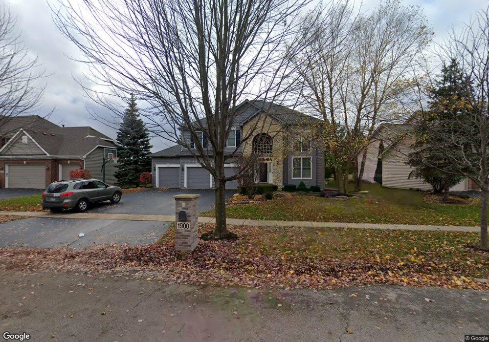
1900 Eldorado Dr Geneva, IL 60134
Eagle Brook NeighborhoodEstimated Value: $690,000 - $743,000
4
Beds
3
Baths
2,760
Sq Ft
$259/Sq Ft
Est. Value
About This Home
This home is located at 1900 Eldorado Dr, Geneva, IL 60134 and is currently estimated at $714,671, approximately $258 per square foot. 1900 Eldorado Dr is a home located in Kane County with nearby schools including Western Avenue Elementary School, Geneva Community High School, and St. Peter School.
Ownership History
Date
Name
Owned For
Owner Type
Purchase Details
Closed on
Jun 28, 2001
Sold by
Weiersheuser Steven Andrew and Weiersheuser Kathleen Alice
Bought by
Lew George H and Lew Jennifer L
Current Estimated Value
Home Financials for this Owner
Home Financials are based on the most recent Mortgage that was taken out on this home.
Original Mortgage
$275,000
Interest Rate
7.28%
Purchase Details
Closed on
Apr 7, 1999
Sold by
American National Bk&Tr Co Of Chicago
Bought by
Weiersheuser Steven Andrew and Weiersheuser Kathleen Alice
Home Financials for this Owner
Home Financials are based on the most recent Mortgage that was taken out on this home.
Original Mortgage
$125,000
Interest Rate
7.1%
Create a Home Valuation Report for This Property
The Home Valuation Report is an in-depth analysis detailing your home's value as well as a comparison with similar homes in the area
Home Values in the Area
Average Home Value in this Area
Purchase History
| Date | Buyer | Sale Price | Title Company |
|---|---|---|---|
| Lew George H | $380,000 | -- | |
| Weiersheuser Steven Andrew | $332,500 | Chicago Title Insurance Co |
Source: Public Records
Mortgage History
| Date | Status | Borrower | Loan Amount |
|---|---|---|---|
| Previous Owner | Lew George H | $275,000 | |
| Previous Owner | Weiersheuser Steven Andrew | $125,000 |
Source: Public Records
Tax History
| Year | Tax Paid | Tax Assessment Tax Assessment Total Assessment is a certain percentage of the fair market value that is determined by local assessors to be the total taxable value of land and additions on the property. | Land | Improvement |
|---|---|---|---|---|
| 2024 | $13,928 | $188,874 | $53,268 | $135,606 |
| 2023 | $13,513 | $171,703 | $48,425 | $123,278 |
| 2022 | $12,903 | $159,545 | $44,996 | $114,549 |
| 2021 | $12,532 | $153,616 | $43,324 | $110,292 |
| 2020 | $11,300 | $151,272 | $42,663 | $108,609 |
| 2019 | $11,271 | $148,408 | $41,855 | $106,553 |
| 2018 | $12,294 | $160,413 | $41,855 | $118,558 |
| 2017 | $12,160 | $156,135 | $40,739 | $115,396 |
| 2016 | $12,222 | $141,964 | $40,188 | $101,776 |
| 2015 | -- | $134,973 | $38,209 | $96,764 |
| 2014 | -- | $130,024 | $38,209 | $91,815 |
| 2013 | -- | $130,024 | $38,209 | $91,815 |
Source: Public Records
Map
Nearby Homes
- 839 S Randall Rd
- 1145 Keim Ct
- Unit 6A Prairie Grove Dr
- Unit 5B Prairie Grove Dr
- Unit 4A Prairie Grove Dr
- Unit 5A Prairie Grove Dr
- Unit 7A Prairie Grove Dr
- Unit 6C Prairie Grove Dr
- Unit 5C Prairie Grove Dr
- Unit 6B Prairie Grove Dr
- Unit 4C Prairie Grove Dr
- Unit 7C Prairie Grove Dr
- 2782 Miller Rd
- 1580 Turnberry Ct
- 2250 South St
- 1949 Gary Ln
- 2300 Kaneville Rd
- 369 Fritz Ln
- 655 Blackhawk Dr
- 1905 Allen Dr
- 1910 Eldorado Dr
- 1880 Eldorado Dr
- 1920 Eldorado Dr
- 1870 Eldorado Dr
- 1909 Eldorado Dr
- 1899 Eldorado Dr
- 1860 Eldorado Dr
- 1915 Eldorado Dr
- 1889 Eldorado Dr
- 2671 Cir
- 821 N First St
- 0S980 E Mallory Dr
- ON614 Titus Place
- lot 7 Syril Dr
- 0N784 Old Kirk Rd
- LOT 2 Pine St
- LOT 1 Pine St
- 1930 Eldorado Dr
- 1850 Eldorado Dr
- 2237 Fox Fire Ct
Your Personal Tour Guide
Ask me questions while you tour the home.