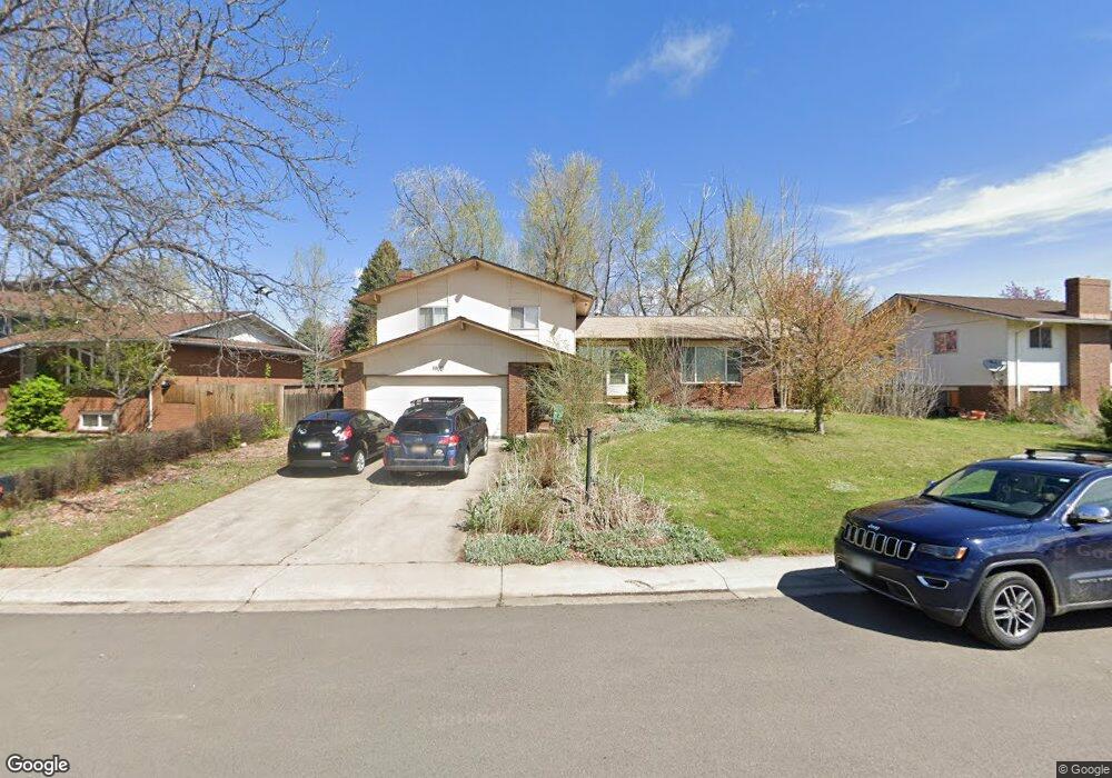
1900 Yorktown Ave Fort Collins, CO 80526
Estimated Value: $513,000 - $674,000
3
Beds
3
Baths
2,164
Sq Ft
$267/Sq Ft
Est. Value
About This Home
This home is located at 1900 Yorktown Ave, Fort Collins, CO 80526 and is currently estimated at $578,031, approximately $267 per square foot. 1900 Yorktown Ave is a home located in Larimer County with nearby schools including Bennett Elementary School, Blevins Middle School, and Rocky Mountain High School.
Ownership History
Date
Name
Owned For
Owner Type
Purchase Details
Closed on
Sep 19, 2003
Sold by
Adamson Rocky and Rhoades James R
Bought by
Rhoades Judith A and Rhoades James R
Current Estimated Value
Home Financials for this Owner
Home Financials are based on the most recent Mortgage that was taken out on this home.
Original Mortgage
$187,656
Outstanding Balance
$80,421
Interest Rate
5.14%
Mortgage Type
Purchase Money Mortgage
Estimated Equity
$497,610
Purchase Details
Closed on
Nov 8, 2002
Sold by
Chiavetta Kenneth J
Bought by
Adamson Rocky and Rhoades James R
Create a Home Valuation Report for This Property
The Home Valuation Report is an in-depth analysis detailing your home's value as well as a comparison with similar homes in the area
Home Values in the Area
Average Home Value in this Area
Purchase History
| Date | Buyer | Sale Price | Title Company |
|---|---|---|---|
| Rhoades Judith A | -- | Guardian Title Agency | |
| Adamson Rocky | $145,000 | North American Title Co |
Source: Public Records
Mortgage History
| Date | Status | Borrower | Loan Amount |
|---|---|---|---|
| Open | Rhoades Judith A | $187,656 |
Source: Public Records
Tax History Compared to Growth
Tax History
| Year | Tax Paid | Tax Assessment Tax Assessment Total Assessment is a certain percentage of the fair market value that is determined by local assessors to be the total taxable value of land and additions on the property. | Land | Improvement |
|---|---|---|---|---|
| 2025 | $3,256 | $37,614 | $3,015 | $34,599 |
| 2024 | $3,098 | $37,614 | $3,015 | $34,599 |
| 2022 | $2,536 | $26,862 | $3,128 | $23,734 |
| 2021 | $2,563 | $27,635 | $3,218 | $24,417 |
| 2020 | $2,517 | $26,899 | $3,218 | $23,681 |
| 2019 | $2,528 | $26,899 | $3,218 | $23,681 |
| 2018 | $2,236 | $24,538 | $3,240 | $21,298 |
| 2017 | $2,229 | $24,538 | $3,240 | $21,298 |
| 2016 | $1,982 | $21,707 | $3,582 | $18,125 |
| 2015 | $1,967 | $21,700 | $3,580 | $18,120 |
| 2014 | $1,782 | $19,540 | $3,580 | $15,960 |
Source: Public Records
Map
Nearby Homes
- 1905 Yorktown Ave
- 2420 Sheffield Cir E
- 1757 Concord Dr
- 2404 Sheffield Cir E
- 2613 Hanover Dr
- 2607 S Taft Hill Rd
- 2800 S Taft Hill Rd
- 2114 Water Blossom Ln
- 2109 W Drake Rd
- 2206 Rambouillet Dr
- 2706 Dunbar Ave
- 2718 Dunbar Ave
- 1419 Glen Haven Dr
- 2855 Trenton Way
- 1701 Glenwood Dr
- 2738 Bradford Square
- 2828 Silverplume Dr
- 2828 Silverplume Dr Unit R3
- 2918 Silverplume Dr Unit C1
- 1601 W Swallow Rd Unit 1
- 1828 Yorktown Ave
- 1904 Yorktown Ave
- 2436 Sheffield Cir E
- 2436 Sheffield Cir E
- 2433 Sheffield Cir W
- 1824 Yorktown Ave
- 1908 Yorktown Ave
- 2432 Sheffield Cir E
- 1901 Yorktown Ave
- 2429 Sheffield Cir W
- 1912 Yorktown Ave
- 1820 Yorktown Ave
- 2428 Sheffield Cir E
- 2437 Sheffield Cir E
- 1909 Yorktown Ave
- 2424 Sheffield Cir W
- 1916 Yorktown Ave
- 2425 Sheffield Cir W
- 1816 Yorktown Ave
- 2424 Sheffield Cir E