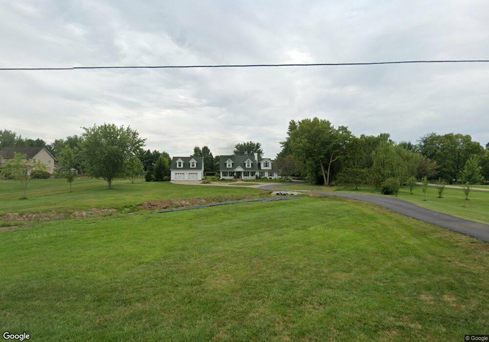
1901 Kirby Rd Lebanon, OH 45036
Turtlecreek Township NeighborhoodEstimated Value: $474,000 - $555,000
3
Beds
3
Baths
2,114
Sq Ft
$240/Sq Ft
Est. Value
About This Home
This home is located at 1901 Kirby Rd, Lebanon, OH 45036 and is currently estimated at $506,898, approximately $239 per square foot. 1901 Kirby Rd is a home located in Warren County with nearby schools including Bowman Primary School, Berry Intermediate School, and Donovan Elementary School.
Ownership History
Date
Name
Owned For
Owner Type
Purchase Details
Closed on
Sep 7, 1993
Bought by
Stapleton and Stapleton Jeffrey S
Current Estimated Value
Purchase Details
Closed on
Mar 12, 1993
Sold by
Lester Hirschbach and Lester H.
Bought by
Ameristar Homes & Inc
Purchase Details
Closed on
Dec 2, 1992
Sold by
Hirschbach Lester H and Hirschbach A
Bought by
Hirschbach and Hirschbach Lester H
Create a Home Valuation Report for This Property
The Home Valuation Report is an in-depth analysis detailing your home's value as well as a comparison with similar homes in the area
Home Values in the Area
Average Home Value in this Area
Purchase History
| Date | Buyer | Sale Price | Title Company |
|---|---|---|---|
| Stapleton | $123,200 | -- | |
| Ameristar Homes & Inc | $12,400 | -- | |
| Hirschbach | -- | -- |
Source: Public Records
Tax History Compared to Growth
Tax History
| Year | Tax Paid | Tax Assessment Tax Assessment Total Assessment is a certain percentage of the fair market value that is determined by local assessors to be the total taxable value of land and additions on the property. | Land | Improvement |
|---|---|---|---|---|
| 2024 | $5,047 | $127,140 | $27,200 | $99,940 |
| 2023 | $4,584 | $104,310 | $15,715 | $88,595 |
| 2022 | $4,526 | $104,311 | $15,715 | $88,596 |
| 2021 | $4,200 | $104,311 | $15,715 | $88,596 |
| 2020 | $4,099 | $84,805 | $12,775 | $72,030 |
| 2019 | $4,122 | $84,805 | $12,775 | $72,030 |
| 2018 | $3,725 | $84,805 | $12,775 | $72,030 |
| 2017 | $3,739 | $76,412 | $11,529 | $64,883 |
| 2016 | $3,844 | $75,996 | $11,529 | $64,467 |
| 2015 | $3,874 | $75,996 | $11,529 | $64,467 |
| 2014 | $3,665 | $68,650 | $10,570 | $58,080 |
| 2013 | $3,411 | $77,030 | $12,400 | $64,630 |
Source: Public Records
Map
Nearby Homes
- 1801 Kirby Rd
- 2266 N St Rt 123
- 2266 N St Rt 123 Unit Site D
- 2266 Ohio 123
- 2266 Ohio 123 Unit Site C
- 2266 Ohio 123 Unit Site A
- 2266 Ohio 123 Unit Site B
- 3562 Aniston Ct
- 0 Aniston Ct Unit 1824950
- 0 Aniston Ct
- 3626 Colton Ct
- 0 Colton Ct Unit 1824949
- 2 Colton Ct
- 0 Colton Ct
- 02 Colton Ct
- 3092 Canvasback Ct
- 3086 Canvasback Ct
- 3080 Canvasback Ct
- 3074 Canvasback Ct
- 3095 Canvasback Ct
- 1843 Kirby Rd
- 1919 Kirby Rd
- 1965 Kirby Rd
- 2412 Columbine Dr
- 2411 Columbine Dr
- 2406 Columbine Dr
- 1987 Kirby Rd
- 2407 Columbine Dr
- 1988 Kirby Rd
- 1755 Kirby Rd
- 2390 Columbine Dr
- 1888 Kirby Rd
- 1999 Kirby Rd
- 2381 Columbine Dr
- 2376 Columbine Dr
- 1832 Kirby Rd
- 2018 Kirby Rd
- 2047 Kirby Rd
- 2355 Columbine Dr
- 1958 Kirby Rd