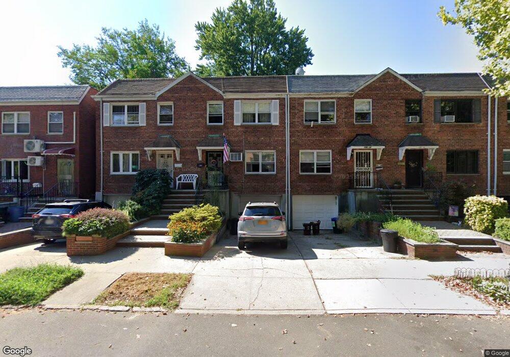
19018 39th Ave Flushing, NY 11358
Auburndale NeighborhoodEstimated Value: $809,511 - $965,000
--
Bed
--
Bath
1,683
Sq Ft
$521/Sq Ft
Est. Value
About This Home
This home is located at 19018 39th Ave, Flushing, NY 11358 and is currently estimated at $876,378, approximately $520 per square foot. 19018 39th Ave is a home located in Queens County with nearby schools including P.S. 32 - State Street, I.S. 25 Adrien Block, and Francis Lewis High School.
Ownership History
Date
Name
Owned For
Owner Type
Purchase Details
Closed on
Jan 4, 2022
Sold by
Lynch Margaret
Bought by
Kathleen Lynch-Choy and Margaret Lynch Trust
Current Estimated Value
Purchase Details
Closed on
Jun 21, 1994
Sold by
Lynch Vincent M and Lynch Margaret M
Bought by
Lynch Margaret M
Home Financials for this Owner
Home Financials are based on the most recent Mortgage that was taken out on this home.
Original Mortgage
$80,000
Interest Rate
8.65%
Create a Home Valuation Report for This Property
The Home Valuation Report is an in-depth analysis detailing your home's value as well as a comparison with similar homes in the area
Home Values in the Area
Average Home Value in this Area
Purchase History
| Date | Buyer | Sale Price | Title Company |
|---|---|---|---|
| Kathleen Lynch-Choy | -- | -- | |
| Kathleen Lynch-Choy | -- | -- | |
| Lynch Margaret M | -- | Commonwealth Land Title Ins | |
| Lynch Margaret M | -- | Commonwealth Land Title Ins |
Source: Public Records
Mortgage History
| Date | Status | Borrower | Loan Amount |
|---|---|---|---|
| Closed | Lynch Margaret M | $80,000 |
Source: Public Records
Tax History Compared to Growth
Tax History
| Year | Tax Paid | Tax Assessment Tax Assessment Total Assessment is a certain percentage of the fair market value that is determined by local assessors to be the total taxable value of land and additions on the property. | Land | Improvement |
|---|---|---|---|---|
| 2025 | $6,424 | $37,928 | $11,231 | $26,697 |
| 2024 | $6,528 | $35,782 | $11,560 | $24,222 |
| 2023 | $6,017 | $33,758 | $9,892 | $23,866 |
| 2022 | $5,699 | $51,360 | $15,120 | $36,240 |
| 2021 | $6,044 | $48,120 | $15,120 | $33,000 |
| 2020 | $6,031 | $52,260 | $15,120 | $37,140 |
| 2019 | $5,579 | $47,880 | $15,120 | $32,760 |
| 2018 | $5,076 | $28,132 | $9,725 | $18,407 |
| 2017 | $4,764 | $26,541 | $10,305 | $16,236 |
| 2016 | $4,685 | $26,541 | $10,305 | $16,236 |
| 2015 | $2,581 | $26,339 | $12,090 | $14,249 |
| 2014 | $2,581 | $24,849 | $13,696 | $11,153 |
Source: Public Records
Map
Nearby Homes
- 192-12 39th Ave Unit 1
- 191-09 39th Ave Unit Lower
- 191-9 39th Ave Unit 164
- 190-05 39th Ave Unit 140
- 190-05 39th Ave Unit 142
- 192-16 39th Ave Unit 1
- 190-12 Station Rd
- 19112 Station Rd
- 4014 191st St
- 40-12 190th St
- 36-20 190th St
- 4022 190th St
- 190-17 42nd Ave
- 4005 Utopia Pkwy
- 40-38 194th St Unit 1A
- 194-23 Station Rd
- 36-20 194th St Unit 3r
- 4048 194th St Unit A3
- 35-20 Utopia Pkwy
- 3639 171st St Unit 26
- 19020 39th Ave
- 19022 39th Ave
- 19022 39th Ave Unit 1Fl
- 19016 39th Ave
- 19024 39th Ave
- 191-04 39th Ave Unit 2Fl
- 191-04 39th Ave Unit 1st Fl
- 191-04 39th Ave
- 19014 39th Ave
- 191-02 39th Ave
- 19102 39th Ave
- 19012 39th Ave
- 190-12 39th Ave
- 19104 39th Ave Unit 2Fl
- 19104 39th Ave
- 19104 39th Ave
- 19104 39th Ave
- 19010 39th Ave
- 19106 39th Ave
- 19010 39th Ave