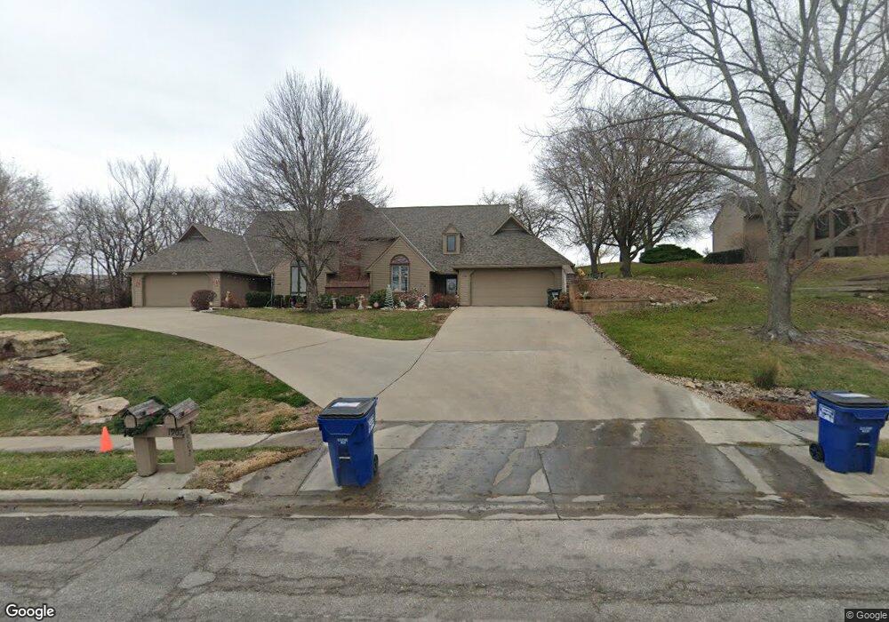
1902 Crossgate Dr Lawrence, KS 66047
Estimated Value: $368,777 - $420,000
3
Beds
3
Baths
2,031
Sq Ft
$192/Sq Ft
Est. Value
About This Home
This home is located at 1902 Crossgate Dr, Lawrence, KS 66047 and is currently estimated at $389,944, approximately $191 per square foot. 1902 Crossgate Dr is a home located in Douglas County with nearby schools including Sunflower Elementary School, Southwest Middle School, and Lawrence High School.
Ownership History
Date
Name
Owned For
Owner Type
Purchase Details
Closed on
May 21, 2025
Sold by
Cox Jodette Ellen
Bought by
Jodette E Cox Revocable Trust and Cox
Current Estimated Value
Purchase Details
Closed on
Jun 1, 2021
Sold by
Belote Betsy J and Betsy J Belote Revocable Trust
Bought by
Cox Jodette Ellen
Purchase Details
Closed on
Oct 9, 2007
Sold by
Safe Harbour Eat Iv Llc
Bought by
Belote Betsy J and Betsy J Belote Revocable Trust
Purchase Details
Closed on
May 12, 2003
Sold by
Kline Tanya Deen and Kline Larry J
Bought by
Kline Larry J and Kline Tanya M
Home Financials for this Owner
Home Financials are based on the most recent Mortgage that was taken out on this home.
Original Mortgage
$120,000
Interest Rate
5.77%
Mortgage Type
Balloon
Create a Home Valuation Report for This Property
The Home Valuation Report is an in-depth analysis detailing your home's value as well as a comparison with similar homes in the area
Home Values in the Area
Average Home Value in this Area
Purchase History
| Date | Buyer | Sale Price | Title Company |
|---|---|---|---|
| Jodette E Cox Revocable Trust | -- | None Listed On Document | |
| Jodette E Cox Revocable Trust | -- | None Listed On Document | |
| Cox Jodette Ellen | -- | Continental Title Co | |
| Belote Betsy J | -- | Kansas Secured Title | |
| Kline Larry J | -- | Kansas Secured Title |
Source: Public Records
Mortgage History
| Date | Status | Borrower | Loan Amount |
|---|---|---|---|
| Previous Owner | Kline Larry J | $120,000 |
Source: Public Records
Tax History Compared to Growth
Tax History
| Year | Tax Paid | Tax Assessment Tax Assessment Total Assessment is a certain percentage of the fair market value that is determined by local assessors to be the total taxable value of land and additions on the property. | Land | Improvement |
|---|---|---|---|---|
| 2025 | $5,296 | $45,105 | $5,750 | $39,355 |
| 2024 | $5,296 | $42,619 | $4,600 | $38,019 |
| 2023 | $5,012 | $38,962 | $4,600 | $34,362 |
| 2022 | $4,917 | $37,950 | $3,679 | $34,271 |
| 2021 | $4,334 | $32,434 | $3,679 | $28,755 |
| 2020 | $4,105 | $30,889 | $3,679 | $27,210 |
| 2019 | $3,946 | $29,739 | $3,679 | $26,060 |
| 2018 | $3,853 | $28,831 | $3,679 | $25,152 |
| 2017 | $3,835 | $28,382 | $3,679 | $24,703 |
| 2016 | $3,832 | $29,613 | $3,679 | $25,934 |
| 2015 | $1,853 | $28,647 | $3,679 | $24,968 |
| 2014 | $1,785 | $27,865 | $3,679 | $24,186 |
Source: Public Records
Map
Nearby Homes
- 1908 Crossgate Dr
- 1840 Quail Creek Dr
- 2100 Inverness Dr
- 4206 Nicklaus Dr
- 4312 Wimbledon Dr
- 2133 Quail Creek Dr
- 1580 Eldorado Dr
- 2013 Camelback Dr
- 4617 Merion Ct
- 1616 Prestwick Dr
- 1507 Medinah Cir
- 2009 Riviera Ct
- 1608 Prestwick Dr
- 2101 Riviera Dr
- 3417 Seminole Dr
- 2109 Riviera Dr
- 2016 Jenny Wren Rd
- 4400 Gretchen Ct
- 1406 Brighton Cir Unit B
- 3109 W 19th St
- 1900 Crossgate Dr
- 1904 Crossgate Dr
- 1906 Crossgate Dr
- 1903 Crossgate Dr
- 1905 Crossgate Dr
- 1901 Crossgate Dr
- 1907 Crossgate Dr
- 1909 Crossgate Dr
- 1910 Crossgate Dr
- 2001 Crossgate Dr
- 2003 Crossgate Dr
- 2000 Crossgate Dr
- 2005 Crossgate Dr
- 2004 Crossgate Dr
- 1919 Quail Run
- 1913 Quail Run
- 1915 Quail Run
- 1921 Quail Run
- 1909 Quail Run
- 1907 Quail Run