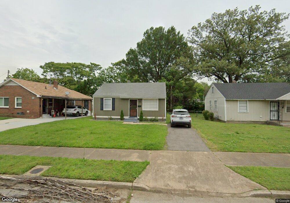
1902 State St Memphis, TN 38114
Southeast Memphis NeighborhoodEstimated Value: $86,000 - $106,000
2
Beds
1
Bath
720
Sq Ft
$130/Sq Ft
Est. Value
About This Home
This home is located at 1902 State St, Memphis, TN 38114 and is currently estimated at $93,877, approximately $130 per square foot. 1902 State St is a home located in Shelby County with nearby schools including Hamilton High School, Memphis College Preparatory, and Veritas College Preparatory.
Ownership History
Date
Name
Owned For
Owner Type
Purchase Details
Closed on
Aug 12, 2024
Sold by
901-2 0 Llc
Bought by
Zook Levi
Current Estimated Value
Purchase Details
Closed on
Feb 27, 2024
Sold by
Mcgriff Laurie T
Bought by
901-20 Llc
Purchase Details
Closed on
Aug 2, 2019
Sold by
Mid South Homebuyers Gp
Bought by
Mcgriff Laurie T
Purchase Details
Closed on
Mar 12, 2019
Sold by
Norwood Mary and Norwood Monte
Bought by
Mid South Homebuyers Gp
Purchase Details
Closed on
Dec 26, 2013
Sold by
House Elbert E
Bought by
Norwood Mary and Norwood Monte
Create a Home Valuation Report for This Property
The Home Valuation Report is an in-depth analysis detailing your home's value as well as a comparison with similar homes in the area
Home Values in the Area
Average Home Value in this Area
Purchase History
| Date | Buyer | Sale Price | Title Company |
|---|---|---|---|
| Zook Levi | $98,400 | None Listed On Document | |
| 901-20 Llc | $70,000 | None Listed On Document | |
| Mcgriff Laurie T | $58,000 | Saddle Creek Title Llc | |
| Mid South Homebuyers Gp | $4,621 | Saddle Creek Title Llc | |
| Norwood Mary | -- | None Available |
Source: Public Records
Mortgage History
| Date | Status | Borrower | Loan Amount |
|---|---|---|---|
| Closed | Mid South Homebuyers Gp | $0 |
Source: Public Records
Tax History
| Year | Tax Paid | Tax Assessment Tax Assessment Total Assessment is a certain percentage of the fair market value that is determined by local assessors to be the total taxable value of land and additions on the property. | Land | Improvement |
|---|---|---|---|---|
| 2025 | -- | $23,575 | $1,500 | $22,075 |
| 2024 | $125 | $3,675 | $1,000 | $2,675 |
| 2023 | $224 | $3,675 | $1,000 | $2,675 |
| 2022 | $224 | $3,675 | $1,000 | $2,675 |
| 2021 | $227 | $3,675 | $1,000 | $2,675 |
| 2020 | $246 | $3,400 | $1,000 | $2,400 |
| 2019 | $109 | $3,400 | $1,000 | $2,400 |
| 2018 | $109 | $3,400 | $1,000 | $2,400 |
| 2017 | $111 | $3,400 | $1,000 | $2,400 |
| 2016 | $175 | $4,000 | $0 | $0 |
Source: Public Records
Map
Nearby Homes
- 1817 S Barksdale St
- 1825 Castalia St
- 1832 Rozelle St
- 1936 Frisco Ave
- 1824 Rozelle St
- 1971 Boyle Ave
- 1954 Boyle Ave
- 1896 Glory Cir
- 1560 Cane Rd
- 1516 Raven Ave
- 1551 Cane Rd
- 1698 Rayner St
- 2151 Goff Ave
- 2136 Sparks St
- 2014 N Dianne Cir
- 1965 Cloverdale Dr
- 0 Airways Blvd Unit 10199303
- 2149 Wabash Ave
- 1975 Cloverdale Dr
- 1448 Valse Rd
- 1894 State St
- 1908 State St
- 1912 State St
- 1901 S Barksdale St
- 1907 S Barksdale St
- 1879 Freemont Rd
- 1887 Freemont Rd
- 1873 Freemont Rd
- 1918 State St
- 1911 S Barksdale St
- 1901 State St
- 1893 State St
- 1907 State St
- 1887 State St
- 1919 S Barksdale St
- 1919 S Barksdale St
- 1911 State St
- 1922 State St
- 1917 State St
- 1923 S Barksdale St
Your Personal Tour Guide
Ask me questions while you tour the home.