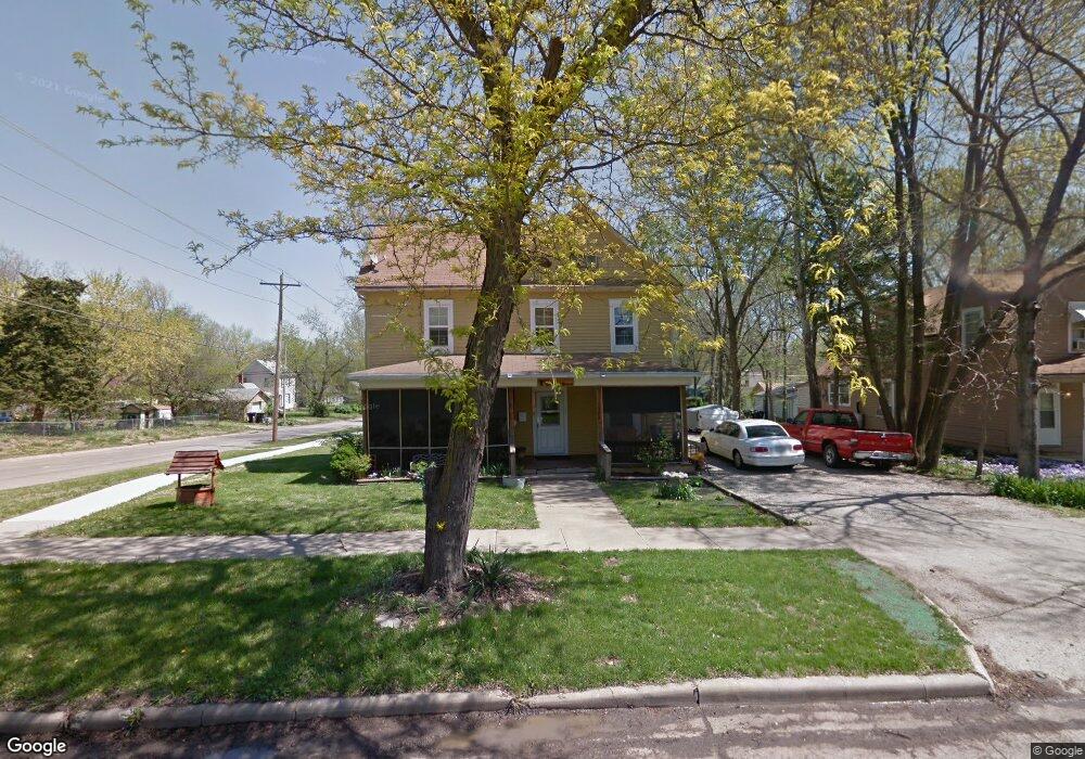
1902 SW Lane St Topeka, KS 66604
Chesney Park NeighborhoodEstimated Value: $107,000 - $138,000
5
Beds
2
Baths
2,076
Sq Ft
$59/Sq Ft
Est. Value
About This Home
This home is located at 1902 SW Lane St, Topeka, KS 66604 and is currently estimated at $123,399, approximately $59 per square foot. 1902 SW Lane St is a home located in Shawnee County with nearby schools including Buckeye Elementary School, Rosenwald Elementary School, and Martin Park Elementary School.
Ownership History
Date
Name
Owned For
Owner Type
Purchase Details
Closed on
May 8, 2008
Sold by
Dodson April and Dodson Mickey
Bought by
Bogart Jean Omara and Bogart Justin
Current Estimated Value
Purchase Details
Closed on
Apr 26, 2005
Sold by
Citifinancial Inc
Bought by
Fernald Enterprises Inc
Home Financials for this Owner
Home Financials are based on the most recent Mortgage that was taken out on this home.
Original Mortgage
$25,000
Interest Rate
5.87%
Mortgage Type
Purchase Money Mortgage
Create a Home Valuation Report for This Property
The Home Valuation Report is an in-depth analysis detailing your home's value as well as a comparison with similar homes in the area
Home Values in the Area
Average Home Value in this Area
Purchase History
| Date | Buyer | Sale Price | Title Company |
|---|---|---|---|
| Bogart Jean Omara | -- | Kansas Secured Title | |
| Fernald Enterprises Inc | -- | None Available |
Source: Public Records
Mortgage History
| Date | Status | Borrower | Loan Amount |
|---|---|---|---|
| Previous Owner | Fernald Enterprises Inc | $25,000 |
Source: Public Records
Tax History Compared to Growth
Tax History
| Year | Tax Paid | Tax Assessment Tax Assessment Total Assessment is a certain percentage of the fair market value that is determined by local assessors to be the total taxable value of land and additions on the property. | Land | Improvement |
|---|---|---|---|---|
| 2025 | $1,381 | $10,953 | -- | -- |
| 2023 | $1,381 | $9,840 | $0 | $0 |
| 2022 | $1,330 | $9,196 | $0 | $0 |
| 2021 | $1,292 | $8,360 | $0 | $0 |
| 2020 | $679 | $4,579 | $0 | $0 |
| 2019 | $669 | $4,490 | $0 | $0 |
| 2018 | $649 | $4,358 | $0 | $0 |
| 2017 | $650 | $4,358 | $0 | $0 |
| 2014 | $752 | $4,947 | $0 | $0 |
Source: Public Records
Map
Nearby Homes
- 1907 SW Buchanan St
- 1912 SW Buchanan St
- 1501-1599 SW 17th St
- 1700 SW Buchanan St
- 2058 SW Buchanan St
- 1630 SW Buchanan St
- 1620 SW Clay St
- 1647 SW 21st St
- 918 SW 17th St
- 2129 SW Buchanan St
- 1637 SW Fillmore St
- 1527 SW Mulvane St
- 1610 SW Central Park Ave
- 1531 SW 15th St
- 1015 SW 16th St
- 1500 SW Mulvane St
- 0 SW Buchanan St
- 1717 SW 15th St
- 1556 SW 23rd St
- 1532 SW Western Ave
- 1906 SW Lane St
- 1912 SW Lane St
- 1834 SW Lane St
- 1905 SW Lincoln St
- 1301 SW 19th St
- 1907 SW Lincoln St
- 1920 SW Lane St
- 1301 SW 19th St
- 1913 SW Lincoln St
- 1830 SW Lane St
- 1915 SW Lincoln St
- 1835 SW Lincoln St
- 1905 SW Lane St
- 1901 SW Lane St
- 1924 SW Lane St
- 1909 SW Lane St
- 1826 SW Lane St
- 1915 SW Lane St
- 1829 SW Lincoln St
- 1833 SW Lane St