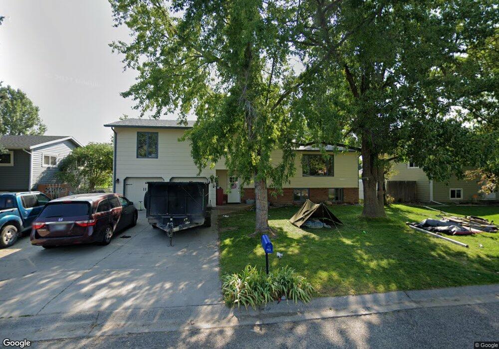
1903 Columbine Dr Billings, MT 59105
Billings Heights NeighborhoodEstimated Value: $416,000 - $444,332
5
Beds
3
Baths
3,053
Sq Ft
$141/Sq Ft
Est. Value
About This Home
This home is located at 1903 Columbine Dr, Billings, MT 59105 and is currently estimated at $429,833, approximately $140 per square foot. 1903 Columbine Dr is a home located in Yellowstone County with nearby schools including Beartooth School, Medicine Crow Middle School, and Skyview High School.
Ownership History
Date
Name
Owned For
Owner Type
Purchase Details
Closed on
Feb 28, 2022
Sold by
Lager Benjamin L
Bought by
Lautenschlager Alyssa
Current Estimated Value
Home Financials for this Owner
Home Financials are based on the most recent Mortgage that was taken out on this home.
Original Mortgage
$401,850
Outstanding Balance
$373,858
Interest Rate
3.55%
Mortgage Type
New Conventional
Estimated Equity
$55,975
Purchase Details
Closed on
May 15, 2015
Sold by
Ratliff David A and Ratliff Sheila D
Bought by
Lager Benjamin L and Lager Gena Marie
Home Financials for this Owner
Home Financials are based on the most recent Mortgage that was taken out on this home.
Original Mortgage
$198,000
Interest Rate
3.64%
Mortgage Type
New Conventional
Create a Home Valuation Report for This Property
The Home Valuation Report is an in-depth analysis detailing your home's value as well as a comparison with similar homes in the area
Home Values in the Area
Average Home Value in this Area
Purchase History
| Date | Buyer | Sale Price | Title Company |
|---|---|---|---|
| Lautenschlager Alyssa | -- | First American Title | |
| Lager Benjamin L | -- | Chicago Title |
Source: Public Records
Mortgage History
| Date | Status | Borrower | Loan Amount |
|---|---|---|---|
| Open | Lautenschlager Alyssa | $401,850 | |
| Previous Owner | Lager Benjamin L | $198,000 |
Source: Public Records
Tax History Compared to Growth
Tax History
| Year | Tax Paid | Tax Assessment Tax Assessment Total Assessment is a certain percentage of the fair market value that is determined by local assessors to be the total taxable value of land and additions on the property. | Land | Improvement |
|---|---|---|---|---|
| 2025 | $3,841 | $422,500 | $62,549 | $359,951 |
| 2024 | $3,841 | $384,600 | $58,981 | $325,619 |
| 2023 | $3,841 | $384,600 | $58,981 | $325,619 |
| 2022 | $3,300 | $288,300 | $0 | $0 |
| 2021 | $3,058 | $280,100 | $0 | $0 |
| 2020 | $3,008 | $262,000 | $0 | $0 |
| 2019 | $2,886 | $262,000 | $0 | $0 |
| 2018 | $2,782 | $247,500 | $0 | $0 |
| 2017 | $2,701 | $247,500 | $0 | $0 |
| 2016 | $2,274 | $207,300 | $0 | $0 |
| 2015 | $2,215 | $206,100 | $0 | $0 |
| 2014 | $2,136 | $105,629 | $0 | $0 |
Source: Public Records
Map
Nearby Homes
- 1320 Mading Dr
- 1961 Bitterroot Dr
- na Hawthorne Ln
- TBD Barrett Rd
- 1203 Peony Dr
- 1982 Sandra Dr
- 1819 Natalie St
- 1402 Emma Ave
- 1727 Wicks Ln
- 1518 S Ping Cir
- 1327 Tania Cir
- 1512 Mary St
- 1106 Victory Ave
- 10 Attika St N
- 1353 Tania Cir
- 901 Kale Dr
- 6 N Bing
- 1332 Hawthorne Ln
- 1028 Competition Ave
- 13 Hartland St N
- 1909 Columbine Dr
- 1849 Columbine Dr
- 1904 Dogwood Dr
- 1913 Columbine Dr
- 1910 Dogwood Dr
- 1850 Dogwood Dr
- 1843 Columbine Dr
- 1904 Columbine Dr
- 1850 Columbine Dr
- 1916 Dogwood Dr
- 1844 Dogwood Dr
- 1919 Columbine Dr
- 1837 Columbine Dr
- 1916 Columbine Dr
- 1844 Columbine Dr
- 1920 Dogwood Dr
- 1838 Dogwood Dr
- 1920 Columbine Dr
- 1838 Columbine Dr
- 1903 Dogwood Dr