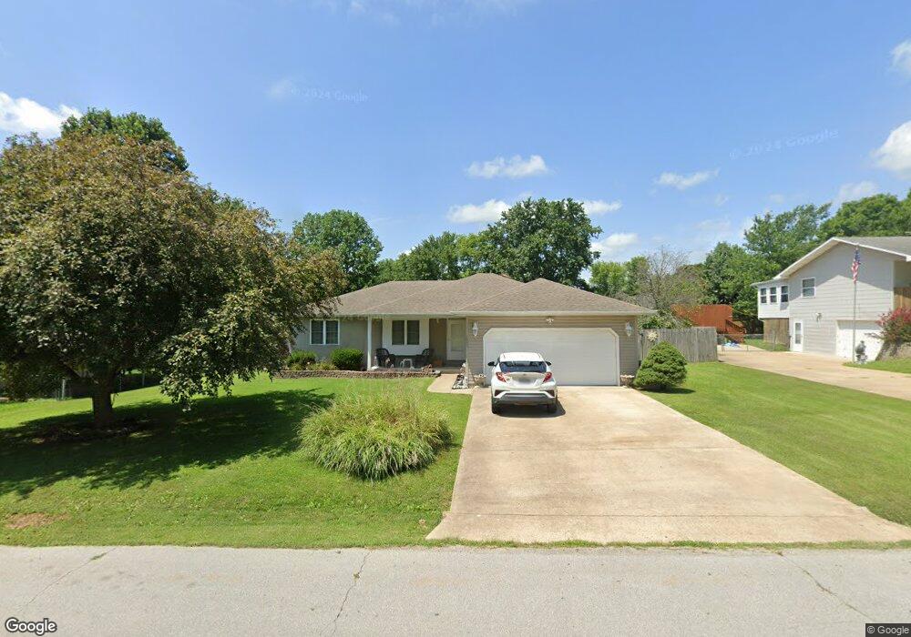
1905 Christopher St West Plains, MO 65775
Estimated Value: $173,969 - $220,000
3
Beds
2
Baths
1,374
Sq Ft
$142/Sq Ft
Est. Value
About This Home
This home is located at 1905 Christopher St, West Plains, MO 65775 and is currently estimated at $195,492, approximately $142 per square foot. 1905 Christopher St is a home located in Howell County with nearby schools including Faith Assembly Christian School.
Ownership History
Date
Name
Owned For
Owner Type
Purchase Details
Closed on
Aug 26, 2020
Sold by
Owens Gary P and Winner Maureen
Bought by
Buchinsky Steven and Buchinsky Kristopher
Current Estimated Value
Purchase Details
Closed on
Jun 28, 2018
Sold by
Owens Gary P
Bought by
Owens Gary P and Winner Maureen
Purchase Details
Closed on
Oct 21, 2010
Sold by
Beck Theodore A and Beck Elsie M
Bought by
Trantham Dennis
Create a Home Valuation Report for This Property
The Home Valuation Report is an in-depth analysis detailing your home's value as well as a comparison with similar homes in the area
Home Values in the Area
Average Home Value in this Area
Purchase History
| Date | Buyer | Sale Price | Title Company |
|---|---|---|---|
| Buchinsky Steven | -- | None Available | |
| Owens Gary P | -- | None Available | |
| Trantham Dennis | -- | None Available |
Source: Public Records
Tax History
| Year | Tax Paid | Tax Assessment Tax Assessment Total Assessment is a certain percentage of the fair market value that is determined by local assessors to be the total taxable value of land and additions on the property. | Land | Improvement |
|---|---|---|---|---|
| 2025 | $643 | $19,930 | $2,270 | $17,660 |
| 2024 | $643 | $17,790 | -- | -- |
| 2023 | $643 | $17,790 | $0 | $0 |
| 2022 | $609 | $16,840 | $0 | $0 |
| 2020 | $567 | $15,620 | $0 | $0 |
| 2019 | $598 | $15,620 | $0 | $0 |
| 2018 | $598 | $15,620 | $0 | $0 |
| 2017 | $598 | $15,620 | $0 | $0 |
Source: Public Records
Map
Nearby Homes
- 1917 Christopher St
- 1913 Katherine Dr
- 2416 Gleghorn St
- 4949 State Route Cc
- 000 Gleghorn St
- 1804 Christopher St
- 3004 Greer Spring St
- 2004 Lynn Dr
- 000 Millwood Subdivision
- 000 County Road 4100
- 1931 Kay Dr
- 2815 Burke Ave
- 000 Joann Dr
- 2808 Burke Ave
- 2810 Burke Ave
- 1709 Westway Dr
- 3013 Westway Dr
- 1303 Westwood Dr
- 2405 Deatherage Ave
- 1605 Padgett St
- 1907 Christopher St
- 1903 Christopher St
- 1906 Katherine Dr
- 1908 Katherine Dr
- 1906 Christopher Dr
- 1902 Katherine Dr
- 1908 Christopher Dr
- 1904 Christopher St
- 1909 Christopher St
- 1904 Christopher Dr
- 1910 Christopher Dr
- Tbd Katherine Dr
- Tbd Lot 11 Katherine Dr
- Tbd Lot 13 Christopher St
- 00 Christopher St
- 1911 Christopher Dr
- 1903 Katherine Dr
- 1907 Katherine Dr
- 1909 Katherine Dr
- 2319 Terra St