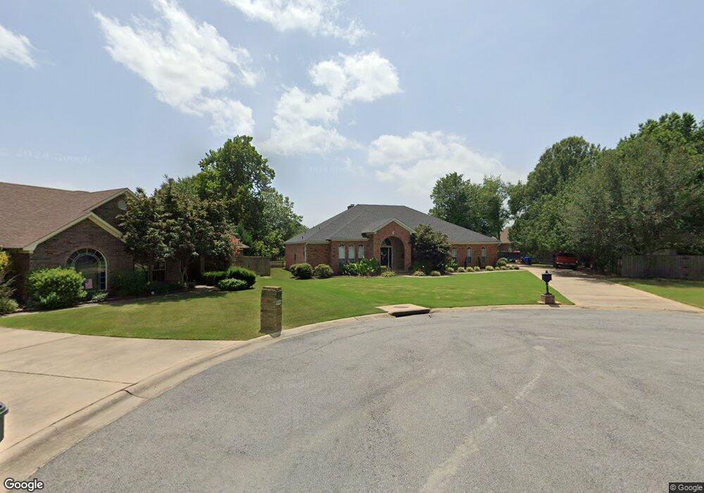
1905 Little River Dr Conway, AR 72034
Downtown Conway NeighborhoodEstimated Value: $354,000 - $409,000
--
Bed
3
Baths
2,625
Sq Ft
$147/Sq Ft
Est. Value
About This Home
This home is located at 1905 Little River Dr, Conway, AR 72034 and is currently estimated at $385,393, approximately $146 per square foot. 1905 Little River Dr is a home located in Faulkner County with nearby schools including Julia Lee Moore Elementary School, Conway Junior High School, and Conway High School.
Ownership History
Date
Name
Owned For
Owner Type
Purchase Details
Closed on
Sep 16, 2011
Sold by
Hess Michael John and Hess Carol Ann
Bought by
Hess Michael John and Hess Carol Ann
Current Estimated Value
Home Financials for this Owner
Home Financials are based on the most recent Mortgage that was taken out on this home.
Original Mortgage
$202,458
Outstanding Balance
$16,775
Interest Rate
3.25%
Mortgage Type
FHA
Estimated Equity
$368,618
Purchase Details
Closed on
Apr 9, 2010
Sold by
Hess Michael John and Hess Carol Ann
Bought by
Hess Michael John and Hess Carol Ann
Create a Home Valuation Report for This Property
The Home Valuation Report is an in-depth analysis detailing your home's value as well as a comparison with similar homes in the area
Home Values in the Area
Average Home Value in this Area
Purchase History
| Date | Buyer | Sale Price | Title Company |
|---|---|---|---|
| Hess Michael John | -- | Lenders Title Co | |
| Hess Michael John | -- | -- |
Source: Public Records
Mortgage History
| Date | Status | Borrower | Loan Amount |
|---|---|---|---|
| Open | Hess Michael John | $202,458 |
Source: Public Records
Tax History Compared to Growth
Tax History
| Year | Tax Paid | Tax Assessment Tax Assessment Total Assessment is a certain percentage of the fair market value that is determined by local assessors to be the total taxable value of land and additions on the property. | Land | Improvement |
|---|---|---|---|---|
| 2025 | $2,702 | $71,180 | $6,600 | $64,580 |
| 2024 | $2,579 | $71,180 | $6,600 | $64,580 |
| 2023 | $2,456 | $50,960 | $5,720 | $45,240 |
| 2022 | $1,974 | $50,960 | $5,720 | $45,240 |
| 2021 | $1,867 | $50,960 | $5,720 | $45,240 |
| 2020 | $1,760 | $42,200 | $5,720 | $36,480 |
| 2019 | $1,760 | $42,200 | $5,720 | $36,480 |
| 2018 | $1,785 | $42,200 | $5,720 | $36,480 |
| 2017 | $1,785 | $42,200 | $5,720 | $36,480 |
| 2016 | $1,785 | $42,200 | $5,720 | $36,480 |
| 2015 | -- | $42,000 | $5,200 | $36,800 |
| 2014 | $1,775 | $42,000 | $5,200 | $36,800 |
Source: Public Records
Map
Nearby Homes
- 3115 Baxter Dr
- 3115 Tyler St
- 3020 Ashley Dr
- 1715 Royal Dr
- 3335 Nicklaus Dr
- 1810 Royal Dr
- 1840 Drury Ln
- 1690 Winterbrook Dr
- 11 Red Oak Dr
- 2850 Carmichael Dr
- 50 White Oak Dr
- 8 Smoking Oaks Rd
- 1240 Salem Rd
- 7 Riviera Dr
- 1205 Salem Rd
- 18 Riviera Dr
- 1145 Salem Rd
- 3525 Juniper Dr
- 1130 Applewood Dr
- 1320 Nob Hill St
- 1900 Little River Dr
- 1915 Little River Dr
- 1780 Calhoun Dr
- 3050 Crawford Loop
- 1790 Calhoun Dr
- 1910 Little River Dr
- 1770 Calhoun Dr
- 1800 Calhoun Dr
- 3060 Crawford Loop
- 3040 Crawford Loop
- 1766 Calhoun Dr
- 1925 Little River Dr
- 3070 Crawford Loop
- 1810 Calhoun Dr
- 3030 Crawford Loop
- 3045 Franklin Cir
- 1935 Little River Dr
- 3155 Carroll Dr
- 1760 Calhoun Dr
- 1775 Calhoun Dr