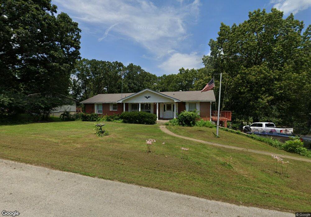
1905 Stein St West Plains, MO 65775
Estimated Value: $230,571 - $276,000
--
Bed
--
Bath
1,792
Sq Ft
$138/Sq Ft
Est. Value
About This Home
This home is located at 1905 Stein St, West Plains, MO 65775 and is currently estimated at $247,393, approximately $138 per square foot. 1905 Stein St is a home with nearby schools including West Plains Senior High School and Faith Assembly Christian School.
Ownership History
Date
Name
Owned For
Owner Type
Purchase Details
Closed on
Jun 23, 2022
Sold by
Wayne Boller Jr Russell and Wayne Denise O
Bought by
Wayne And Denise Boller Living Trust
Current Estimated Value
Purchase Details
Closed on
Nov 29, 2011
Sold by
Hall James W and Hall Vera May
Bought by
Boller Russell Wayne and Boller Denise O
Home Financials for this Owner
Home Financials are based on the most recent Mortgage that was taken out on this home.
Original Mortgage
$132,795
Interest Rate
4.13%
Mortgage Type
VA
Create a Home Valuation Report for This Property
The Home Valuation Report is an in-depth analysis detailing your home's value as well as a comparison with similar homes in the area
Home Values in the Area
Average Home Value in this Area
Purchase History
| Date | Buyer | Sale Price | Title Company |
|---|---|---|---|
| Wayne And Denise Boller Living Trust | -- | None Listed On Document | |
| Boller Russell Wayne | -- | Btc |
Source: Public Records
Mortgage History
| Date | Status | Borrower | Loan Amount |
|---|---|---|---|
| Previous Owner | Boller Russell Wayne | $132,795 |
Source: Public Records
Tax History Compared to Growth
Tax History
| Year | Tax Paid | Tax Assessment Tax Assessment Total Assessment is a certain percentage of the fair market value that is determined by local assessors to be the total taxable value of land and additions on the property. | Land | Improvement |
|---|---|---|---|---|
| 2025 | $1,137 | $27,460 | $2,990 | $24,470 |
| 2024 | $1,131 | $24,520 | -- | -- |
| 2023 | $1,131 | $24,520 | $0 | $0 |
| 2022 | $1,068 | $23,200 | $0 | $0 |
| 2021 | $790 | $23,200 | $0 | $0 |
| 2020 | $790 | $16,750 | $0 | $0 |
| 2019 | $813 | $16,600 | $0 | $0 |
| 2018 | $813 | $16,600 | $0 | $0 |
| 2017 | $809 | $16,600 | $0 | $0 |
| 2015 | -- | $16,060 | $0 | $0 |
| 2014 | -- | $16,060 | $0 | $0 |
| 2013 | -- | $16,060 | $0 | $0 |
Source: Public Records
Map
Nearby Homes
- 2823 Laurie Ave
- 2821 Christie Dr
- 3002 Ginger Dr
- 2818 Christie Dr
- 000 Lot 4 Block 13 Morrison Sub
- 000 Lot 2 Block 13 Morrison Sub
- 2707 Ridgewood Dr
- 000 Ginger Dr
- 000 Rhonda Dr
- 2701 Paula Dr
- 2704 Jennifer Dr
- 000 Lot 3 Block 13 Morrison Sub
- 2601 Kody Dr
- 2502 Kody Dr
- 000 Mcfarland St
- 000 Lee Anna Dr
- 2505 Courtney Place
- 000 Lot 2 Block 12 Morrison Sub
- 2405 Deatherage Ave
- 2808 Burke Ave
- 1907 Stein St
- 1903 Stein St
- 1903 Stein St
- 2904 Laurie Dr
- 1901 Stein Ave
- 2907 Laurie Dr
- 3011 Christie Dr
- 1904 Stein St
- 2905 Laurie Ave
- 1902 Stein Ave
- 2908 Ridgewood Dr
- 1911 Kelly Ave
- 1909 Kelly Dr
- 2005 Kelly Dr
- 2904 Ridgewood Dr
- 0 Lot 11 Block 6 Wayhaven Sub
- 1907 Kelly Ave
- 2914 Laurie Dr
- 2007 Kelly Dr
- Tbd Christie Dr