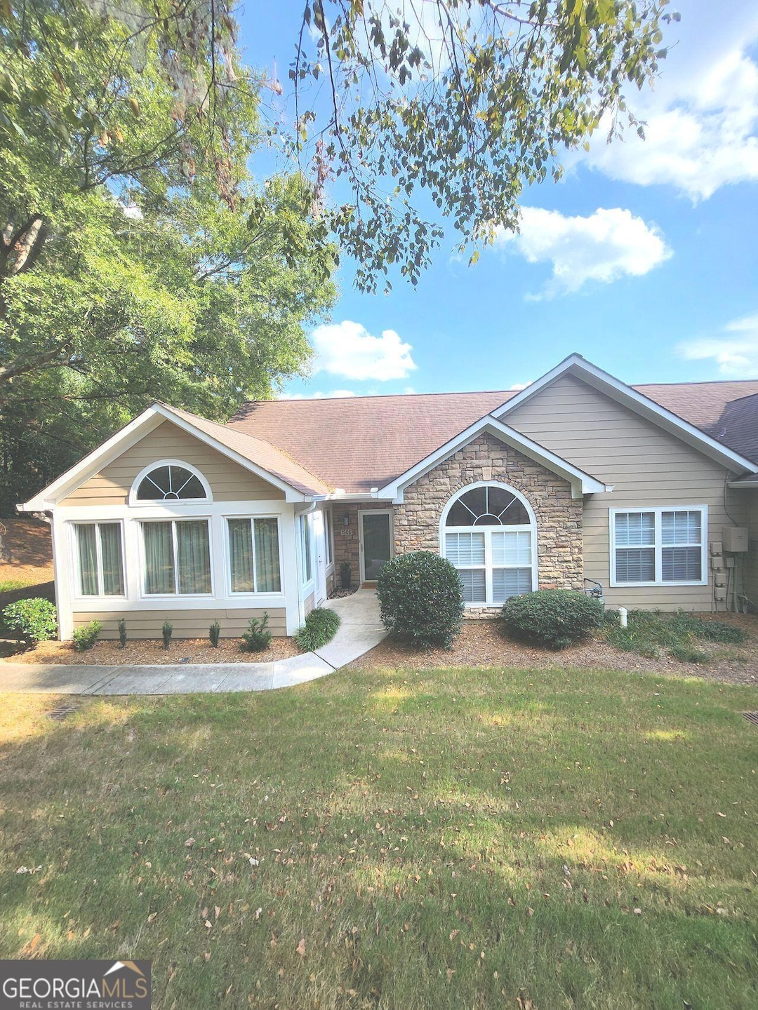
1906 Kolb Farm Cir SW Unit 51 Marietta, GA 30008
Southwestern Marietta NeighborhoodEstimated payment $2,635/month
Highlights
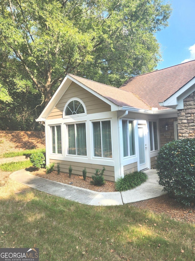
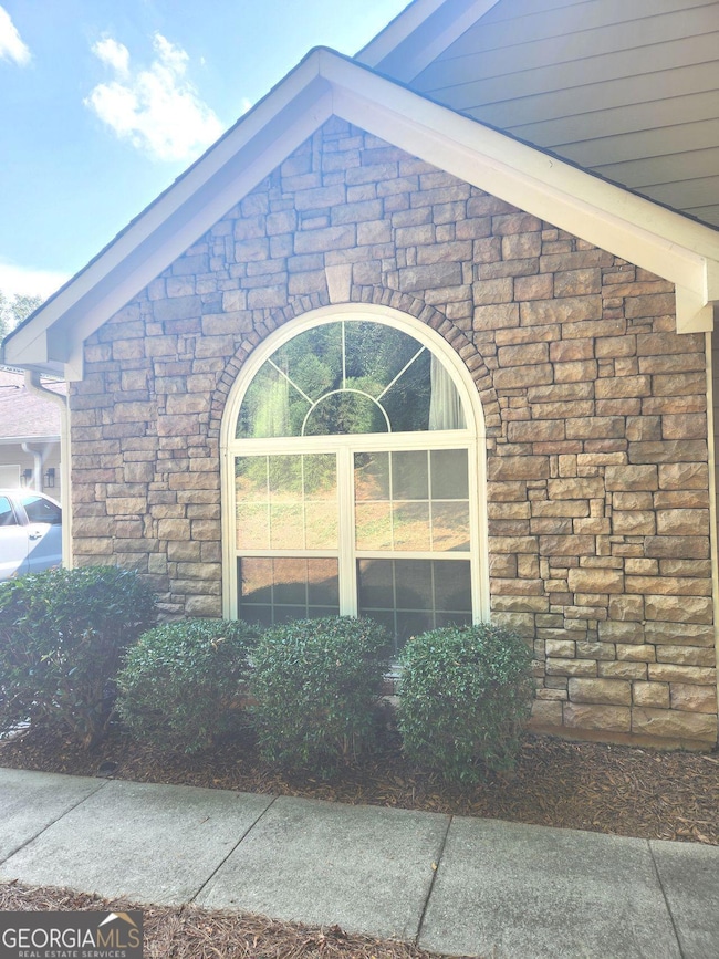
- Ranch Style House
- Sun or Florida Room
- High Ceiling
- 1 Fireplace
- Corner Lot
- Great Room
About This Home
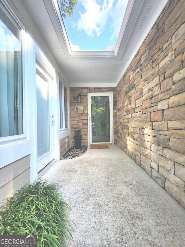
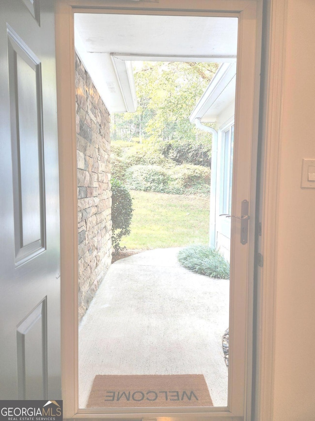
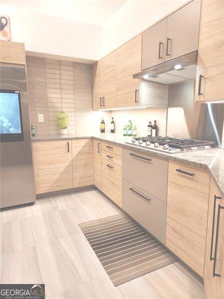
Must see this completely renovated and reimagined home featuring a new and expanded kitchen with European style cabinetry with soft close doors and drawers, built-in combination microwave and wall ovens, 5 burner gas cooktop, vent hood, dishwasher, disposal and counter-depth refrigerator featuring a built-in computer screen, granite counter tops with waterfall edge, counter height breakfast bar, built in desk area, custom glass, tile and stainless steel backsplash, LED under cabinet lighting and beautiful porcelain tile flooring throughout the kitchen, laundry and rear entry areas. The owner's suite features new patterned neutral carpet. The luxurious ensuite bathroom features new cabinetry with spacious granite countertop, 2 sinks with Grohe faucets, 2 LED mirrors, New full porcelain tile shower and great storage including a large linen closet and spacious walk-in closet with closet organizers and framed full view wardrobe mirror, all with porcelain tile floors! The secondary bathroom features new vanity cabinet, granite countertop, sink, Grohe faucet, framed mirror, porcelain tile floor, and new toilet! All closets feature closet organizer systems and new shelving throughout! New luxury vinyl plank flooring in living, dining and secondary bedrooms! New double thermal insulated windows and exterior door, new glass and wood French doors between family room and sunroom, and durable carpet squares in the spacious sunroom! Upgraded lighting throughout, which includes recessed LED lighting in all main rooms and bedrooms, new chandeliers in the dining area and sunroom, new exterior dusk-to-dawn carriage lighting at front door and garage door and new dusk-to-dawn exterior security lighting! Lighting in all rooms can be dimmed with wall mounted dimmers! New ceiling fans with dimmable LED lighting in all bedrooms and living room! Smooth ceilings throughout! New 98% efficient tankless water heater! The 2-car garage has a beautiful new commercial grade floor!

Property Details
Home Type
- Condominium
Est. Annual Taxes
- $4,135
Year Built
- Built in 1999 | Remodeled
Lot Details
- Level Lot
HOA Fees
- $28 Monthly HOA Fees
Home Design
- Ranch Style House
- Garden Home
- Stone Frame
- Composition Roof
- Concrete Siding
- Stone Siding
- Stone
Interior Spaces
- 1,423 Sq Ft Home
- Roommate Plan
- High Ceiling
- 1 Fireplace
- Great Room
- Sun or Florida Room
- Pull Down Stairs to Attic
Kitchen
- Built-In Oven
- Cooktop
- Dishwasher
- Stainless Steel Appliances
- Disposal
Flooring
- Carpet
- Laminate
- Tile
Bedrooms and Bathrooms
- 3 Main Level Bedrooms
- Walk-In Closet
- 2 Full Bathrooms
- Bathtub Includes Tile Surround
Laundry
- Laundry in Mud Room
- Laundry Room
Parking
- 2 Car Garage
- Parking Accessed On Kitchen Level
- Side or Rear Entrance to Parking
- Garage Door Opener
Schools
- Dowell Elementary School
- Smitha Middle School
- Osborne High School
Utilities
- Forced Air Heating and Cooling System
- Heating System Uses Natural Gas
- Underground Utilities
- Tankless Water Heater
- Gas Water Heater
- High Speed Internet
- Cable TV Available
Community Details
Overview
- Association fees include maintenance exterior, ground maintenance, insurance, management fee, reserve fund, sewer, swimming, trash, water
- Villas At Kolb Farm Subdivision
Recreation
- Community Pool
Map
Home Values in the Area
Average Home Value in this Area
Tax History
| Year | Tax Paid | Tax Assessment Tax Assessment Total Assessment is a certain percentage of the fair market value that is determined by local assessors to be the total taxable value of land and additions on the property. | Land | Improvement |
|---|---|---|---|---|
| 2025 | $4,133 | $137,156 | $28,000 | $109,156 |
| 2024 | $4,135 | $137,156 | $28,000 | $109,156 |
| 2023 | $614 | $137,156 | $28,000 | $109,156 |
| 2022 | $705 | $98,636 | $12,600 | $86,036 |
| 2021 | $632 | $74,200 | $12,600 | $61,600 |
| 2020 | $632 | $74,200 | $12,600 | $61,600 |
| 2019 | $602 | $64,104 | $12,600 | $51,504 |
| 2018 | $602 | $64,104 | $12,600 | $51,504 |
| 2017 | $473 | $54,900 | $12,600 | $42,300 |
| 2016 | $438 | $51,192 | $12,600 | $38,592 |
| 2015 | $469 | $51,192 | $12,600 | $38,592 |
| 2014 | $480 | $51,192 | $0 | $0 |
Property History
| Date | Event | Price | List to Sale | Price per Sq Ft |
|---|---|---|---|---|
| 09/15/2025 09/15/25 | Pending | -- | -- | -- |
| 09/15/2025 09/15/25 | For Sale | $430,000 | -- | $302 / Sq Ft |
Purchase History
| Date | Type | Sale Price | Title Company |
|---|---|---|---|
| Deed | $167,900 | -- | |
| Deed | $153,000 | -- | |
| Deed | $149,000 | -- |
Mortgage History
| Date | Status | Loan Amount | Loan Type |
|---|---|---|---|
| Open | $60,000 | New Conventional | |
| Previous Owner | $104,250 | New Conventional |
Source: Georgia MLS
MLS Number: 10605769
APN: 19-0403-0-038-0
Disclaimer: Certain information contained herein is derived from information provided by parties other than Homes.com. All information provided is deemed reliable, but is not guaranteed to be accurate and should be independently verified.
![]() The data relating to real estate for sale on this web site comes in part from the Broker Reciprocity Program of Georgia MLS. Real estate listings held by brokerage firms other than Redfin are marked with the Broker Reciprocity logo and detailed information about them includes the name of the listing brokers. Information deemed reliable but not guaranteed. Copyright 2025 Georgia MLS. All rights reserved.
The data relating to real estate for sale on this web site comes in part from the Broker Reciprocity Program of Georgia MLS. Real estate listings held by brokerage firms other than Redfin are marked with the Broker Reciprocity logo and detailed information about them includes the name of the listing brokers. Information deemed reliable but not guaranteed. Copyright 2025 Georgia MLS. All rights reserved.
- 1927 Kolb Farm Cir SW Unit 90
- 1830 Kolb Farm Cir SW Unit 7
- 1472 Chapel Hill Ln SW
- 1951 Bergerac Ct SW
- 1784 Hammond Woods Cir SW
- 1718 Rifle Ridge SW
- 1799 Hammond Woods Cir SW
- 1589 Hammond Woods Cir SW
- 1533 Fallen Leaf Dr SW
- 1500 Larson Way SW Unit 2
- 1704 Sterling Trail SW
- 2001 MacLand Square Dr Unit 11
- 2121 Cumberland Creek Trail SW
- 2002 MacLand Square Dr Unit 1
- 1646 Desford Ct SW
- 1946 MacLand Rd SW