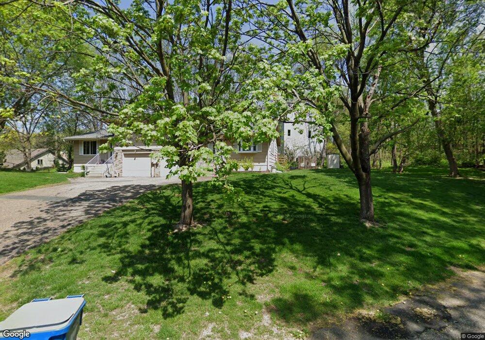
1906 Stryker Ave Saint Paul, MN 55118
Estimated Value: $210,000 - $325,000
2
Beds
2
Baths
1,350
Sq Ft
$191/Sq Ft
Est. Value
About This Home
This home is located at 1906 Stryker Ave, Saint Paul, MN 55118 and is currently estimated at $258,475, approximately $191 per square foot. 1906 Stryker Ave is a home located in Dakota County with nearby schools including Garlough Environmental Magnet, Friendly Hills Middle School, and Two Rivers High School.
Ownership History
Date
Name
Owned For
Owner Type
Purchase Details
Closed on
May 30, 2014
Sold by
Kirby Colleen P
Bought by
Johanneck Adriane M and Johanneck Geoffry
Current Estimated Value
Home Financials for this Owner
Home Financials are based on the most recent Mortgage that was taken out on this home.
Original Mortgage
$126,663
Outstanding Balance
$96,524
Interest Rate
4.25%
Mortgage Type
FHA
Estimated Equity
$161,951
Create a Home Valuation Report for This Property
The Home Valuation Report is an in-depth analysis detailing your home's value as well as a comparison with similar homes in the area
Home Values in the Area
Average Home Value in this Area
Purchase History
| Date | Buyer | Sale Price | Title Company |
|---|---|---|---|
| Johanneck Adriane M | $129,000 | Midwest Guaranty Title Compa |
Source: Public Records
Mortgage History
| Date | Status | Borrower | Loan Amount |
|---|---|---|---|
| Open | Johanneck Adriane M | $126,663 |
Source: Public Records
Tax History Compared to Growth
Tax History
| Year | Tax Paid | Tax Assessment Tax Assessment Total Assessment is a certain percentage of the fair market value that is determined by local assessors to be the total taxable value of land and additions on the property. | Land | Improvement |
|---|---|---|---|---|
| 2024 | $2,932 | $247,500 | $86,900 | $160,600 |
| 2023 | $2,932 | $249,400 | $92,100 | $157,300 |
| 2022 | $2,618 | $244,500 | $92,500 | $152,000 |
| 2021 | $2,536 | $214,400 | $80,400 | $134,000 |
| 2020 | $2,344 | $207,200 | $76,600 | $130,600 |
| 2019 | $2,157 | $188,800 | $72,900 | $115,900 |
| 2018 | $1,971 | $168,900 | $68,200 | $100,700 |
| 2017 | $1,816 | $162,400 | $64,900 | $97,500 |
| 2016 | $1,749 | $146,700 | $59,000 | $87,700 |
| 2015 | $1,655 | $117,976 | $47,969 | $70,007 |
| 2014 | -- | $107,839 | $43,508 | $64,331 |
| 2013 | -- | $96,503 | $39,010 | $57,493 |
Source: Public Records
Map
Nearby Homes
- 8XX Humboldt Ave
- 25 W Kraft Rd
- 2012 Pine Ridge Dr
- 1694 Humboldt Ave
- 180 Wentworth Ave W Unit E
- 170 Wentworth Ave W Unit F
- 48 Thompson Ave W Unit 40
- 1620 Charlton St Unit 109
- 485 Preserve Path
- 1450 Bidwell St Unit 110
- 1810 Delaware Ave
- 492 Deer Run Trail
- Capri Plan at Thompson Square East
- Barcelona Plan at Thompson Square East
- Athens Plan at Thompson Square East
- Athens II Plan at Thompson Square East
- Bayfield Plan at Thompson Square East
- Hayward Plan at Thompson Square East
- 1531 Traverse Ln
- 366 Trenton Ln
- 1904 Stryker Ave
- 2 Fox Ridge Ct
- 1902 Stryker Ave
- 1910 Stryker Ave
- 1908 Shields Ln
- 1908 Stryker Ave
- 1908 Shields Ln
- 1912 Stryker Ave
- 44 Fox Ridge Ct
- 1 Fox Ridge Ct
- 1890 Stryker Ave
- 1884 Stryker Ave
- 66 Fox Ridge Ct
- 1900 Stryker Ave
- 4 Fox Ridge Ct Unit 1008A
- 4 Fox Ridge Ct Unit 1007D
- 4 Fox Ridge Ct Unit 1006B
- 4 Fox Ridge Ct Unit 1005C
- 6 Fox Ridge Ct Unit 1004B
- 6 Fox Ridge Ct Unit 1003C