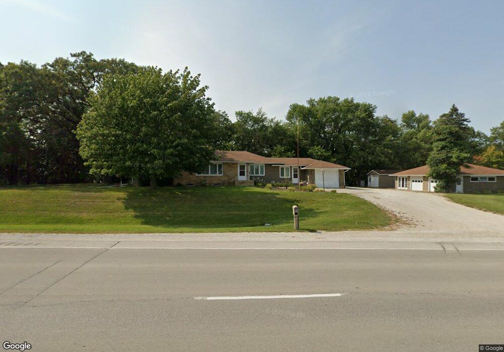
1907 Highway 169 Algona, IA 50511
Estimated Value: $328,000 - $432,427
2
Beds
2
Baths
1,840
Sq Ft
$202/Sq Ft
Est. Value
About This Home
This home is located at 1907 Highway 169, Algona, IA 50511 and is currently estimated at $371,357, approximately $201 per square foot. 1907 Highway 169 is a home located in Kossuth County with nearby schools including Bertha Godfrey Elementary School, Lucia Wallace Elementary School, and Bryant Elementary School.
Ownership History
Date
Name
Owned For
Owner Type
Purchase Details
Closed on
Oct 3, 2024
Sold by
Hamilton Theresa B and Hamilton Leo J
Bought by
Bradley B Priebe Revocable Trust and Priebe
Current Estimated Value
Purchase Details
Closed on
May 9, 2018
Sold by
Bilyeu Terry J and Bilyeu Shelley K
Bought by
Hamilton Theresa B
Home Financials for this Owner
Home Financials are based on the most recent Mortgage that was taken out on this home.
Original Mortgage
$208,000
Interest Rate
4.5%
Mortgage Type
New Conventional
Create a Home Valuation Report for This Property
The Home Valuation Report is an in-depth analysis detailing your home's value as well as a comparison with similar homes in the area
Home Values in the Area
Average Home Value in this Area
Purchase History
| Date | Buyer | Sale Price | Title Company |
|---|---|---|---|
| Bradley B Priebe Revocable Trust | $335,000 | None Listed On Document | |
| Hamilton Theresa B | $260,000 | -- |
Source: Public Records
Mortgage History
| Date | Status | Borrower | Loan Amount |
|---|---|---|---|
| Previous Owner | Hamilton Theresa B | $208,000 |
Source: Public Records
Tax History Compared to Growth
Tax History
| Year | Tax Paid | Tax Assessment Tax Assessment Total Assessment is a certain percentage of the fair market value that is determined by local assessors to be the total taxable value of land and additions on the property. | Land | Improvement |
|---|---|---|---|---|
| 2025 | $2,572 | $324,136 | $63,150 | $260,986 |
| 2024 | $2,572 | $277,137 | $52,520 | $224,617 |
| 2023 | $2,880 | $277,137 | $52,520 | $224,617 |
| 2022 | $2,502 | $272,479 | $52,520 | $219,959 |
| 2021 | $2,408 | $238,578 | $52,520 | $186,058 |
| 2020 | $2,380 | $218,765 | $52,520 | $166,245 |
| 2019 | $2,176 | $196,313 | $0 | $0 |
| 2018 | $2,042 | $196,313 | $0 | $0 |
| 2017 | $2,042 | $188,029 | $0 | $0 |
| 2016 | $1,914 | $188,029 | $0 | $0 |
| 2015 | $1,886 | $178,656 | $0 | $0 |
| 2014 | $1,824 | $178,656 | $0 | $0 |
Source: Public Records
Map
Nearby Homes
- 1215 190th St
- 403 Brookridge Dr
- 203 Hillside Dr
- 711 E Chubb St
- 716 S Jones St
- 709 S Jones St
- 704 S Wooster St
- 606 S Harriet St
- 515 S Harlan St
- Lot 1 W Riverview Dr
- 1024 E Mcgregor St
- 408 S Hall St Unit 8
- 605 E Mcgregor St
- 120 W College St
- 215 E Mcgregor St Unit 5
- 8 E Mcgregor St
- 1703 E Mcgregor St
- 117 S Woodworth St
- 120 S Roan St
- 200 S Mccoy St
- 1913 Highway 169
- 1913 U S 169
- 1 Hilltop Ln
- 1905 Highway 169
- 1905 Highway 169
- 1905 Highway 169
- 1906 U S 169
- 5 Hilltop Ln
- 1903 Highway 169 Unit B
- 2 Hilltop Ln
- 2 Hilltop Ln
- 214 Wood Acres
- 105 Wood Acres
- 109 Wood Acres
- 104 Wood Acres
- 210 Wood Acres
- 102 Wood Acres
- 1908 U S 169
- 4 Hilltop Ln
- 1908 Highway 169