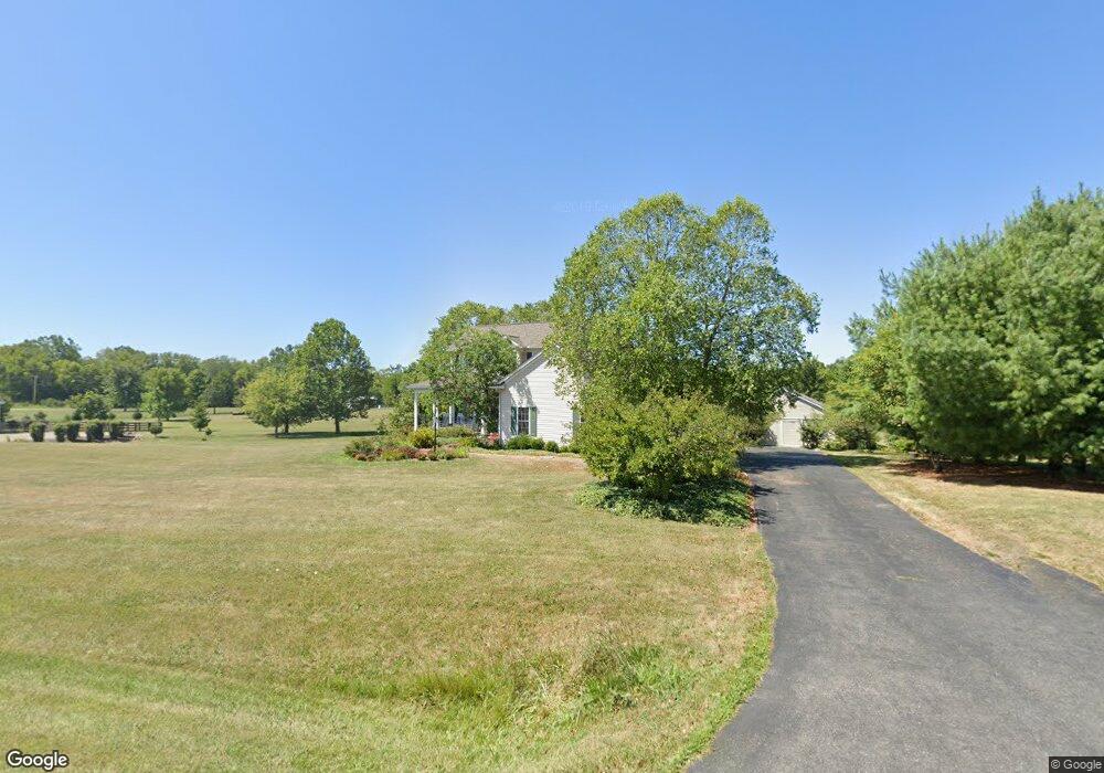
1907 River Rd Delaware, OH 43015
Estimated Value: $574,000 - $663,000
4
Beds
3
Baths
2,585
Sq Ft
$235/Sq Ft
Est. Value
About This Home
This home is located at 1907 River Rd, Delaware, OH 43015 and is currently estimated at $608,540, approximately $235 per square foot. 1907 River Rd is a home located in Delaware County with nearby schools including Buckeye Valley High School.
Ownership History
Date
Name
Owned For
Owner Type
Purchase Details
Closed on
Jul 1, 2019
Sold by
Eyerman J Anthony and Eyerman Patricia M
Bought by
Eyerman Patricia M and Eyerman Patricia
Current Estimated Value
Purchase Details
Closed on
May 7, 2018
Sold by
Eyerman Patricia
Bought by
Eyerman Eyerman J and Eyerman Patricia M
Purchase Details
Closed on
Nov 6, 2014
Sold by
Eyerman Anthony
Bought by
Eyerman Patricia
Create a Home Valuation Report for This Property
The Home Valuation Report is an in-depth analysis detailing your home's value as well as a comparison with similar homes in the area
Home Values in the Area
Average Home Value in this Area
Purchase History
| Date | Buyer | Sale Price | Title Company |
|---|---|---|---|
| Eyerman Patricia M | -- | None Available | |
| Eyerman Eyerman J | -- | None Available | |
| Eyerman Patricia | -- | None Available |
Source: Public Records
Tax History
| Year | Tax Paid | Tax Assessment Tax Assessment Total Assessment is a certain percentage of the fair market value that is determined by local assessors to be the total taxable value of land and additions on the property. | Land | Improvement |
|---|---|---|---|---|
| 2024 | $5,832 | $158,660 | $27,900 | $130,760 |
| 2023 | $5,830 | $158,660 | $27,900 | $130,760 |
| 2022 | $5,314 | $128,310 | $18,620 | $109,690 |
| 2021 | $5,319 | $128,310 | $18,620 | $109,690 |
| 2020 | $5,345 | $128,310 | $18,620 | $109,690 |
| 2019 | $4,547 | $107,630 | $16,210 | $91,420 |
| 2018 | $4,615 | $107,630 | $16,210 | $91,420 |
| 2017 | $4,037 | $97,340 | $14,390 | $82,950 |
| 2016 | $3,728 | $97,340 | $14,390 | $82,950 |
| 2015 | $3,934 | $97,340 | $14,390 | $82,950 |
| 2014 | $3,696 | $97,340 | $14,390 | $82,950 |
| 2013 | $3,763 | $94,160 | $14,390 | $79,770 |
Source: Public Records
Map
Nearby Homes
- 1817 Lawrence Rd
- 0 Mink Street Rd Unit 226007139
- 715 Tyler Rd
- 6685 State Route 37 W
- 4389 State Route 203
- 0 Marsh Rd Unit 226008897
- 3935 N Section Line Rd
- 3734 Warrensburg Rd
- 3680 Warrensburg Rd
- 130 Cedar Creek St
- 240 Glemsbury Dr
- 159 Marblewood Dr
- 2961 Warrensburg Rd
- 0 Carr Rd Unit 225016840
- 615 S Section Line Rd
- 854 S Section Line Rd
- 573 Penwell Dr
- 45 W Park St
- 23200 Ohio 37
- 309 Timbersmith Dr
- 2005 River Rd
- 1905 River Rd
- 2007 River Rd
- 1938 River Rd
- 1835 River Rd
- 1860 River Rd
- 2040 River Rd
- 1980 River Rd
- 1954 River Rd
- 2010 River Rd
- 1900 River Rd
- 1824 River Rd
- 1940 Ohio 257
- 1966 River Rd
- 1909 State Route 257 N
- 2121 River Rd
- 1745 State Route 257 N
- 5930 Mink Street Rd
- 5970 Mink Street Rd
- 2151 River Rd
Your Personal Tour Guide
Ask me questions while you tour the home.