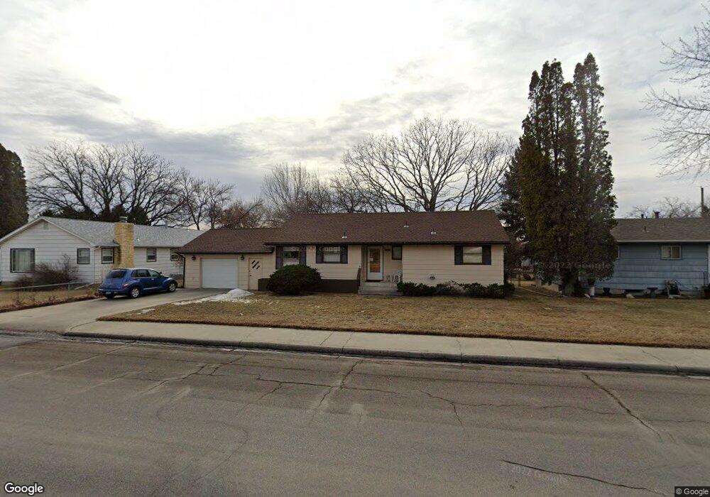
1908 Colton Blvd Billings, MT 59102
North Central Billings NeighborhoodEstimated Value: $320,689 - $348,000
4
Beds
2
Baths
1,144
Sq Ft
$289/Sq Ft
Est. Value
About This Home
This home is located at 1908 Colton Blvd, Billings, MT 59102 and is currently estimated at $331,172, approximately $289 per square foot. 1908 Colton Blvd is a home located in Yellowstone County with nearby schools including Rose Park School, Lewis & Clark Junior High School, and Billings Senior High School.
Ownership History
Date
Name
Owned For
Owner Type
Purchase Details
Closed on
Jul 8, 2009
Sold by
Berntson Marlene
Bought by
Berntson Marlene and Cox Meridith B
Current Estimated Value
Create a Home Valuation Report for This Property
The Home Valuation Report is an in-depth analysis detailing your home's value as well as a comparison with similar homes in the area
Home Values in the Area
Average Home Value in this Area
Purchase History
| Date | Buyer | Sale Price | Title Company |
|---|---|---|---|
| Berntson Marlene | -- | None Available |
Source: Public Records
Tax History Compared to Growth
Tax History
| Year | Tax Paid | Tax Assessment Tax Assessment Total Assessment is a certain percentage of the fair market value that is determined by local assessors to be the total taxable value of land and additions on the property. | Land | Improvement |
|---|---|---|---|---|
| 2025 | $665 | $322,300 | $54,363 | $267,937 |
| 2024 | $665 | $266,300 | $51,699 | $214,601 |
| 2023 | $1,168 | $266,300 | $51,699 | $214,601 |
| 2022 | $487 | $211,600 | $0 | $0 |
| 2021 | $699 | $211,600 | $0 | $0 |
| 2020 | $654 | $205,700 | $0 | $0 |
| 2019 | $628 | $205,700 | $0 | $0 |
| 2018 | $634 | $205,900 | $0 | $0 |
| 2017 | $1,358 | $205,900 | $0 | $0 |
| 2016 | $534 | $195,800 | $0 | $0 |
| 2015 | $537 | $210,700 | $0 | $0 |
| 2014 | $480 | $94,287 | $0 | $0 |
Source: Public Records
Map
Nearby Homes
- 1944 Colton Blvd
- 2124 Dahlia Ln
- 1833 Iris Ln
- 1734 Mariposa Ln
- 2414 Ivy Ln
- 2035 Avenue D
- 2510 Terrace Dr
- 2020 Plaza Dr
- 1607 21st St W
- 9 Stanford Ct
- 2718 Terrace Dr
- 46 Shadow Place Unit 6B
- 2230 Avenue C
- 2030 Rimrock Rd
- 2260 Avenue C
- 2618 Sunnyview Ln
- 1505 Avenue F
- 2219 Avenue B
- 6 Heatherwood Ln
- 2042 Green Terrace Dr
- 2014 19th St W
- 1914 Colton Blvd
- 1907 Beverly Hill Blvd
- 1911 Beverly Hill Blvd
- 1920 Colton Blvd
- 1901 Beverly Hill Blvd
- 2103 Dahlia Ln
- 1921 Beverly Hill Blvd
- 1926 Colton Blvd
- 2113 Dahlia Ln
- 2112 Hoover Ave
- 1927 Beverly Hill Blvd
- 2029 19th St W
- 2025 19th St W
- 2108 Dahlia Ln
- 2101 Hoover Ave
- 1932 Colton Blvd
- 1910 Beverly Hill Blvd
- 2019 19th St W
- 1916 Beverly Hill Blvd