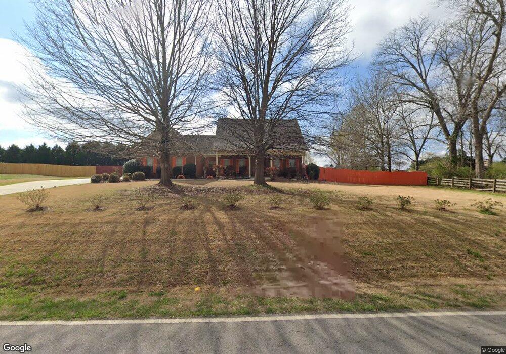
1908 Stroud Rd McDonough, GA 30252
Estimated Value: $327,019 - $370,000
3
Beds
2
Baths
2,152
Sq Ft
$166/Sq Ft
Est. Value
About This Home
This home is located at 1908 Stroud Rd, McDonough, GA 30252 and is currently estimated at $357,505, approximately $166 per square foot. 1908 Stroud Rd is a home located in Henry County with nearby schools including Rock Spring Elementary School, Ola Middle School, and Ola High School.
Ownership History
Date
Name
Owned For
Owner Type
Purchase Details
Closed on
Sep 6, 2018
Sold by
Paine Rebecca E
Bought by
Osborn Sharon C
Current Estimated Value
Purchase Details
Closed on
Jul 15, 2009
Sold by
United Community Bank
Bought by
Paine Rebecca E
Home Financials for this Owner
Home Financials are based on the most recent Mortgage that was taken out on this home.
Original Mortgage
$152,040
Interest Rate
5.37%
Mortgage Type
Stand Alone Second
Purchase Details
Closed on
Apr 7, 2009
Sold by
Gibby Randall C
Bought by
Southern Community Bank
Purchase Details
Closed on
Jan 30, 2009
Sold by
Stroud Commons Llc
Bought by
Gibby Randall C
Purchase Details
Closed on
Jun 13, 2006
Sold by
Stroud Commons Llc
Bought by
Brinson Randall J
Home Financials for this Owner
Home Financials are based on the most recent Mortgage that was taken out on this home.
Original Mortgage
$357,000
Interest Rate
6.57%
Create a Home Valuation Report for This Property
The Home Valuation Report is an in-depth analysis detailing your home's value as well as a comparison with similar homes in the area
Home Values in the Area
Average Home Value in this Area
Purchase History
| Date | Buyer | Sale Price | Title Company |
|---|---|---|---|
| Osborn Sharon C | $225,000 | -- | |
| Paine Rebecca E | $149,000 | -- | |
| Southern Community Bank | $209,000 | -- | |
| Gibby Randall C | -- | -- | |
| Brinson Randall J | $100,000 | -- |
Source: Public Records
Mortgage History
| Date | Status | Borrower | Loan Amount |
|---|---|---|---|
| Previous Owner | Paine Rebecca E | $152,040 | |
| Previous Owner | Brinson Randall J | $357,000 |
Source: Public Records
Tax History
| Year | Tax Paid | Tax Assessment Tax Assessment Total Assessment is a certain percentage of the fair market value that is determined by local assessors to be the total taxable value of land and additions on the property. | Land | Improvement |
|---|---|---|---|---|
| 2025 | $2,752 | $142,120 | $18,000 | $124,120 |
| 2024 | $2,752 | $153,680 | $18,000 | $135,680 |
| 2023 | $2,319 | $150,080 | $14,800 | $135,280 |
| 2022 | $2,871 | $120,800 | $14,800 | $106,000 |
| 2021 | $2,374 | $99,760 | $14,800 | $84,960 |
| 2020 | $2,929 | $93,240 | $12,000 | $81,240 |
| 2019 | $3,492 | $90,000 | $11,790 | $78,210 |
| 2018 | $0 | $86,520 | $12,000 | $74,520 |
| 2016 | $2,637 | $74,760 | $10,000 | $64,760 |
| 2015 | $2,345 | $65,560 | $10,000 | $55,560 |
| 2014 | $2,193 | $61,160 | $10,000 | $51,160 |
Source: Public Records
Map
Nearby Homes
- 50 Giles Dr
- 1774 Stroud Rd
- 129 Nettie Ln
- 133 Potomac Dr
- 527 Gallantry Trail
- 423 Serenity Walk
- 0 Fincherville Rd Unit TRACT 2 10435272
- 0 Fincherville Rd Unit TRACT 3 10435292
- 133 Gambier Cove
- 0 Hyannis Dr Unit 26428085
- 0 Hyannis Dr Unit 10698010
- 139 Loam Dr
- 267 Ellistown Rd
- 125 Clearsprings Dr
- 320 Ponderosa Trail
- 204 Clear Springs Ct
- 1120 Stroud Rd
- 1100 Stroud Rd
- 180 Preservation Dr
- 675 Sandy Ridge Rd
- 1908 Stroud Rd Unit 1
- 1910 Stroud Rd Unit N/a
- 1910 Stroud Rd Unit .
- 1910 Stroud Rd
- 1844 Keys Ferry Rd
- 2248 Stroud Rd
- 1824 Keys Ferry Rd
- 215 Aves Ct
- 1912 Stroud Rd
- 219 Aves Ct
- 219 Aves Ct Unit 25
- 1808 Keys Ferry Rd
- 211 Aves Ct
- 223 Aves Ct
- 223 Aves Ct Unit 203
- 1825 Keys Ferry Rd
- 1914 Stroud Rd Unit 4
- 1914 Stroud Rd
- 209 Aves Ct
- 227 Aves Ct
Your Personal Tour Guide
Ask me questions while you tour the home.