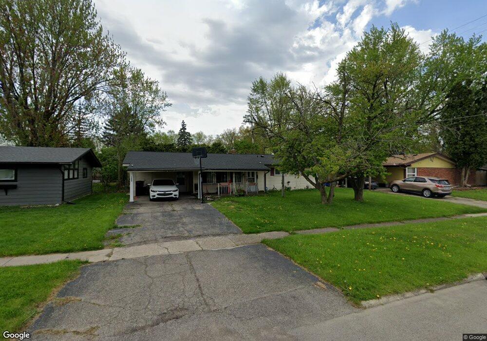
1909 Park Forest Dr Flint, MI 48507
Westgate NeighborhoodEstimated Value: $92,000 - $127,000
3
Beds
2
Baths
1,358
Sq Ft
$83/Sq Ft
Est. Value
About This Home
This home is located at 1909 Park Forest Dr, Flint, MI 48507 and is currently estimated at $112,228, approximately $82 per square foot. 1909 Park Forest Dr is a home located in Genesee County with nearby schools including Neithercut Elementary School, Flint Southwestern Classical Academy, and International Academy of Flint (K-12).
Ownership History
Date
Name
Owned For
Owner Type
Purchase Details
Closed on
Jan 10, 2022
Sold by
Heidi Burnett Karin
Bought by
Smith Ashley Ryan
Current Estimated Value
Home Financials for this Owner
Home Financials are based on the most recent Mortgage that was taken out on this home.
Original Mortgage
$60,320
Outstanding Balance
$55,592
Interest Rate
3.11%
Mortgage Type
FHA
Estimated Equity
$56,636
Purchase Details
Closed on
May 11, 2005
Sold by
Drews Steven Lynn
Bought by
Drews Karin Heidi
Create a Home Valuation Report for This Property
The Home Valuation Report is an in-depth analysis detailing your home's value as well as a comparison with similar homes in the area
Home Values in the Area
Average Home Value in this Area
Purchase History
| Date | Buyer | Sale Price | Title Company |
|---|---|---|---|
| Smith Ashley Ryan | $65,000 | None Listed On Document | |
| Smith Ashley Ryan | $65,000 | None Listed On Document | |
| Drews Karin Heidi | -- | -- |
Source: Public Records
Mortgage History
| Date | Status | Borrower | Loan Amount |
|---|---|---|---|
| Open | Smith Ashley Ryan | $60,320 | |
| Closed | Smith Ashley Ryan | $9,310 |
Source: Public Records
Tax History
| Year | Tax Paid | Tax Assessment Tax Assessment Total Assessment is a certain percentage of the fair market value that is determined by local assessors to be the total taxable value of land and additions on the property. | Land | Improvement |
|---|---|---|---|---|
| 2025 | $2,621 | $52,900 | $0 | $0 |
| 2024 | $2,318 | $51,500 | $0 | $0 |
| 2023 | $2,244 | $42,100 | $0 | $0 |
| 2022 | $0 | $36,300 | $0 | $0 |
| 2021 | $1,750 | $30,800 | $0 | $0 |
| 2020 | $1,591 | $25,400 | $0 | $0 |
| 2019 | $1,542 | $24,700 | $0 | $0 |
| 2018 | $1,573 | $20,900 | $0 | $0 |
| 2017 | $1,843 | $0 | $0 | $0 |
| 2016 | $1,828 | $0 | $0 | $0 |
| 2015 | -- | $0 | $0 | $0 |
| 2014 | -- | $0 | $0 | $0 |
| 2012 | -- | $28,900 | $0 | $0 |
Source: Public Records
Map
Nearby Homes
- 1818 Rockcreek Ln
- 1902 Rockcreek Ln
- 1933 Greenbriar Ln
- 4101 Greenbrook Ln
- 4202 Park Forest Dr
- 1741 Carmanbrook Pkwy
- 1814 Carmanbrook Pkwy
- 1727 Briarwood Dr
- Lot 57 Walnut Creek Dr
- 1826 Greenbrook Ln
- 4502 Huckleberry Ln
- 1506 Pettibone Ave
- 1410 Berrywood Ln
- 1413 Lincoln Ave
- 1627 Blackberry Ln
- 1225 Waldman Ave
- 1446 Stephens Ave
- 1310 Huron St
- 1318 Ingleside Ave
- 1234 Huron St
- 1913 Park Forest Dr
- 1905 Park Forest Dr
- 1906 Penbrook Ln
- 1901 Park Forest Dr
- 1910 Penbrook Ln
- 1902 Penbrook Ln
- 1917 Park Forest Dr
- 1914 Penbrook Ln
- 1830 Penbrook Ln
- 1910 Park Forest Dr
- 1831 Park Forest Dr
- 1906 Park Forest Dr
- 1914 Park Forest Dr
- 1918 Penbrook Ln
- 1902 Park Forest Dr
- 1826 Penbrook Ln
- 1918 Park Forest Dr
- 1922 Penbrook Ln
- 1827 Park Forest Dr
- 1925 Park Forest Dr
Your Personal Tour Guide
Ask me questions while you tour the home.