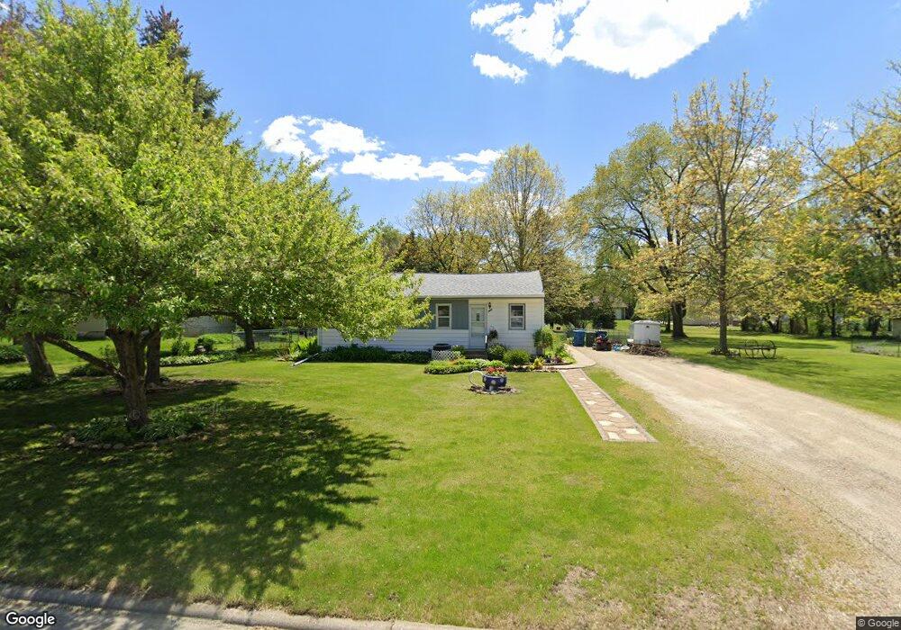
1909 Robin Rd Waterloo, IA 50701
Estimated Value: $158,134 - $190,000
2
Beds
2
Baths
1,064
Sq Ft
$165/Sq Ft
Est. Value
About This Home
This home is located at 1909 Robin Rd, Waterloo, IA 50701 and is currently estimated at $176,034, approximately $165 per square foot. 1909 Robin Rd is a home located in Black Hawk County with nearby schools including Becker Elementary School, Central Middle School, and West High School.
Ownership History
Date
Name
Owned For
Owner Type
Purchase Details
Closed on
Dec 31, 2024
Sold by
Shubert Jeffery Lynn and Shubert Jeffrey Lynn
Bought by
Shubert Investments Llc
Current Estimated Value
Create a Home Valuation Report for This Property
The Home Valuation Report is an in-depth analysis detailing your home's value as well as a comparison with similar homes in the area
Purchase History
| Date | Buyer | Sale Price | Title Company |
|---|---|---|---|
| Shubert Investments Llc | -- | None Listed On Document | |
| Shubert Investments Llc | -- | None Listed On Document |
Source: Public Records
Tax History
| Year | Tax Paid | Tax Assessment Tax Assessment Total Assessment is a certain percentage of the fair market value that is determined by local assessors to be the total taxable value of land and additions on the property. | Land | Improvement |
|---|---|---|---|---|
| 2025 | $3,166 | $161,400 | $41,470 | $119,930 |
| 2024 | $3,166 | $145,970 | $41,470 | $104,500 |
| 2023 | $2,552 | $142,200 | $37,700 | $104,500 |
| 2022 | $2,482 | $125,030 | $37,700 | $87,330 |
| 2021 | $2,506 | $125,030 | $37,700 | $87,330 |
| 2020 | $2,460 | $119,230 | $31,900 | $87,330 |
| 2019 | $2,460 | $119,230 | $31,900 | $87,330 |
| 2018 | $2,464 | $119,230 | $31,900 | $87,330 |
| 2017 | $2,442 | $119,230 | $31,900 | $87,330 |
| 2016 | $2,408 | $114,860 | $31,900 | $82,960 |
| 2015 | $2,408 | $114,860 | $31,900 | $82,960 |
| 2014 | $2,454 | $114,860 | $31,900 | $82,960 |
Source: Public Records
Map
Nearby Homes
- 1839 Rush St
- 1290 Scott Ave
- 1286 Scott Ave
- 1266 Doreen Ave
- 1811 Sager Ave
- 1221 Julian Ave
- 1114 Eleanor Dr
- 1221 Downing Ave
- 2320 University Ave
- 819 Hanna Blvd
- Lot 19 Mark Dr
- Lot 22 Mark Dr
- Lot 20 Mark Dr
- Lot 15 Mark Dr
- Lot 21 Mark Dr
- Lot 16 Mark Dr
- Lot 23 Mark Dr
- Lot 2 Matthew Dr
- Lot 41 Luke St
- Lot 10 Luke St
Your Personal Tour Guide
Ask me questions while you tour the home.